Gauge Conditions
Primary
Runnable: 1,200.0 – 7,000.0 CFS
Data from American Whitewater & USGS
Run Map
Description
General Description
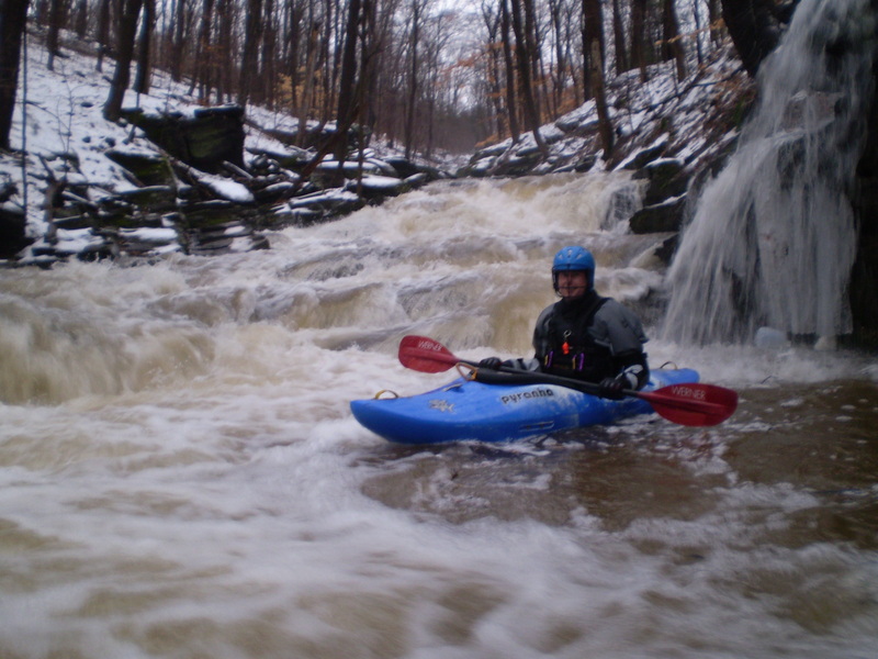
This little tributary to the Delaware may offer the best in Class V steep creeking that New Jersey has to offer. For about a 1/2 mile, it offers up non-stop, very steep, technical drops that will get the adrenaline going for just about anyone. This little gem actually doesn't have a name but is located at the base of the cliff/rock formation known as the Devil's Tea Table located just about half way between Stockton and Frenchtown on Rt. 29. Given the nature of the run, the name seems fitting. There are only about 3 or 4 eddies big enough for more than one boat along this entire stretch and only a few more that will even fit one boat. _Therefore, don't get on this run unless you are fully confident in your ability to read and react to continuous, steep drops and to catch micro-eddies as needed._
If the area has gotten 1 to 2" of heavy rain and the gauge for the Lock is going straight up and over 1200 cfs or if the Lock and the Wick are already too high, this may be running. My guess is that it will not be runnable more than a few hours after the rain stops. It probably is runnable just a handful of times a year so catch it when you can.
Rapid Description
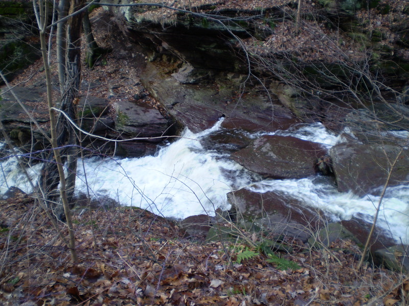
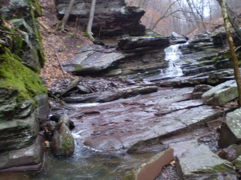
The hundred yards or so above the first bridge features a continuous series of Class III/IV slides, which is all the warm-up you are going to get. Just above the bridge, the bottom drops out and it would be impossible to describe all the drops in any detail, since it is essentially one continuous rapid to the take-out. There are probably two drops of note though.
Right Out Of Hell:
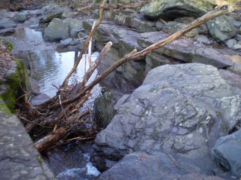
The first is about 100 yards below the bridge where the creek drops into a very narrow slot on the left. At low flows, you will have to run this tight sketchy left slot, while at higher flow a very sweet 7’ boof off a slab rock opens up on the right side of the slot. The biggest drop of the run, currently dubbed “Jersey Devil”, is about 2/3’s of the way down. It is a steep 15-20 foot slide with an undercut wall along its right side. Run this left and expect to get pushed toward the right cliff at the bottom. Take-out at any available eddy on the left above the tunnel that takes the creek under Rt. 29 or if you've scouted it and it was clear, the tunnel has a nice steep slide in it that is runnable as long as it is clear of wood.
Since the entire run is roadside, make sure you know where any wood is and locate the nearest catchable eddy above the wood before you put-on. As of March 2008, there were no mandatory wood portages but a couple of trees that required tight lines which might not be acceptable for some to run.
ACCESS: So far, there has been no problems with access, but as with any area, be very respectful of local residents so problems don't arise. Do not park in the resident's creek side parking spots above the .5 mile putin bridge.
Please do not park on Warsaw road below the .5 mile put in bridge unless you are in the one and only single car pull out at the 0.5 mile putin bridge itself. There is parking 100 yards north on Rt 29. Hike laps if need be, don't block the narrow road and be as descrete as possible on this posted private property.
Rapids in this Run (2)
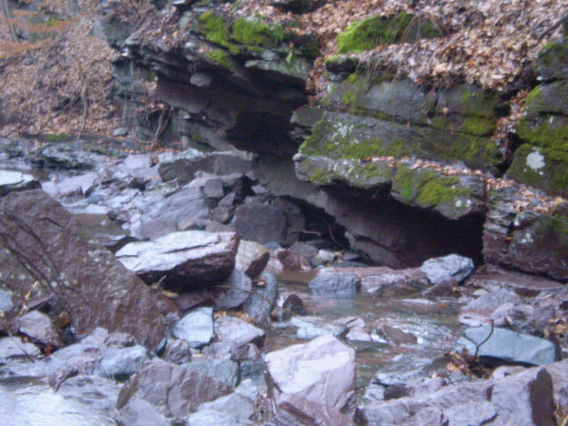
Hazards & Portages (3)
Caution: The following locations may require scouting or portaging. Always check current conditions.
Difficulty
Class V
Length
0.6 mi
Gradient
420 ft/mi
Rapids
2
3 Hazards
Access Points
Shuttle Info
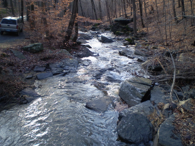
**Put-In and Take-out**
Warsaw Road parallels the entire runnable length of this creek. There is a pull-out on the left about a 100 yards up from Rt. 29 that is a good spot to park a car for the take-out. You can scout pretty much the entire run from the road as you drive up to the put-in, but be forewarned, everything is bigger and steeper at creek level. There is a pull-out on the right about 200 yards above the first bridge that is a good spot for parking and finding a spot to put in. You could probably go another 1/2 mile up to the second bridge, but you wouldn't be gaining too much in terms of additional rapids.
Difficulty Classes
I Easy
II Novice
III Intermediate
IV Advanced
V Expert/Extreme
VI Unrunnable
Current Conditions
5-Day Forecast
Whitewater data from
American Whitewater
American Whitewater