Dirt road off Hwy 11 to Hwy 11 bridge
Linked via: Nhdplus gnis 95% confidence Synced 6mo ago
Gauge Conditions
Primary
Runnable: 300.0 – 100,000.0 CFS
Data from American Whitewater & USGS
Run Map
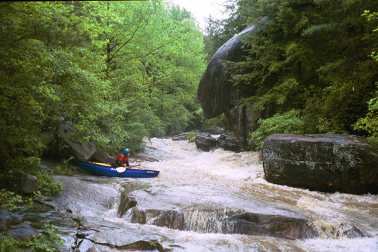
Description
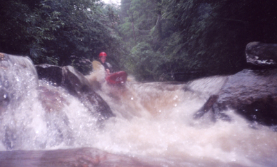
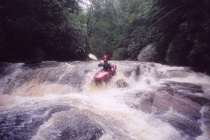
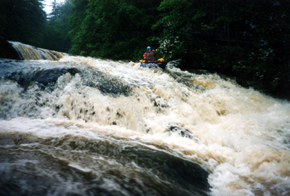
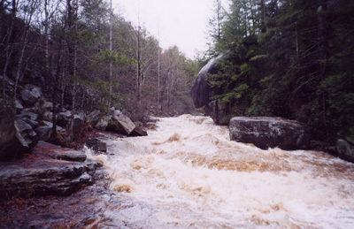
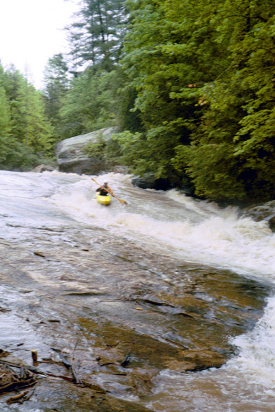
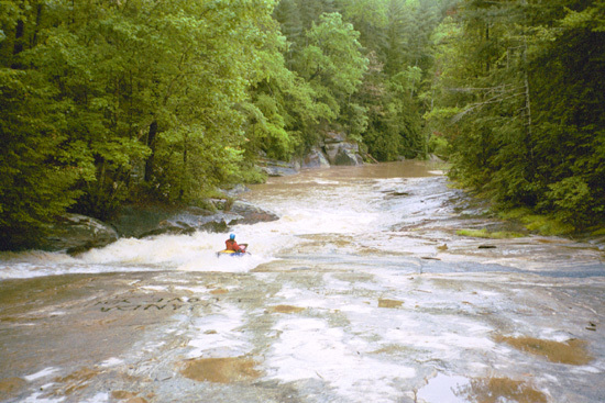
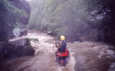
The Little Eastatoe starts out in a quick pool almost immediately above the first big slide. From here on to the Hwy 11 bridge it _plunges_ over big slides, _rushes_ past undercuts, and finally calms down to resemble the North Fork of the French Broad. The run requires lots of local rain.
Directions:(From somewhere over near Georgia, Salem, or Seneca)
Go North on Hwy 11 until you cross Lake Keowee. About 3 miles past Lake Keowee you will cross over the the Little Eastatoe. That bridge is the takeout. Continue North and East on Hwy 11 about a mile. You will pass a bunch of jeep trails on the south side of Hwy 11. Hop out at the jeep trails and walk down to the big slide to check water levels. To get to the put-in go upstream about another quarter mile to a chained off dirt road. Follow the dirt road down to the river. (Brad Roberts)
There is also the option of putting on at Little Eastatoe rd. This make for a nice warm up, but you do have to paddle about a mile of flatwater and duck under some trees before you get to the good stuff.
Rapids in this Run (1)
Waterfalls (6)
Hazards & Portages (4)
Caution: The following locations may require scouting or portaging. Always check current conditions.
Difficulty
Class III-IV
Length
0.7 mi
Gradient
100 ft/mi
Rapids
1
4 Hazards
Access Points
Difficulty Classes
I Easy
II Novice
III Intermediate
IV Advanced
V Expert/Extreme
VI Unrunnable
Current Conditions
5-Day Forecast
Whitewater data from
American Whitewater
American Whitewater