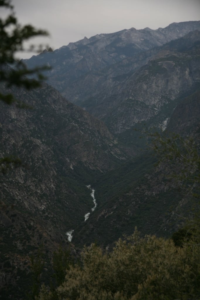
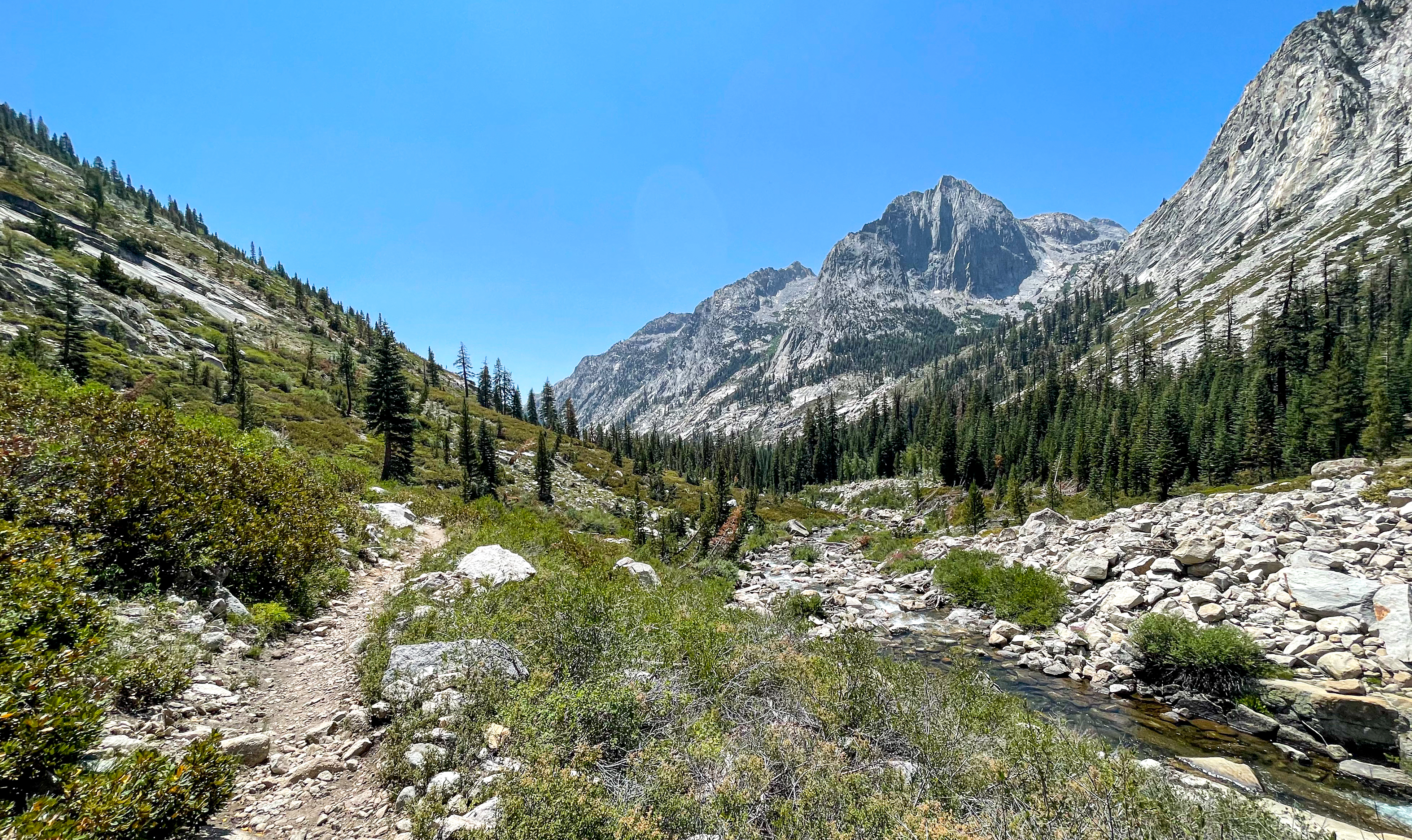
Dusy Branch to S. Fork confluence
Linked via: Nhdplus gnis 95% confidence Synced 6mo ago
Gauge Conditions
Runnable: ? – ? CFS
Approximate reading: This gauge is 0.5 miles away on Kings. Use as a general reference only.
Data from American Whitewater & USGS
Run Map
Run Time Estimate
Select put-in and take-out to estimate time.
Unlock Advanced Trip Planning
See wind-adjusted speed maps, forecast planning, and detailed time estimates.
Sign in to generate an AI timing estimate for this run.
Whitewater timing varies with scouting, portages, and group pace. Use as a planning baseline.
Description
This reach is now being paddled by a few groups each year. For most groups it takes a day to hike over Bishop pass to the put in and then several days of paddling on the river. Of the various late season high Sierra runs, the MF Kings is generally the last to drop into boatable range.
Wilderness permits are required for overnight travel and must be obtained from Inyo National Forest. The river runs mostly through Kings Canyon National Park, but forms the boundary of Sierra National Forest and Sequoia National Forest once it leaves Tehipite Valley. In addition, the national forest section of the river is protected by the Kings River Special Management Area.
Shuttle Options: The best option is to get a shuttle driver to drop you off at South Lake and then pick you up at the end. A northern route goes through Yosemite National Park over Tioga Pass. A southern route uses highway 58 over Tehachapi Pass to connect highways 99 and 395.
Take Out Options: There are two basic take out options with variations on the second option.
1) At the confluence of the middle and south forks, take the Yucca Point trail and climb two steep miles to highway 180. From here you can conveniently explore the SF Kings river, Cedar Grove, and other parts of Sequoia Kings Canyon National Parks. National park entrance fees are required as you pass through the Grant Grove entrance station.
2) Garnet Dike is 10 river miles downstream through the wonderful Garlic Falls section. Garnet Dike is at the end of an 8 mile dirt road, reached by a long, windy, paved road around Pine Flat reservoir. This is an isolated area with free primitive camping. There are pit toilets here.
2a) Continue paddling down the class 3 Banzai section to reach paved road near Kirch Flat. There are many good camp sites along this reach and at Kirch Flat. While this is an isolated and hot area there is some remarkable exploring available close by along Dinkey Creek, the NF Kings and Big Creek.
Other information Sources:
The 7 Rivers Expedition: Middle Kings River\- "Trip of a Lifetime."
The 7 Rivers Expedition: "Whitewater Classics" on the Middle Kings
ULTIMATE DOUBLE HEADER. MIDDLE KINGS vs UPPER CHERRY Video & Story by Cody Howard
Middle Kings: 2007 Video by Chris Gragtmans
Middle Fork of the Kings from tim\_kelton on Vimeo.
Middle Kings Free in a Day
By Grayson Schaffer June 20, 2007 \[Adventure\]
"Yesterday, John Grace and Tommy Hilleke became the first people to run California's Middle Kings River in one day. Their time to hike 11 miles over the 12,000-foot pass and then run 30 miles and 6,400 vertical feet of Class V water: 19 hours 53 minutes."
http://thoseresponsible.com/blog/default.asp?Category=4
LVM TV: Middle Fork of the Kings River
Blog Trip report A ride through the ringer (MF Kings) 2008 report by Taylor Cavin
Liquid Lore MF Kings: excellent description with photos from 2008 and Google Map waypoints.
A GUIDE TO THE BEST WHITEWATER IN THE STATE OF CALIFORNIA, HOLBEK & STANLEY, 1988 Sequoia & Kings Canyon National Park EPA: Federal Register: General Management Plan; Middle and South Forks Kings River Middle Fork Kings River Gorge - Climber.Org Trip Report
How to Obtain a Wilderness Permit.pdf (136 KB)

Inyo National Forest
351 Pacu Lane
Suite 200
Bishop, CA 93514
760-873-2400
Rapids in this Run (1)
Hazards & Portages (2)
Caution: The following locations may require scouting or portaging. Always check current conditions.
Difficulty
Class V+
Length
29.0 mi
Gradient
240 ft/mi
Rapids
1
2 Portages
Access Points
Shuttle Info

A northern route goes through Yosemite National Park over Tioga Pass. From Bishop go north on highway 395 to Lee Vining, then take highway 120 over Tioga Pass. Drive into Yosemite Valley and take 41 south to fresno to 180.
A southern route uses highway 58 over Tehachapi Pass to connect highways 99 and 395.
Difficulty Classes
I Easy
II Novice
III Intermediate
IV Advanced
V Expert/Extreme
VI Unrunnable
Permit Required
Wilderness Permits are required for overnight camping. Permits can be obtained from the Inyo National Forest office in Bishop. Phone 760-873-2400
No permit is needed to run the river.
Current Conditions
5-Day Forecast
Whitewater data from
American Whitewater
American Whitewater