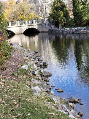
East Troy Mill Pond Park (former dam site)
Linked via: Proximity 96% confidence Synced 6mo ago
Gauge Conditions
Runnable: ? – ? CFS
Approximate reading: This gauge is 6.8 miles away on Honey Creek (Fox (IL) Trib). Use as a general reference only.
Data from American Whitewater & USGS
Run Map
Description
Removal of a dam in East Troy and consequent remediation of the streambed of former mill pond has created a spot which may catch the interest of novice boaters. While it may look like a bit of exciting whitewater, it is more likely to prove disappointing.
The remediation has created a few ponded areas by placing 'boulder chokes' in a few locations. Unfortunately, at most normal/usual flows, attempting to run these boulder chokes will mostly result in unavoidable impacts with rocks. After heavy rains, or times of significant snowmelt (which S.E.Wis. seldom sees anymore), there may be enough flow to reduce or eliminate such impacts.
NOTE: stream image (and 'river geometry') above use old topo map, from before dam was removed. Click to get to map page, click 'Topo' to change to 'Satellite' which will better represent present configuration of this creek.
NOTE 2: Reference gauge lies 21 miles north, and has 35.9 sq.mi. drainage. Flows here *might* be 10% higher than listed gauge. (All closer gauges are subject to regulation, making them less useful.)


Difficulty
Class I-II
Length
0.7 mi
Gradient
10 ft/mi
Rapids
10
Access Points
Difficulty Classes
I Easy
II Novice
III Intermediate
IV Advanced
V Expert/Extreme
VI Unrunnable
Current Conditions
5-Day Forecast
Whitewater data from
American Whitewater
American Whitewater