Elsie Road to Hwy.41 (9.5 miles)
Pilgrim
Linked via: Unknown Synced 6mo ago
Gauge Conditions
Runnable: 125.0 – 600.0 CFS
Almost certainly too low for anything but boat abuse.
Data from American Whitewater & USGS
Run Map
Run Time Estimate
Select put-in and take-out to estimate time.
Unlock Advanced Trip Planning
See wind-adjusted speed maps, forecast planning, and detailed time estimates.
Sign in to generate an AI timing estimate for this run.
Whitewater timing varies with scouting, portages, and group pace. Use as a planning baseline.
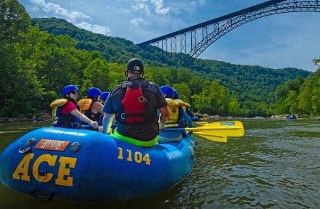
Description
Stupid boater tricks? Micro creeking? Fantasy boating? Maybe. Likely in the neighborhood of only 5 square miles (+/-) at listed put-in.
But since 2014 USGS has a gauge on this little river! In five of the years from 2014 through 2023, it had a peak flows over 600 cfs, including (in 2023) going to 1,060 cfs!
Likely a few driveway bridges which may _not_ have adequate passage at boatable flows (if such flows are actually sustained long enough to catch this 'river'. Extremely important would be to request permission from a few property owners to have a look at the bridges to check for adequate clearance.
Steepest gradient is in first 1.0-1.5 miles. After that, it's 8miles at 20fpm overall.
Satellite views (even in those lower-gradient 8 miles) seem to show adequate areas of likely whitewater interest. Shorter trips are possible between each of the road crossings.
Listed put-in is actually (apparently) a tributary, though it appears larger than what is marked as the upper portion of the Pilgrim. (That may prove more paddleable due to abscence of bridges, but has much lower gradient and apparently less features.) Extremely likely (being so small) to have issues with deadfall and strainers which will necessitate vigilance and likely portages.
Rapids in this Run (3)
Waterfalls (1)
Hazards & Portages (2)
Caution: The following locations may require scouting or portaging. Always check current conditions.
Difficulty
Class II-IV
Length
8.1 mi
Gradient
30 ft/mi
max 100
Rapids
3
2 Hazards
Access Points
Difficulty Classes
I Easy
II Novice
III Intermediate
IV Advanced
V Expert/Extreme
VI Unrunnable
Current Conditions
5-Day Forecast
Whitewater data from
American Whitewater
American Whitewater