Eure Lake to Thickety Creek Rd
Little River (Pee Dee Tributary)
Linked via: Proximity 97% confidence Synced 6mo ago
Gauge Conditions
Runnable: 300.0 – 2,200.0 CFS
Data from American Whitewater & USGS
Run Map
Run Time Estimate
Select put-in and take-out to estimate time.
Unlock Advanced Trip Planning
See wind-adjusted speed maps, forecast planning, and detailed time estimates.
Sign in to generate an AI timing estimate for this run.
Whitewater timing varies with scouting, portages, and group pace. Use as a planning baseline.
Description
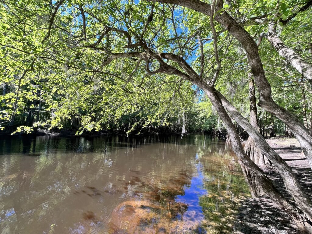
This section of river, which passes through the Uwharrie National Forest on the south end with Piney Mountain on river left is mentioned in Paddling Eastern North Carolina by Paul Ferguson with a minimum of 1.9 ft on the USGS gage at Little River in Star, NC. However, if whitewater is what you're looking for, I'd suggest over 3 ft on the gage.
At estimated minimum, this should be class II and on the higher end of the range (4.5 ft or more), this gets more difficult due to the continuousness and gradient and is somewhat pushy compared to other class II runs around. The gauge is approximately 16 miles upstream, but suggested levels should still work for this run. It starts with a 1.3 mile flat paddle on Lake Eure and there is a $10 fee to launch at the private boat ramp there. It is worth the paddle on the lake once you get past the dam since the river below is continuous for two miles. As you're paddling on the lake, you'll see the surroundings that would suggest maybe there is more excitement below the surface of the water that would be unlocked should the 45 foot dam ever be removed. I have below some alternate put in options to consider if you do not want to pay to launch. If you choose to start at Rocky Creek, you want even more rain than normal for this to be runnable. The creek was scrapable and mildly entertaining when we made this trip with 5.2 ft and slowly dropping on the USGS gage at Star, NC.
From the lake, portage river right a bit before the dam and follow the trail below looking for a spot to put in just below. It might be easier to put in further downstream, but you'd miss some good rapids in the first 30 yards or so. The first half mile of rapids are the most difficult boogie with some small ledges and no distinct drops, but powerful current with large waves. The next mile and a half is a bit easier boogie throughout with very few stretches of flat. Once you see the bridge at Thickety Creek Rd, work your way left. Current is strong at the bridge, so you will want to catch a river left eddy to reach your takeout point. Otherwise, you will be swept downstream some distance before you can get out. This is a very under paddled stretch of river that would likely be more popular if people really knew how fun it is. If the Eure dam and the dam below Pekin Rd are ever removed, this would be an excellent run for paddlers all around the area. For those familiar with the Lower Rocky River (Deep River Tributary) it is on par in terms of difficulty and feel. In contrast, however, it is more continuous and does not have any distinct drops that would require anything other than a boat scout. There are opportunities for surfing small waves on the way down with a larger wave immediately below the Eure Dam and smaller stuff further downstream.
Suggested alternate put ins to avoid the $10 fee:
_Troy Boat Ramp (35.295605, -79.885212):_ The pull off for this launch is from Pekin Rd. Some flat water at the beginning and an extra dam portage. Heavier rapids below the dam than what would be found in the main part of the run based on gradient. This is an extra 3.2 miles.
_Rocky Creek at Pleasant Grove Church Rd (35.281748, -79.911938):_ One class two rapid followed by flat and additional 1.1 miles to the total trip. Current moves fairly swiftly at the confluence with Lake Eure till about the point of the boat ramp launch, where the dam backs up flow.
_Rocky Creek at Robedo Rd (35.299987, -79.907692):_ One class III rapid at the beginning, another class II+ about 50 yards downstream followed by easy class I-II read and run. This is an extra 3.2 miles to add to the total trip. Watch for wood especially in the first half of this creek. Consider this option only if you put in immediately following rain or while it is still raining.
Hazards & Portages (1)
Caution: The following locations may require scouting or portaging. Always check current conditions.
Difficulty
Class II+
Length
4.0 mi
Rapids
0
1 Portage
Access Points
Difficulty Classes
I Easy
II Novice
III Intermediate
IV Advanced
V Expert/Extreme
VI Unrunnable
Current Conditions
5-Day Forecast
Whitewater data from
American Whitewater
American Whitewater