Falls of the Ohio - Upper (1 mile)
Ohio
Linked via: Unknown Synced 3mo ago
Gauge Conditions
Runnable: 12.0 – 55.0 FT
Data from American Whitewater & USGS
Run Map
Description
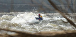
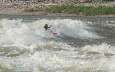
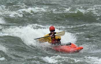
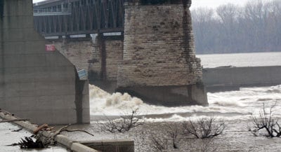
The Falls of the Ohio is one of the most distinctive paddling locations in the United States. Within sight of downtown Louisville, Kentucky, is one of the premier high flow runs.
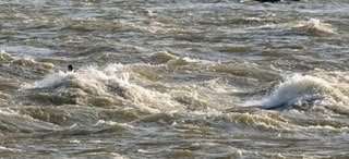
The Falls were originally a series of rapids formed by the exposure of a Devonian era coral reef which existed 350 million years ago. It is the world's largest exposed reef of this period. Today the McAlpine Locks and Dam control the river and expose the fossil bed along the Indiana shoreline. As water is released from the Upper Tainter Dam it flows over the exposed bed providing big water fun from (approximately) November till June. At higher water, the exploding waves appear, giving paddlers a quick, crazy ride from the dam down to the interpretive center.
The Falls of the Ohio is a National Wildlife Conservation Area. Please do not disturb any birds nesting or remove fossils. For more information see the Falls of the Ohio State Park website.
Directions:
Take Exit 0 from I-65 and follow signs to the Falls of the Ohio Interpretive Center. No shuttle for this fun, the interpretive center is both the Put in and Takeout. Just walk down the stairs to the river. Note:The State park is now charging a fee to park, you may avoid the fee by parking upstream under the railroad bridge.
There is also a Lower Falls of the Ohio site 1 mile down stream that is accessed via the clark boat ramp.
Map and Description: Putting in at the Interpretive center, a long eddy allows paddlers to make their way to the gates. From there cross the very large eddy line and enjoy the waves below. Be careful as wood often collects along the eddy line. Swims can be very long at the Falls; at higher levels, swimmers may be in the water for over a mile before they can reach the Indiana shore.
At lower levels the fossil bed becomes exposed along the KY side and one can ferry across the 1600ft wide river section to access additional playspots.

Playspots (4)
Hazards & Portages (1)
Caution: The following locations may require scouting or portaging. Always check current conditions.
Difficulty
Class II(IV)
Length
1.0 mi
Gradient
22 ft/mi
Rapids
0
1 Hazard
Access Points
Difficulty Classes
I Easy
II Novice
III Intermediate
IV Advanced
V Expert/Extreme
VI Unrunnable
Current Conditions
5-Day Forecast
Whitewater data from
American Whitewater
American Whitewater