First bridge to second bridge
Linked via: Nhdplus created 95% confidence Synced 6mo ago
Gauge Conditions
Runnable: ? – ? CFS
Approximate reading: This gauge is 4.8 miles away on Elk Creek. Use as a general reference only.
Data from American Whitewater & USGS
Run Map
Run Time Estimate
Select put-in and take-out to estimate time.
Unlock Advanced Trip Planning
See wind-adjusted speed maps, forecast planning, and detailed time estimates.
Sign in to generate an AI timing estimate for this run.
Whitewater timing varies with scouting, portages, and group pace. Use as a planning baseline.
Description
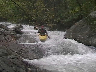
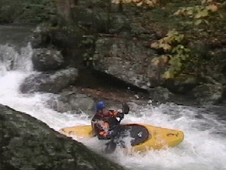
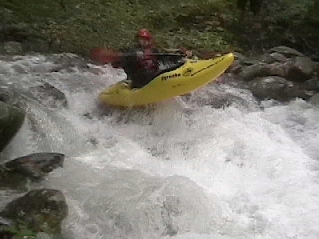
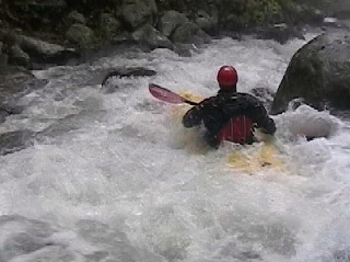
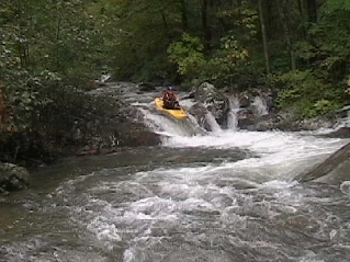
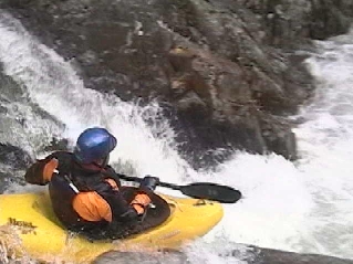
East Fork of Elk Creek is located along Forest Service Road 35 just outside the James River Face Wilderness Area in central VA. I wouldn’t suggest driving far for this little gem, but if you’re already in the area and everything else is high it’s worth a look. This small micro creek rarely has enough water, but when it does it rewards paddlers with two miles of non-stop class III-IV boulder action with the best rapids contained in the final 1/2-mile. The continuous nature of this creek is reminiscent of paddling in the Smoky Mountains of TN, and as with all small creeks paddlers should be on the constant lookout for wood. Luckily much of this creek can be scouted from the road while running shuttle. When it has enough water to paddle there are few eddies on the entire creek, so take the time to check for wood before putting on, then you can enjoy bombing down. On 10/7/06 we only had to get out around two trees.
With its easy access I wouldn’t be surprised if this creek had been previously explored, however it runs so infrequently I have my doubts. Anyone with additional information or photos is encouraged to comment here or contact me. My knowledge of the history of this run is as follows: Craig Granfield and I (Adam Goshorn) ran a section of this creek including Folded Falls early in the spring of 2003. John Howard also reports a run on Folded Falls later that same spring. Brandon Hughett and I made a run on 10/7/06 from a little below the first road bridge (near Sulfur Springs Trailhead) to the rapid below the second road bridge.
The river right side of this run was affected by the 2023 Matts Creek Fire.
Difficulty
Class III-IV
Length
1.3 mi
Gradient
165 ft/mi
Rapids
6
Access Points
Difficulty Classes
I Easy
II Novice
III Intermediate
IV Advanced
V Expert/Extreme
VI Unrunnable
Current Conditions
5-Day Forecast
Whitewater data from
American Whitewater
American Whitewater