Forks of Knownothing Creek to SF Salmon River
Linked via: Proximity 98% confidence Synced 6mo ago
Gauge Conditions
Runnable: ? – ? CFS
Approximate reading: This gauge is 13.3 miles away on Knownothing Creek. Use as a general reference only.
Data from American Whitewater & USGS
Run Map
Run Time Estimate
Select put-in and take-out to estimate time.
Unlock Advanced Trip Planning
See wind-adjusted speed maps, forecast planning, and detailed time estimates.
Sign in to generate an AI timing estimate for this run.
Whitewater timing varies with scouting, portages, and group pace. Use as a planning baseline.
Description
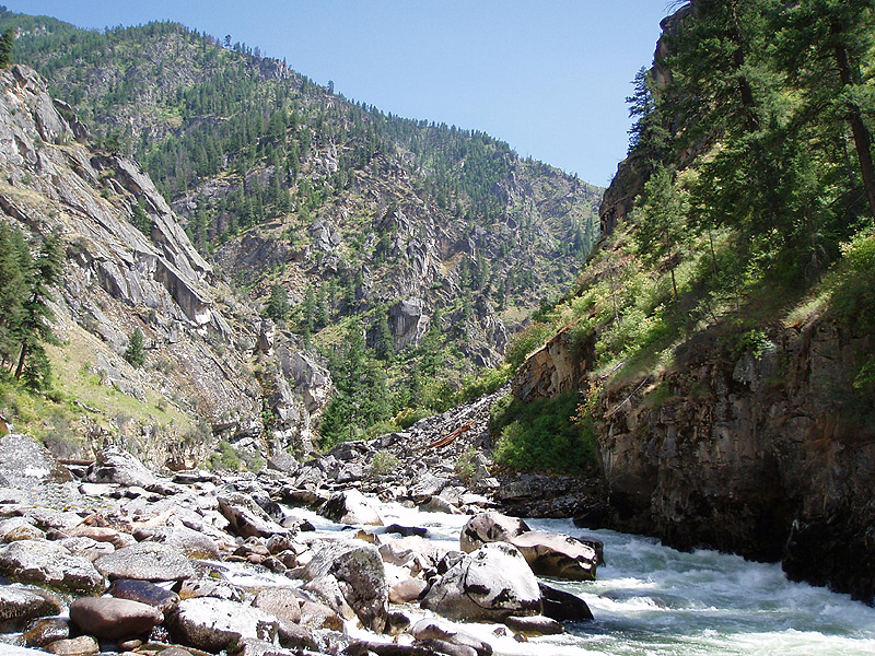
Knownothing Creek is the largest tributary to the lower South Fork Salmon River, draining the northern side of the Salmon Mountains opposite the headwaters of the New River. This isn't a classic boating stream, but it is pretty, easy to access, and the water is pure. It is a small, constant gradient stream with few eddies. It is very rarely boated.
But first you must know about the multiple (11) large wood fish habitat restoration structures that have been placed in the stream to aid ailing salmon runs. These may pose a serious hazard to boaters. See the trips reports for more info and check the map of large wood. You must know where they are and have confirmed that the wood is not spanning the full channel and then you must stay in control and on line while boating. That right there keeps most paddlers away, and that's probably a good thing. The creek is a great place to visit on foot too and there's lots of prime quality boating elsewhere in the Salmon River watershed.
But for those who do want to venture down the creek knowing the risks, you should scout as much of the creek as possible prior to paddling. There are at least 11 large wood structures in the creek in addition to any naturally occurring wood jams. When constructed in 2018, all 11 structures were built to span no more than about half of the channel width. The reason for this was unrelated to boating passage, and the structures are intended to accumulate more wood as it floats down the creek. Therefore, any or all of the structures may now span the full channel. You get the idea: assume there are at least 11 full width wood jams on this run and act accordingly. Scouting can be done by hiking from the short distance from the road to the creek as many times as needed for you to check for obstructions.
Put in about 2.5 miles up the creek below the confluence of the East Fork and West Fork. The land at the confluence is privately owned so put in a little ways below here. There is no developed access point or trail. After 2.5 miles on the creek you'll join the South Fork Salmon River at a boily confluence. Paddle about 2.5 miles on the South Fork to reach Forks of Salmon, continue another half mile on the mainstem Salmon River and take out at the first large beach on the right. This is the Forks of Salmon River Access and it is reached by the unmarked dirt road directly opposite the white community club building on Salmon River Road at the 17-mile marker (next to the school). All told you will have paddled nearly 6 miles from put-in to take-out.
Additional Information
Salmon River Restoration Council's Whitewater Recreation Page - great overview and detail on the whitewater of the Salmon River drainage
Salmon River Hazard Map - map of known hazards in the river and tributaries
Rapids in this Run (2)
Hazards & Portages (1)
Caution: The following locations may require scouting or portaging. Always check current conditions.
Difficulty
Class III+(V)
Length
2.5 mi
Rapids
2
1 Hazard
Access Points
Difficulty Classes
I Easy
II Novice
III Intermediate
IV Advanced
V Expert/Extreme
VI Unrunnable
Current Conditions
5-Day Forecast
Whitewater data from
American Whitewater
American Whitewater