FR 341 to Holly Springs Rd Bridge
Conasauga Creek (Hiwassee R. trib.)
Linked via: Nhdplus discovery 90% confidence Synced 6mo ago
Gauge Conditions
Runnable: 5.0 – 8.0 FT
Data from American Whitewater & USGS
Run Map
Description
_It is rumored that Conasauga Creek was run first by Mike Lewis of USA raft_
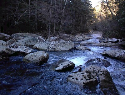
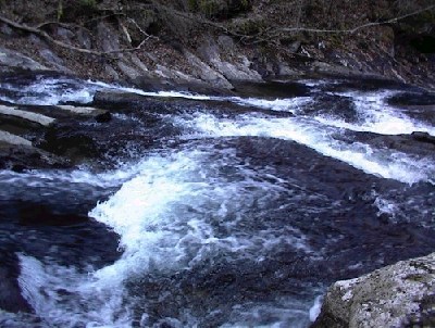
The run is 1.7 miles of whitewater and 1.3 of flatwater, due to a lack of an earlier takeout at this point. From Tellico Plains, go 2.5 miles south on Highway 68. Turn onto Holly Springs Rd., which has a sign for Towee Falls Church. Proceed through this quiet mountain valley for 3 miles, bearing right at a Y, thus not crossing the creek. Continue just under half a mile to a bridge that crosses the stream. Park in the spot on the downstream river right side of the bridge just out of the way of traffic. This is the takeout and the gauge. To the putin, go back to 68 and after turning right, immediately turn right on to FR 341 to Conasauga Falls. 2.5 miles down the road there is a right turn for the Falls Trailhead. One can scout the creek from this trail. To the putin, continue past this turnoff another 2 miles to where the creek is. Putin here. There is limited parking at the putin and takeout.
Description: The creek starts right off with a 5 foot ledge best run on the right, though a more interesting line is on the left. The creek is non stop 3-3+ moves and boofs for the next 4/10 mile. The gradient for this stretch averages to 280ft/m There is an undercut half way through this section. The wood is cleaned out for now. A brief respite ensues, followed by an island. Go left, but avoid the log at the end by beaching up on the shallows on the right. Some more bends and isolated class 3 brings the paddler to the takeout eddy for the falls. If you haven't been here before, err on the side of caution.
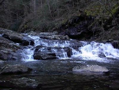
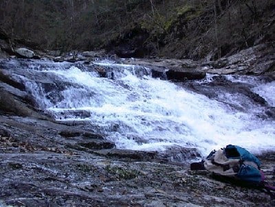
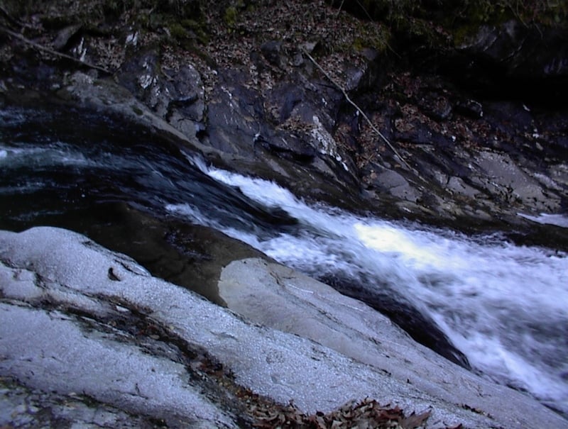
The falls is a 35 foot cascade called Conasauga Falls, and is definitely 5+. It is a drop of LVM type nature. It can be run, but I will not explain it. Below here is a series of slides that is called Chutes and Ladders. There is a 7,12,8,and 15 foot series here, which is overall gradual in nature but still very horizon-lined and intimidating if you haven't scouted. Easy big fun though.
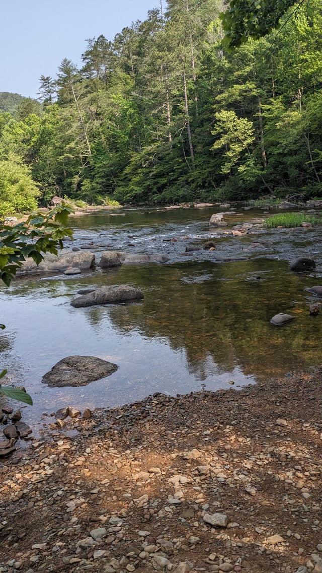
After the slides, look around and notice this previously unnoticed beautiful gorge. Appreciate the lack of roads and human impact. It's rare. Next the stream kicks several class 3 rapids and 3-5 foot complex ledges your way all the way to the flats in the valley. At higher levels this run is definitely solid class 4 and only a couple of inches at the gauge will make a big difference in the gorge, due to it's channeling effect. The valley is beautiful and there are two beaver dams, one you run and another that is a walk. The farmers will probably give you some weird looks but they seem friendly. Since this is such a new run please takeout at the county bridge, as this is the only public area to takeout at this point. We don't want access jeopardized for future paddlers.
Rapids in this Run (1)
Waterfalls (5)
Hazards & Portages (1)
Caution: The following locations may require scouting or portaging. Always check current conditions.
Difficulty
Class III-IV(V+)
Length
3.1 mi
Gradient
130 ft/mi
max 280
Rapids
1
1 Hazard
Access Points
Difficulty Classes
I Easy
II Novice
III Intermediate
IV Advanced
V Expert/Extreme
VI Unrunnable
Current Conditions
5-Day Forecast
Whitewater data from
American Whitewater
American Whitewater