Galens Road to Hwy 14 (6.4 miles)
Linked via: Proximity 97% confidence Synced 6mo ago
Gauge Conditions
Runnable: ? – ? CFS
Approximate reading: This gauge is 13.5 miles away on Wolf Bayou. Use as a general reference only.
Data from American Whitewater & USGS
Run Map
Run Time Estimate
Select put-in and take-out to estimate time.
Unlock Advanced Trip Planning
See wind-adjusted speed maps, forecast planning, and detailed time estimates.
Sign in to generate an AI timing estimate for this run.
Whitewater timing varies with scouting, portages, and group pace. Use as a planning baseline.
Description
Put-in: Located on Galens Road. Go 2.3 miles North on Hwy 25 from the junction of Hwy 5 at the community of Wolf Bayou. Turn North onto Galens Road (dirt) and go about a mile to a fork. Go through the right gate which should be open. Continue down this road (4-WD) for another mile to the creek. Park on the left just before reaching the creek. (Elevation 615) This is a private road so please be respectful, especially during hunting season. Optional access is to park at the gate and carry/drag the rest of the way to the creek.
Take-out: Hwy 14 bridge. From the Put-in, continue North on Hwy 25 through Concord. Turn left (West) on Hwy 14 at Locust Grove at the bottom of the mountain. Go 6.3 miles to the creek. Park on the East side of the creek upstream of the bridge on the old roadway. Leave room for other vehicles to access the adjacent field. (Elevation 270)
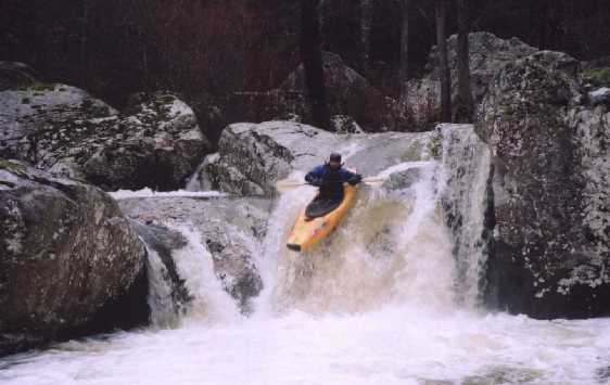
Main rapids are in first mile which drops 110 feet. 0.3 miles at 165 ft/mile.
The first 0.3 miles consists of a shallow bedrock shoals and ledges offering some play potential.
A tall bluff on river left will appear and the creek will make a sharp bend back to the right. The first slot move is located at the start of the bend. Go either side of the boulder. A short pool leads to a broken 4-ft ledge. Cleanest line is a boof about 1/3 of the way out from the right bank.
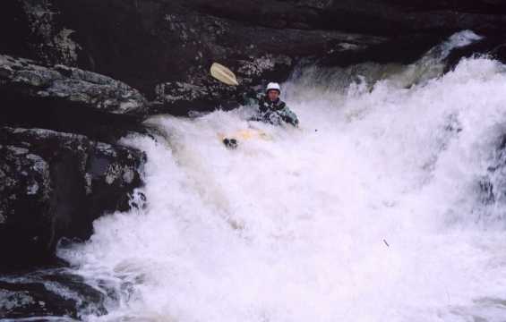
The main drops come in quick succession after this ledge. 'Wolf Bite', 'Road To Grandmother's House', 'Grandmother's House' and the main attraction 'Wolf Whistle'.
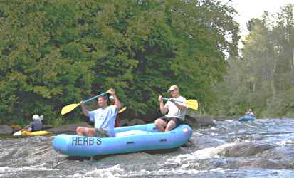
After 'Wolf Whistle', the remaining 5.5 miles of creek offer some nice class II to III+ rapids among the pools. The gorge offers wonderful scenery with the towering bluffs and cascading waterfalls. The creek exits the gorge about a mile above the take-out as the gradient eases and offers more willow jungles to negotiate.
Rapids in this Run (2)
Waterfalls (1)
Hazards & Portages (1)
Caution: The following locations may require scouting or portaging. Always check current conditions.
Difficulty
Class II-IV
Length
6.2 mi
Gradient
55 ft/mi
max 165
Rapids
2
1 Hazard
Access Points
Shuttle Info
**Put-in:** Located on Galens Road. Go 2.3 miles North on Hwy 25 from the junction of Hwy 5 at the community of Wolf Bayou. Turn North onto Galens Road (dirt) and go about a mile to a fork. Go through the right gate which should be open. Continue down this road (4-WD) for another mile to the creek. Park on the left just before reaching the creek. (Elevation 615) This is a private road so please be respectful, especially during hunting season. Optional access is to park at the gate and carry/drag the rest of the way to the creek.
**Take-out:** Hwy 14 bridge. From the Put-in, continue North on Hwy 25 through Concord. Turn left (West) on Hwy 14 at Locust Grove at the bottom of the mountain. Go 6.3 miles to the creek. Park on the East side of the creek upstream of the bridge on the old roadway. Leave room for other vehicles to access the adjacent field. (Elevation 270)
Difficulty Classes
I Easy
II Novice
III Intermediate
IV Advanced
V Expert/Extreme
VI Unrunnable
Current Conditions
5-Day Forecast
Whitewater data from
American Whitewater
American Whitewater