Germantown Nature Center to Twin Creek
Boomershine Branch
Linked via: Unknown Synced 6mo ago
Gauge Conditions
Runnable: ? – ? CFS
Approximate reading: This gauge is 1.2 miles away on Boomershine Branch. Use as a general reference only.
Data from American Whitewater & USGS
Run Map
Run Time Estimate
Select put-in and take-out to estimate time.
Unlock Advanced Trip Planning
See wind-adjusted speed maps, forecast planning, and detailed time estimates.
Sign in to generate an AI timing estimate for this run.
Whitewater timing varies with scouting, portages, and group pace. Use as a planning baseline.
Description
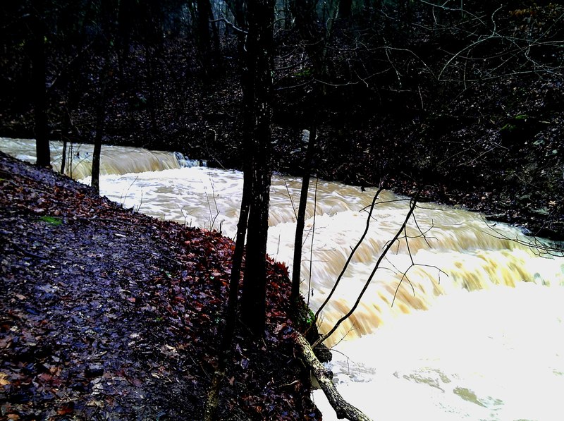
First lets be clear about this little creek. It rarely has good flows because it is a small creek. However it drains a large area of flat corn fields and thus has somewhat muddy but ample water when there are heavy rains.
Ok how does this creek add up? It is not a steep creek by southeastern standards but it would be if it were longer.This run will take 15-30 minutes for a good creek boater and you can run laps if the water level holds.
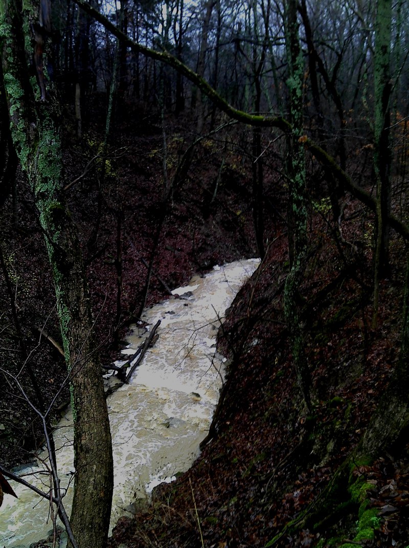
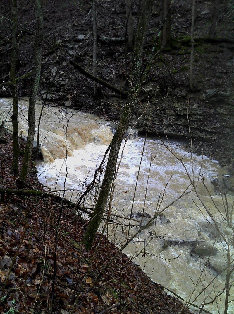
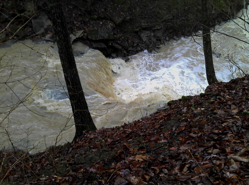
The put in is located where the trailhead crosses the stream above the gorge. It takes off in a matter of feet after the put in.You will start screaming down the slope over 1 to 5 foot ledges. Keep your eyes open for trees. On my first and second run I had 2 trees that I needed to walk around.There were some other pieces of wood that were poorly placed but manageable. After the first few ledges the action really starts to pick up and you are going to be hitting the two big drops that are over 5 to almost 7 feet in height.The difficulty picks up and some of the drops could lead to pinning. After the big ledge the gradient picks up and feels quite steep. Make sure there is no wood in here before you start or at least avoid boating past the last eddy you can see.The gradient eases up as you approach Twin Creek. Get out on river left or right to hike back up. I prefered river right.
The gradient is a bit of an exaggeration.The creek is only 0.5 mile in length and it drops about 150 feet in one crazy downhill rock slide or boulders and ledges.
Rapids in this Run (2)
Waterfalls (2)
Difficulty
Class III-IV
Length
0.6 mi
Gradient
100 ft/mi
max 200
Rapids
2
Access Points
Shuttle Info
I prefer to walk back up the white trail. You can easily park at the otehr side of the Germantown Dam and walk up from the river. WHATEVER you do DO NOT go into the Germantown Dam on Twin Creek.
Difficulty Classes
I Easy
II Novice
III Intermediate
IV Advanced
V Expert/Extreme
VI Unrunnable
Current Conditions
5-Day Forecast
Whitewater data from
American Whitewater
American Whitewater