Globe Road to Upton
Linked via: Proximity 97% confidence Synced 6mo ago
Gauge Conditions
Runnable: ? – ? CFS
Approximate reading: This gauge is 11.0 miles away on Thunderhole Creek. Use as a general reference only.
Data from American Whitewater & USGS
Run Map
Run Time Estimate
Select put-in and take-out to estimate time.
Unlock Advanced Trip Planning
See wind-adjusted speed maps, forecast planning, and detailed time estimates.
Sign in to generate an AI timing estimate for this run.
Whitewater timing varies with scouting, portages, and group pace. Use as a planning baseline.
Description
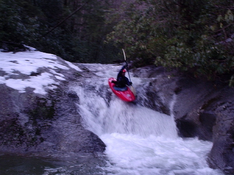
Thunderhole Creek is off of Globe Rd. between Collettsville and Blowing Rock. If you have a NC gazetteer, it's easy to find. The access trail is a spur off of FR 4071. We hiked in about a mile to get the footage you saw. The rest of the creek was too low to run. Thunderhole would need a lot of rain to run. Very small watershed. A run of about 3-4 miles could be made down to Upton, there's good access there. Don't know about in between, but it looks as if the gradient is all in the upper parts. A put-in as high as the confluence with New Years Creek would be possible I think. I would say that it is mainly class III, but boat control and eddy catching skills are a must as wood is always a problem on creeks this small.
You could use the short put in option to cut out some of the scrappy stuff near the bottom but you'll have about .2-3 of a mile hike out.
In the event of a hike out the trail crosses Thunderhole Creek several times but is generally on river left.
Put-in : ~1850' at New Years Ck Conf. at 36.1062, -81.6949
Take-out: ~1200' at Upton at 36.0682, -81.6948
Elev.loss: ~650'
NOTE: The gate is closed January 2nd - April 1
Rapids in this Run (3)
Difficulty
Class III-IV
Length
3.9 mi
Rapids
3
Access Points
Difficulty Classes
I Easy
II Novice
III Intermediate
IV Advanced
V Expert/Extreme
VI Unrunnable
Current Conditions
5-Day Forecast
Whitewater data from
American Whitewater
American Whitewater