Groveland Rd to the Tohickon Creek Confluence
Linked via: Nhdplus gnis 95% confidence Synced 6mo ago
Gauge Conditions
Runnable: ? – ? CFS
Approximate reading: This gauge is 1.7 miles away on Geddes Creek. Use as a general reference only.
Data from American Whitewater & USGS
Run Map
Description
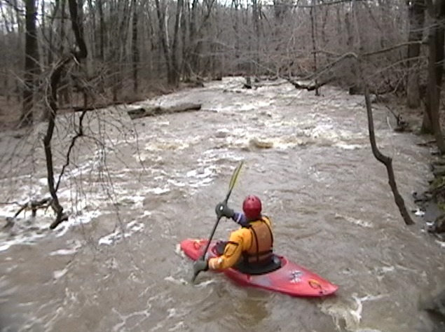
Geddes is a shallow fast creekbed. A roll almost always means grazing a rock while upsidedown. The run may be done as a 2 mile or 1 mile run. The first mile is easier and a bit less continuous. The upper mile ends at the closed steel bridge (on tollgate road) where a tributary comes in on river right. At times this is a very significant merge of water. You can easily hike back to the 2 mile putin by the river left side on tollgate road.
Many boaters like to warm up in the upper wider and thus scratchier mile but the creeker that wants the best goods often drives Tollgate rd to the closed bridge (1 mile putin) and runs laps from there. Note the road that parallels the lower mile is closed due to the road falling into the creek gorge (without creek obstruction). There is very limited parking at both the 1 mile putin and even less at the 2 mile putin. Pack it in as best you can. Whatever you do, DO NOT BLOCK the land owners driveway on the narrow road right at the 1 mile putin on Tollgate road.
Geddes is known as a very difficult creek to get on because it flashes out very quickly. Unless the water is Very High I wouldn't even bother driving from the takeout to the 2 mile putin if the rain is still not falling. The paddler that drives to the creek before the Tohickon Gauge rises will get on Geddes. By the time the Tohickon rises Geddes is often gone. It is frequent that the creek will fluctuate half a block during your run plus/minus . The Wick guage across the river in NJ rises as quickly as Geddes and is the key to know when to drive to the Geddes putin. If the Wick spikes and the rain event isn't expected to end soon drive and likely get your Geddes run.
AREA Creeking: In the way of utilizing the rain the best, you get on Geddes 1st, then the Wick in NJ (to covered bridge) followed by the Lock in NJ for the best local triple crown day. Don't run the whole Wick (lower)...its not on par with the other Goods. If things get insanely high you can try and get a run in on the nearby Devils Tea Table too in NJ, but this is the most rare event as the creek probably runs less than 6 times a year. The Lock would need to spike to 2000 cfs for Devils to be even a possibility.
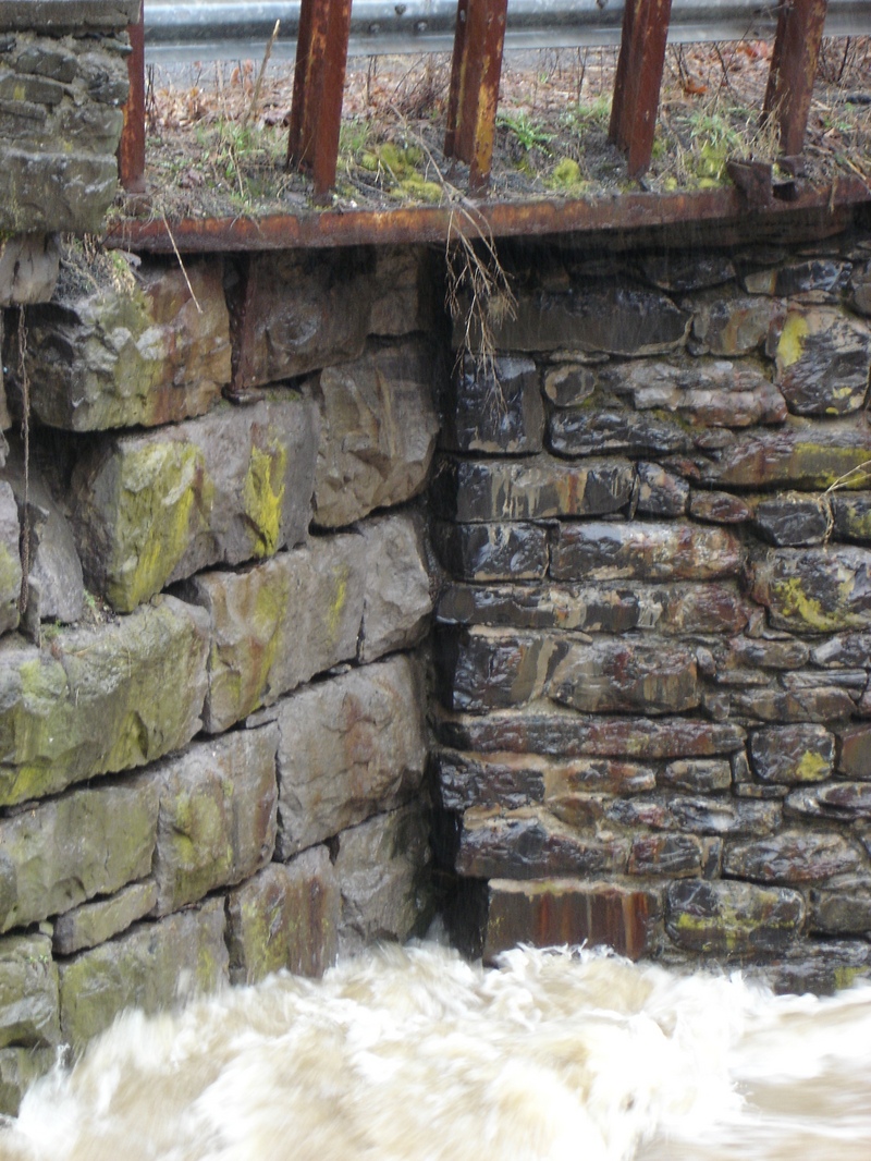
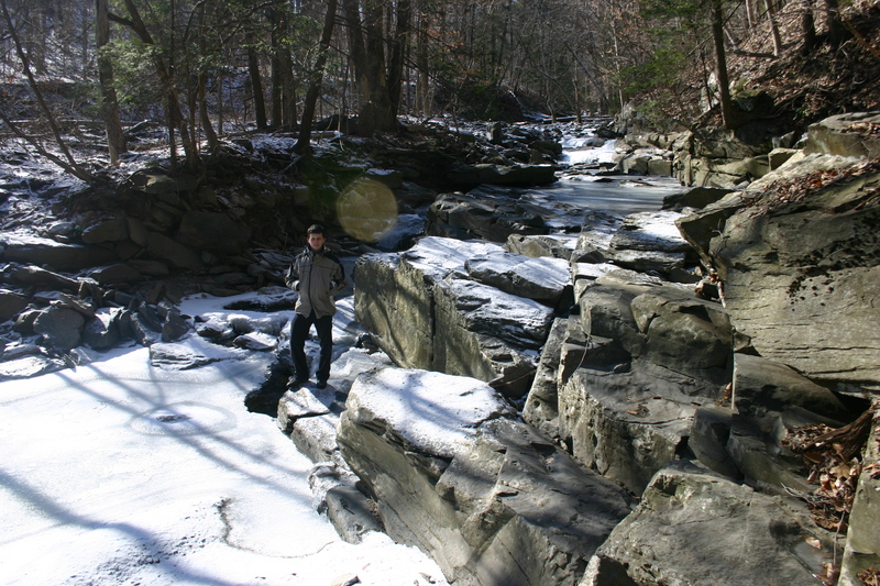
Geddes is most accurately described as bobsled ride that can get VERY continuous where you are on top of strainers before you know it! Lots of Blind Curves... So look for people just getting off running Geddes laps to get the strainer 411. The creek is fairly well maintained by locals but the wood condition is undocumented since the HUGE flooding of Aug/Sept 2011 (check the comments here). During this high water event the gauge was burried in silt from the farmlands. _The gauge will be reading higher till the silt flushes out of the area just above tohickon hill road bridge where the river left wall gauge is located...so take the level references here with a grain of salt_.
Gauge: The gauge is read by looking for the vertical seam in the river right drywall that is just upstream from the Tohickon Hill bridge. You read it from the bridge and not in your car pissing off the locals. Walk there and peer down and read it. On the downstream side of the vertical seam you count the blocks from the top going down that are exposed. Each block is aproximately 18". 4.5 Blocks is about the Highest run known by Wayne Gman and Jared Seiler in 2007. 6 blocks exposed and less is a higher level best for creekers with class 5 experience in probing challenging lines. 6 blocks is the balance point of when things start to get more serious quick. 6 to 6.75 blocks exposed are good first timer levels and levels without tons of pressure, but you still have to be on your toes. You must have a sense of if the water is coming up, stable or falling out. Frequently the creek will rise OR fall half a block during your run. If its not raining at all keep the run moving along. This character is why there have been so few pictures on this creek.
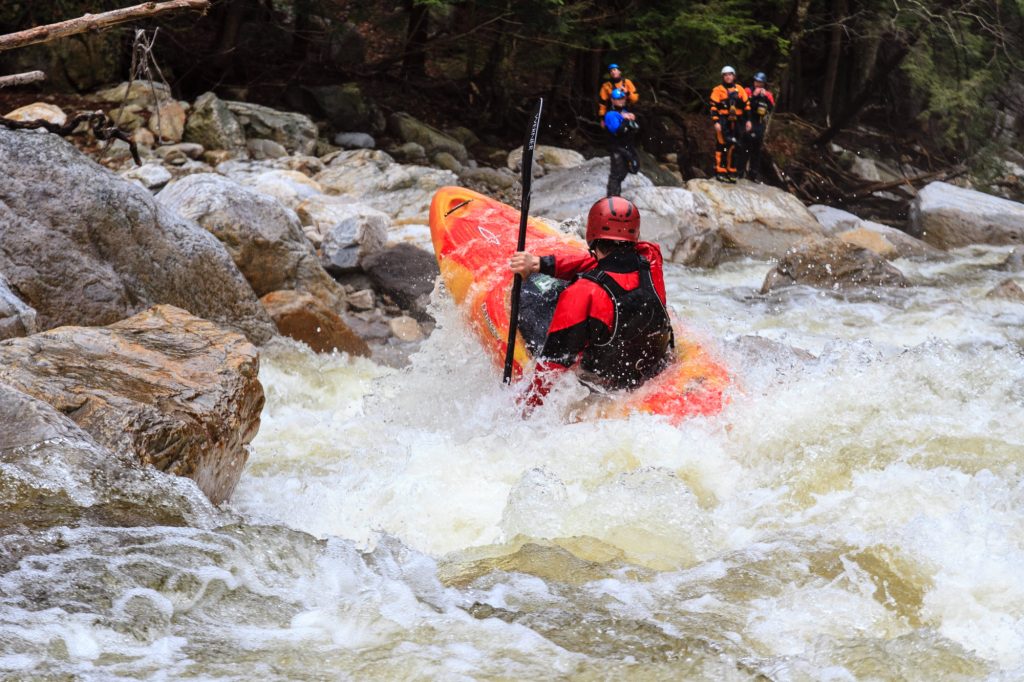
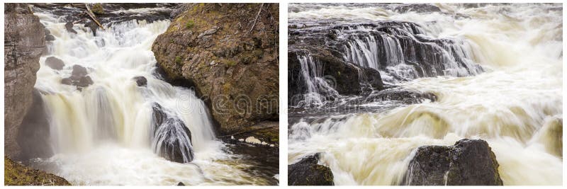
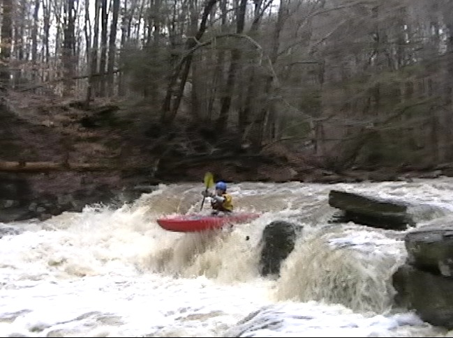
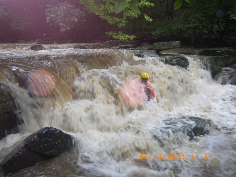
Averaging aprox 200 ft/ mile the top mile starts out as a typical small bouldered creek. It is wider and more scratchy than the bottom mile. The top mile builds in intensity to the bottom mile. The Bottom Mile is more steep, tight and technical. The creekbed often tilts from river right to river left. The creek winds its way around and the water sloshes with power right and left in an unusual way. It will slosh you to places you will not want to be, so stay on line. At reasonable low levels there are no truely worriesome holes and its hard to think of any one feature that is harder than class 3+ but the continuousness and committing nature and many blind bends, without many easy eddies, push the base line rating of Geddes to a solid class 4. There are mostly single or double boat wide eddies, very few large eddies. Great Class 5 creekers will be able to break the creek down, the rest will just flume along into whatever.
At medium to high water the continuous nature really kicks in demanding real Class 4+/5 skills.....So....playboaters getting off the Tohickon better think twice before trying to be too opportunistic and playboating Geddes just because they happen to stumbled into Geddes running. A couple hundred yards downstream of the 1 mile putin (closed bridge) is the Hairy Clam ledge with the Stone Trap pinning spot. Play boaters will vertically pin there with low volume bows. If you are on line for the pin it will grab you in a piton, it will hold you solid, and if the flow is bigger, 6 blocks or less exposed, your head may easily be underwater with huge water pressure on your back. I know of 5 playboats that have pinned in StoneTrap prior to 2007...not so many now that the word is out.
X-Rated rapid names(a history): I finished a geddes run in near darkness after taking Ken Voytec on his first Geddes run. We pushed darkness to its limits of only seeing the white of the whitewater for the last half mile which I knew by the back of my hand. There was no strainers on my last run there. Our shuttle bunny was very concerned at the take out getting the club boaters coming off the Tohickon quite worked up over our safety. People were getting ready with headlamps to walk upstream to find us. We emerge out of the darkness to a quite stressed group. They simply were not used to situations like this. Ken and I walk to AppleJack's bar for wings and beer when I notice "crazy" Ricks Van. I expect to see him, jared and graham seiler in Apple Jacks. When I don't see them I don't think much else and over the next hour I drink a couple brews and chow down on amazing HUGE wings. As we are about to leave 90 min after sunset....in stumble the guys that would be known in a couple years as DEMSHITZ hooting and hollering about a fantastic night run on the Tohickon that they just put down on memory and feel. It was a very black night and I was astonished. Ken leaves and I stay to have another round with my Demshitz buddies. During that time we talk about how none of the Geddes rapids have names.....and we named them over hot wings and suds. Jared declares he always wanted to name all the drops on a run xrated.....in sophmoric fashion we run down ridiculously vulgar options. The Stone Trap feature was thought to be an upstream leaning clam shell feature so we dubbed that the Hairy Clam with obvious double entendre. Back in 2007 before some blocks blew out there was a really troublesome ledge feature creating a natural low head dam effect causing lots of bad swims....(my first class 4 swim in fact)....We named that one Ass Fuck falls....based on my paniced swim I whole heartedly agreed.
(wayne g-man 2011)
Rapids in this Run (7)
Waterfalls (2)
Hazards & Portages (2)
Caution: The following locations may require scouting or portaging. Always check current conditions.
Difficulty
Class IV
Length
1.9 mi
Gradient
200 ft/mi
Rapids
7
2 Hazards
Access Points
Shuttle Info
Geddes shares the takeout for the Class 3 Tohickon Creek. A 5 car parking lot at the confluence of both creeks at the intersection of Tohickon Hill Road and State Hwy 32 (aka river road)
**To 2 mile run putin:**
1\. Drive up hill on Tohickon hill road. Just over a mile you make the first possible Left on Groveland Road.
2\. Continue half a mile See Tollgate Road. By Pass Tollgate and continue several hundread yards to the first very small bridge which is the Geddes 2 mile putin bridge.
3\. **1 mile/Iron Bridge PUTIN**: If the 2 mile putin looks too scratchy you can try the 1 mile putin where the creek is more narrow. Back track a few hundred yards to Tollgate road. Turn South or in the downstream direction on Tollgaite (0.5 miles) and drive to the Dead End at the Iron Bridge.
Park tight and Please do not block the land owners driveway. If you see the old man on the porch wave, say hi and ask if you can walk to the creek. No issues with access yet but be very polite and do not change within 20 ft of the home windows where you likely will park. you'll cause trouble. If Iron Bridge parking is ever a problem it is possible to park 3 cars on the far side of the Iron bridge with very simple "around the block" type driving always bearing Left to get around to the otherside. Note that Point Pleasant Pike road is closed between Tollgate rd and Hwy 32(river road) this is the river right road for the bottom mile of the run below the iron bridge.
Difficulty Classes
I Easy
II Novice
III Intermediate
IV Advanced
V Expert/Extreme
VI Unrunnable
Current Conditions
5-Day Forecast
Whitewater data from
American Whitewater
American Whitewater