Hastings to Gilead
Linked via: Nhdplus discovery 90% confidence Synced 3mo ago
Gauge Conditions
Runnable: 4.5 – 8.0 FT
Data from American Whitewater & USGS
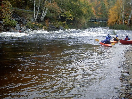
Run Map
Description
\[Note: Commentary and description taken from email from Gary Bamberger. Eventually we'll write up a proper description of this river.\]
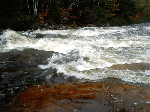
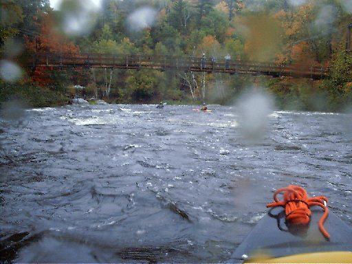
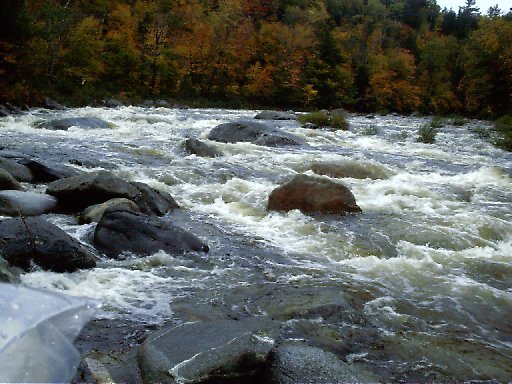
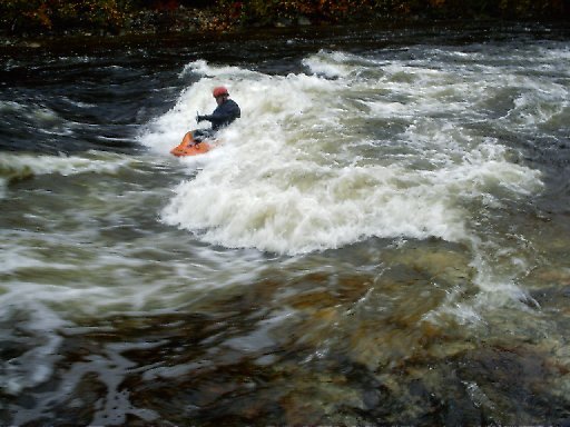
Yahoo, we finally caught the WILD RIVER at a prime level. We did 2 runs today and as the AMC Guide says...a few inches makes a BIG difference! On the first run we decided to take the left fork in the road (Me Rte #113) at the suspension bridge and run Evans Brook which runs along route 113 down the north side of Evans Notch into the WILD RIVER and then down the Wild to the take out at Rte. #2. Evans Brook is a really small stream and it will likely be a while before it's runable again. Although it did have a bit of wood in it, we were able to paddle through without getting out of our boats. The second run we ran the more traditional Wild river trip by driving/walking up the right fork in the road to the upper section. All in all we agreed that the best paddling/play is really below the suspension bridge so even if the gate is locked to Wild RIver Campground...you haven't miss too much play. HOWEVER, when Me. Rte #113 (the Evans Notch Rd) is closed, as it was today, it's a long walk to the confluence of Evan Brook and the Wild River at the suspension bridge...a minimum of ~1 1/2 miles and more if you want to run Evans Brook or the upper section from Wild River Campground (~5 miles)...However, we had the key to the gate hee- hee! ;-) Anyway here's our consensus: The first run according to the USGS gage was running ~7 feet (~3500CFS) and on the second it had dropped to 6.5' (~2500CFS). On both runs the water was up into the trees/bushes along the riverside. The first run felt a little washed out with some good sized waves, many holes you really would really rather look at from the other side of the river, and few eddys to rest in. The second run was much more playful with wave upon wave to surf and more friendly holes to play in. It surprised me that just 6 inches made such a difference. I had heard from other local paddlers that 6 to 8 feet was the level to try to catch the Wild at, and I would have to agree with ~6.5' for play and ~7.5' for big water river running. We agreed that the run is primarily class III with several class IV drops thrown in to keep you on your toes and felt a lot like Lower Poplar Rapid on the Dead at 5500CFS, but with WAY MORE PLAY. The river definitely goes in my book as one of the great "Play Rivers" since as soon as you washed off one wave and turn back around downstream, there were 3 or 4 more looking you in the face! :-) One of the paddlers in our group compared it to the Donnaconna section of the Jacques Cartier, although a smaller version. I never been up there but maybe this summer. Sooooo, attached below are some personal notes I made about the Wild RIVER in my computer and let's not hope it's another 5 years before this gem runs again.
WILD RIVER- 4/28/05 Park at take out at USGS gage at Rte 113 & Rte 2. which is 10.9 miles east of NH Rte #16/#2 intersection in Gorham, NH and/or 9.5 miles west of Bethel, ME on Rte #2. It's then 1.5 miles to the Maine DOT Gate that closes Evans Notch in the winter and then an additional 1.4 more miles beyond that gate to the fork in the road at the Suspension Bridge. (Confluence of Evans Brook and the Wild River) We did 2 runs 1st @ 7.0' (3400CFS) Evans Brook-Wild River to the take out and the 2nd @ 6.5" (2500CFS) which was a better level Wild River all the way. Best play from suspension bridge to rte #2 (~3 miles). Class III with ~4 class IV drops-all boat scoutable. Note at these levels the water is up into the trees/brush along the river. Future recommendations-between 6 and 7 feet on the USGS gage.
Gary Bamberger, DVM
407 White Mountain Rd.
North Conway, N.H. 03860
PS: Oh yea, I almost forgot...as we were taking out after our second run we ran into the USGS "boys" who were just about to take a reading of the river manually to calibrated their gage. It was really interesting to watch them work. They climb up into a 2 man "cable car" running across the river at the USGS gage and lower a heavy sensor into the river. The cable is marked off in what looked like 10 foot increments and they would go to each spot on the cable and take a reading of the flow starting on the right shore and working slowly over to the left shore. One of the men had what looked like a huge wrist watch on his left wrist from which they received the data from the submerged sensor while the other man wrote down the info in a logbook. We talked to them a little on shore and it seemed that they found our playing in the river as interesting as we found hearing what exactly they were doing. I just wish they would put that Ellis River Gage back in though... gary
Rapids in this Run (3)
Difficulty
Class III-IV
Length
8.7 mi
Gradient
47 ft/mi
max 80
Rapids
3
Access Points
Difficulty Classes
I Easy
II Novice
III Intermediate
IV Advanced
V Expert/Extreme
VI Unrunnable
Current Conditions
5-Day Forecast
Whitewater data from
American Whitewater
American Whitewater