Hayfork to Nine Mile Bridge
Linked via: Proximity 99% confidence Synced 6mo ago
Gauge Conditions
Runnable: ? – ? CFS
Approximate reading: This gauge is 14.0 miles away on Hayfork Creek. Use as a general reference only.
Data from American Whitewater & USGS
Run Map
Description
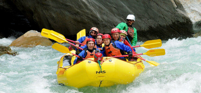
Just outside Hayfork is this gem of an intermediate level run on Hayfork Creek. Once on the Shasta-Trinity National Forest, there are options for creekside camping. Logistics are easy as the run is paralleled by Hyampom Road.
Due to contentious private property issues at access points closer to the start of the whitewater on this run, paddlers should put in at the Highway 3 bridge in Hayfork (state law allows paddlers to access rivers at bridges, just stay within 30 feet of the roadway and bridge). This adds a three-mile float through the valley before the canyon closes in and the whitewater begins. This section has some brush hazards and can involve brush portages. The next bridge at Doctor Lane has river access and there are no signs declaring no parking or private property, but put on here at your own risk.
Below Doctor Lane bride the creek is mainly class II for the first half of the run. The first class III rapid Gobo is a straightforward drop with a river right scout. There are a couple more class III rapids before you hit class IV Fraggle Rock towards the end of the run. Make sure you scout Fraggle Rock, as it can hold wood and the left line that looks like a cheat is a large ledge that can be worse than the main chute depending on flows. Scout either side of the river.
Take out immediately upstream of the Nine Mile Bridge on Hyampom Road. This is also the put-in for the Lower Run which is considerably more difficult.
Rapids in this Run (2)
Difficulty
Class III+(IV)
Length
8.0 mi
Rapids
2
Access Points
Difficulty Classes
I Easy
II Novice
III Intermediate
IV Advanced
V Expert/Extreme
VI Unrunnable
Current Conditions
5-Day Forecast
Whitewater data from
American Whitewater
American Whitewater