Highway 180 to Wonder Valley
Linked via: Nhdplus discovery 90% confidence Synced 6mo ago
Gauge Conditions
Runnable: ? – ? CFS
Approximate reading: This gauge is 26.5 miles away on Mill Creek (Fresno County). Use as a general reference only.
Data from American Whitewater & USGS
Run Map
Description
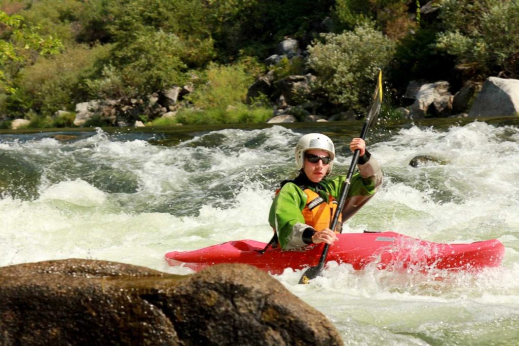
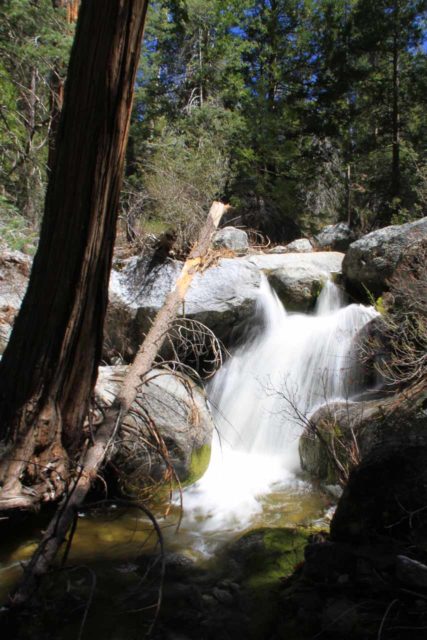
Mill Creek is a tiny, low elevation foothill creek that has sections of super classic bedrock falls and rapids.
This creek will be kayakable only in the winter after big rainstorms or a steady series of storms. During drier winters it will not get high enough for boating. The very top of its drainage is a bit over 5,000 feet near Big Stump in Kings Canyon National Park, but most of its drainage is low elevation foothills with oak woodlands and lots of houses. Water quality will likely be poor and it will certainly be muddy or cloudy. Getting there: From Fresno, take Highway 180 east into the foothills, through Squaw Valley, then down past a fire station to the bridge over Mill Creek. Driving time is about 45 minutes from Fresno.
Put-in: Local paddlers have worked out permission from land owners to launch where the Highway 180 crosses the creek, but it may not apply to everyone. On some occasions kayakers have been prevented from launching here, by other land owners or by officers from fish and game. Elevation is about 1,390 feet.
Take-out: Backtrack on Highway 180 southwest towards Yokuts Basin, then turn right (north) on Elwood Road to Wonder Valley. On entering Wonder Valley, look for the creek on your right, then take the first road right and park near the bridge that crosses the creek. Elevation is about 900 feet.
For the first quarter mile after the creek leaves the highway, it is shallow and braided, with several barbed wire fences across it. Soon however, the creek turns north and starts dropping into a deep canyon between Bald Mt. and Dalton Mt. (named after the famous 1890s Dalton Gang of bank and train robbers). The first large falls is intimidating as it can only be scouted or portaged high on river left and there is no easy way to set up safety for anybody running the rapid. There is also a nasty room of doom alcove, with a recirculating eddy hidden underneath the left wall at the base of the falls. Scouting or portage at subsequent drops is more reasonable. Many of the drops in this section are outstanding and very big.
At the halfway point the creek turns west, opens up, flattens out, braids and becomes infested with reeds. I found floating and scraping through little tunnels in the weeds very exciting in a strange way but subsequent boaters seem to find walking on the cow trails next to the creek easier and perhaps faster in many parts of this section.
-Paul Martzen
Rapids in this Run (4)
Waterfalls (1)
Difficulty
Class V
Length
7.4 mi
Gradient
118 ft/mi
max 230
Rapids
4
Access Points
Difficulty Classes
I Easy
II Novice
III Intermediate
IV Advanced
V Expert/Extreme
VI Unrunnable
Current Conditions
5-Day Forecast
Whitewater data from
American Whitewater
American Whitewater