Hwy.96/Day Street to Hwy.32/57/Greenleaf Road (2 miles)
Greenleaf Creek
Linked via: Unknown Synced 6mo ago
Gauge Conditions
Runnable: 180.0 – 900.0 CFS
Unless there has been major rain earlier (in day/prior-day), expect too little flow for this creek.
Runnable: 100.0 – 600.0 CFS
Perhaps 0-35 cfs; likely too low to boat.
Data from American Whitewater & USGS
Run Map
Run Time Estimate
Select put-in and take-out to estimate time.
Unlock Advanced Trip Planning
See wind-adjusted speed maps, forecast planning, and detailed time estimates.
Sign in to generate an AI timing estimate for this run.
Whitewater timing varies with scouting, portages, and group pace. Use as a planning baseline.
Description
Quick Facts:
Location: Approximately 9 miles ENE from downtown Kaukauna, WI or 16 miles SSW of Green Bay.
Shuttle Length: 1.5 miles.
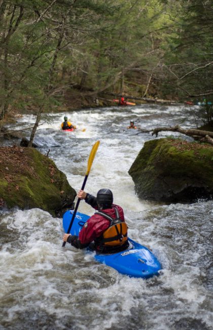
Character: Tiny creek with bedrock river-bed. Expect plenty of strainers, sweepers, and dangerous conditions if you ever find enough water here to think about boating.
Put-in is approximately 830' elevation.
Take-out is approximately 690' elevation.
Thus total elevation change is approximately 140'.
General Overview
This is seriously small (~6.3 sq.mi. at listed put-in), and likely in the vein of 'stupid boater tricks'. This creek actually has no name that I can find. I call it 'Greenleaf Creek' only for its proximity to that area, and to have some name for this apparently unnamed tributary of the East River. As it passes out of open pasture, it passes powerlines and drops through a fence, and into a fairly heavily wooded area. It may be to your advantage to see if you can get permission (from the property owner at the end of Wobeck Lane) to park and put-in from their property. (It is not known how 'boater friendly' they might be.)
There is a full mile with around 115' of drop. Unfortunately, you can expect to have to deal with some major deadfall and snags. In fact, in the unlikely anyone attempts to boat this, they will probably find it easier at some point to just get out (after the best of the gradient) and walk the final 1/4-1/2 mile to the indicated take-out. However, at any boatable flow, it may be seriously difficult to find an eddy and exit the stream before being swept into a strainer. Advanced creek boating skills are essential for such a tiny creek. Streams this small require the utmost in caution! With enough water to be runnable, there will be virtually no eddies, and any strainer (trees or branches down in the water, blocking your route) or sweeper (bushes and branches low overhanging the water, which will make paddling difficult or impossible) could be disastrous (deadly). In fact, it would be highly recommended to (get permission to) walk as much of this stretch as possible before putting on, to carefully assess the strainers, and sweepers.
Rapids in this Run (4)


Difficulty
Class II-III+(IV)
Length
1.6 mi
Gradient
72 ft/mi
max 115
Rapids
4
Access Points
Difficulty Classes
I Easy
II Novice
III Intermediate
IV Advanced
V Expert/Extreme
VI Unrunnable
Current Conditions
5-Day Forecast
Whitewater data from
American Whitewater
American Whitewater