Iron Mountain Road (NJ) to Rt 94(NY)
Linked via: Nhdplus discovery 90% confidence Synced 6mo ago
Gauge Conditions
Runnable: ? – ? CFS
Approximate reading: This gauge is 4.4 miles away on Doublekill. Use as a general reference only.
Data from American Whitewater & USGS
Run Map
Description
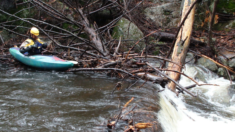
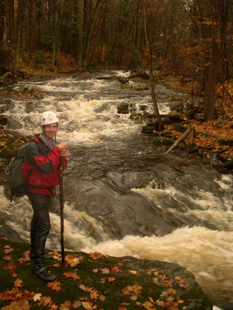
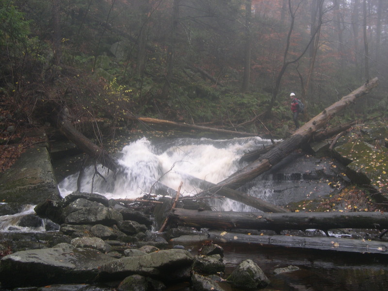
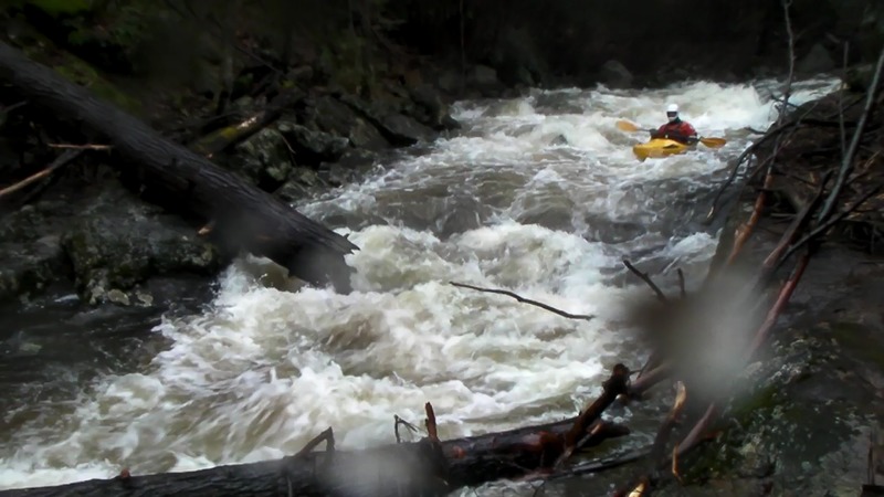
This is an amazing beautiful remote run. The dense old growth set in a deep and steep rocky gorge give a unique feeling especially for NJ. Come get NJ at it's best! These are the among best if not the very best remote NJ bedrock drops. Only Devil's Tea table comes close in my mind but it lacks the Doublekill's length, remoteness and stomp factor.
Gradient by mile:
Mile 1: 263 ft
Mile 2: 260 ft
Mile 3: 144 ft
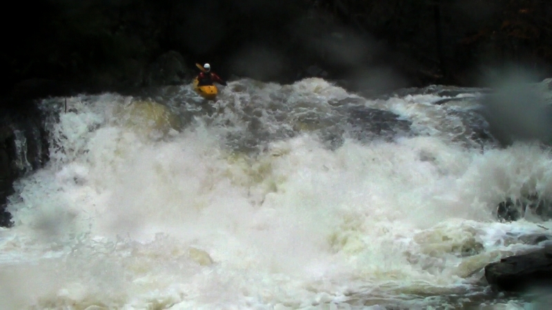
MAX GRADIENT: 360 ft/mile, which occurs from about mile .75 to mile 1.25.\
1.9 miles of the run is within New Jersey and the last .6 miles is in New York state. Watershed is aprox 6-7 square miles.
When the big rains come you can swing by this gem to see if it's up. The large marshy headwaters with several ponds may keep the levels up more than we might expect for multiple days. Please post runs and the amount of rain that allowed you to boat the doublekill. The doublekill always seems to have some water so I think it may go more often than one might assume.
Take care not to enter the gorge too early in the Early Spring as this north facing deeply shaded gorge acts like an icebox and holds ice in the drops much longer than the surrounding areas.
First Descent:
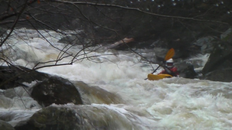
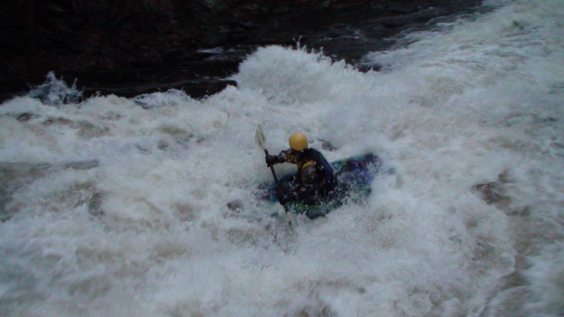
Especially while the creek is strainer intensive runs should be started early in the day. The first decent on 3/30/2010 by Wayne Gman and Steve Strange started at 1pm (start of hike) and ended at 8pm just 15 minutes after dark. That day the two hiked and boated in a hard rain adding 1 inch to the 1 inch that already fell over the previous 12 hrs. The watershed was very wet before this rain event started.
the West Brook guage had spiked to 275 cfs the previous day and spiked to 400 cfs while the 1st D was run. The guage continued to rise to 475 overnight.
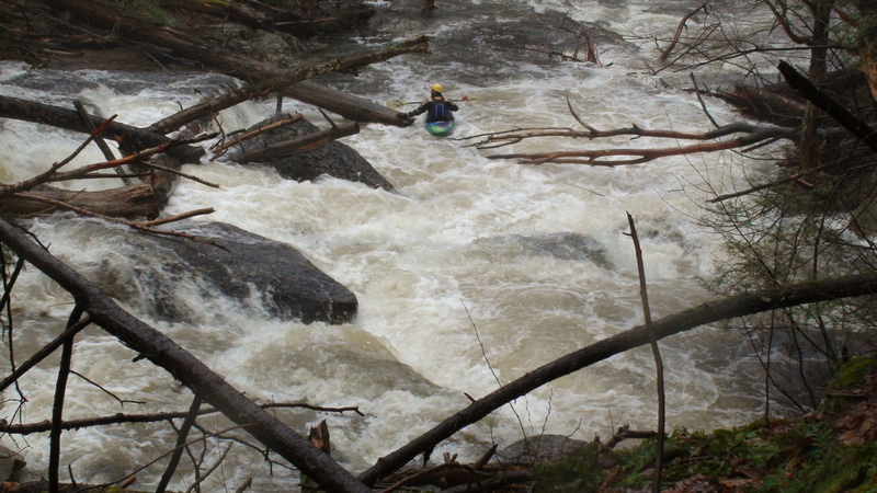
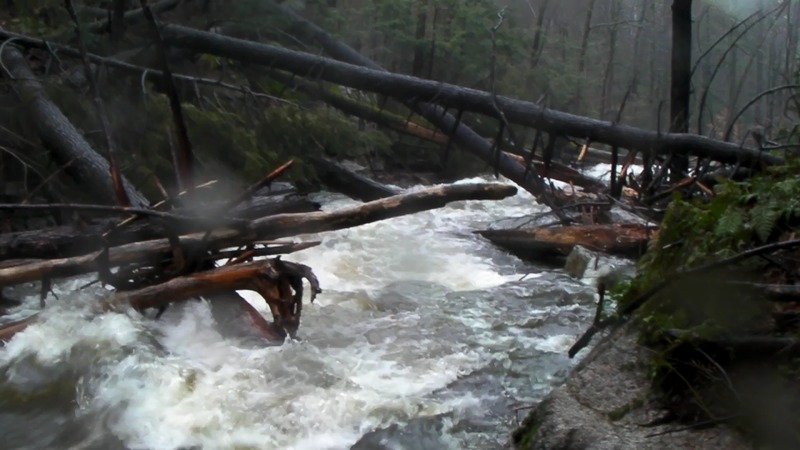
All drops were run on the 1st D day except for Boof & Rally. There are many life threatening strainers on the run right now. Only boaters comfortable with running probe on class 5 creeks should consider a run. Sooner or later everyone will likely find themselves out in front on probe because they'll blow an eddy. This said if the creek flow seems low I suspect many attentive boaters can give it a go too. It's all about how fast the creek is pushing you into the next strainer.
Rapid Distances: The mile markers for the distance from the start are at best very suspect but we tried to make them as reasonable as possible. It's not like a GPS will work in the heavy cover in the gorge. Someone could record rapids' GPS coordinates when boating when the leaves have fallen.
Dry Scouting: If you want to fill a camelbak and hike the run first you should take a buddy and expect it to take 3-4 hours. The hike is very rugged.
Walking Off: If you need to walk out do so on river left before Meatball. It's very steep, you will encounter the AT trail access. Follow the trail to the right/west back to Barret Rd. You can always walk out anywhere on river Left for that matter but it will just be eaiser before Meatball. Soon after Boof & Rally there are houses on the left up high.
Rescue: Any need for extraction in the gorge in the afternoon will likely be an overnight affair if you can't get out yourself. I can't fully explain how much of a pain in the ass it is to hike in there. Everything is slippery and muddy; rocks teetering ready to shift under foot and the 250 year old logs littered everywhere on steep angles are especially difficult to negociate even in a short portage.
Rapids in this Run (5)
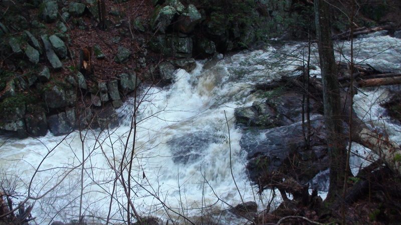
Waterfalls (2)
Playspots (3)
Hazards & Portages (3)
Caution: The following locations may require scouting or portaging. Always check current conditions.
Difficulty
Class V+
Length
2.0 mi
Gradient
223 ft/mi
max 360
Rapids
5
3 Hazards
Access Points
Shuttle Info
When Wawayanda State Park is closed for the winter you must hike in.
**Take Out:** We parked at Mom's Deli in a small stripmall 100 yards west/south on Rt 94 (towards NJ). The deli owner is really friendly help a local out buy a sandwich and let Mom know you are a boater. They have lots of parking and seem willing to share it with us. Nice bathroom too. There are numerous ways to get out of the creek in the area of the RT 94 bridge. There is bridge under construction just barely downstream of the Rt 94 bridge, so scout this for construction hazards.
**Hike to Putin Directions:**
After dropping your car at Mom's Deli
Make a Left on Rt 94. Go a very short distance.
Make an immediate Left on Barret Road.
Go uphill a mile or so and notice open fields on left and right.
Park in the several car pull off on right before the Treeline resumes.
30 yards uphill on the road from the pullout is the AT trail access on the opposite side of the road just inside the treeline.
Your hike will roughly be 40 minutes give or take.
1\. Hike the fire road in the woods till it gets to the top of the hill. At the end of the road if you go straight down into the gorge (off trail) you will end up at Meatball rapid.
2\. At the top of the fireroad look for the white blaze trail to make a right and off of the fire road. This trail will at times stray away from the gorge and it might concern you. It did concern us and we regetably left the trail to bushwhack near the creek. Near the putin we found the trail come back to us and it would have been much easier to just stay on the trail.
3\. The trail comes out on Old Mountain Road. Make a left and follow it to the steel bridge over the Doublekill which is immediately obvious. There is nothing in this area that could be confused for your putin bridge.
Alternate Putin is Via paddling 1 or 2 ponds in the headwaters of the doublekill. Click on satalite as the ponds don't show on terrain or map settings. If you have the desire to look this up you'll be more than capable to figure out this putin avenue. Note Wawayanda Road is a park road that is only open when the park is open.
Difficulty Classes
I Easy
II Novice
III Intermediate
IV Advanced
V Expert/Extreme
VI Unrunnable
Current Conditions
5-Day Forecast
Whitewater data from
American Whitewater
American Whitewater