K. US 26 (Warm Springs) to Sherars Falls
Linked via: Proximity 89% confidence Synced 6mo ago
Gauge Conditions
Runnable: 3,000.0 – 8,000.0 CFS
Data from American Whitewater & USGS
Run Map
Run Time Estimate
Select put-in and take-out to estimate time.
Unlock Advanced Trip Planning
See wind-adjusted speed maps, forecast planning, and detailed time estimates.
Sign in to generate an AI timing estimate for this run.
Whitewater timing varies with scouting, portages, and group pace. Use as a planning baseline.
Description
SEASON: All year possible. The summer is most popular for both private trips and commercial outfitters.
DESCRIPTION:
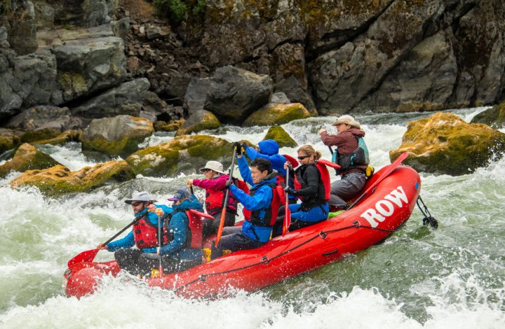
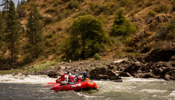
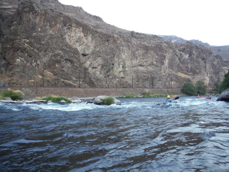
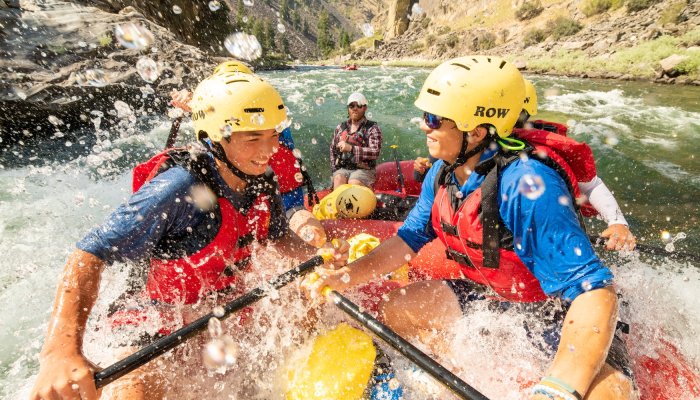
The Lower Deschutes is probably Oregon's most popular overnight float trip and is a classic among fishermen. Experienced river runners will find this to be a relaxing river float but a few class III rapids deserve strict attention. While this can be a great beginner trip for those who have an experienced guide along, inexperienced river runners get themselves into trouble every year and there have been several fatalities on the river.
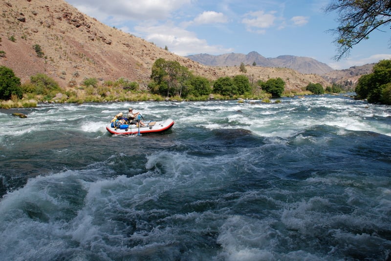
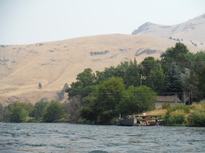
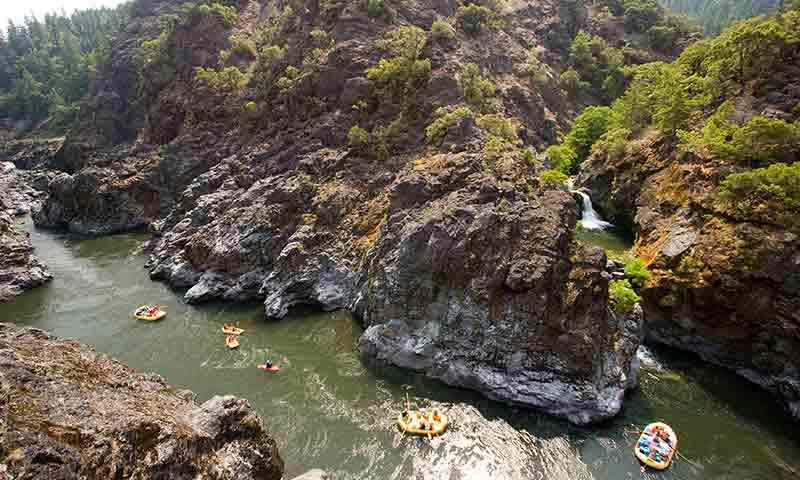
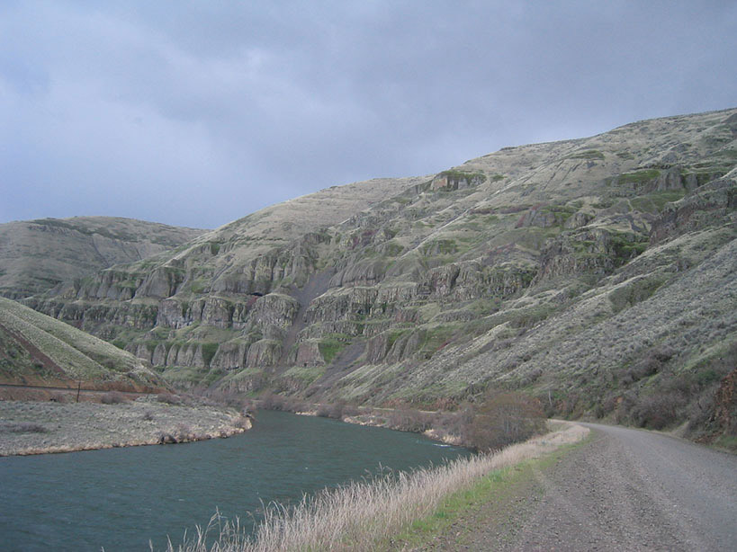
Agricultural diversions upstream near Bend remove water from the river, but springs on the Crooked, Deschutes, and Metolius rivers provide consistent year-around flow which is further regulated by the Pelton Round Butte Hydroelectric project. The peak season is the summer and the river attracts a wide range of user groups including recreational floaters and drift boat fishermen. While the beautiful canyon scenery interspersed with small groves of trees providing welcome shade makes this a great trip, don't come expecting wilderness solitude. The use tends to be biased towards trips where you pack the rafts with everything you could possibly need (and then some) and kick back for a good time with your friends.
Permits are required but it is a reservation system and given that the river is managed for high use, it is generally easy to find a slot if you plan in advance. The run can be divided into two sections with the first half popular as the start of an overnight trip and the lower section popular as a day trip.
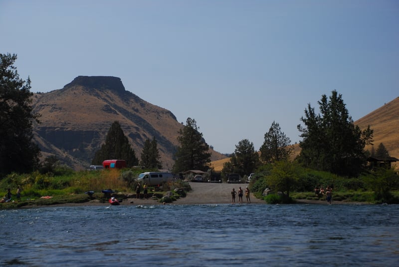
_Segment 1: Warm Springs Boat Ramp to Harpham Flat (42.0 miles, alternate put-in points, group size limited to 16)_
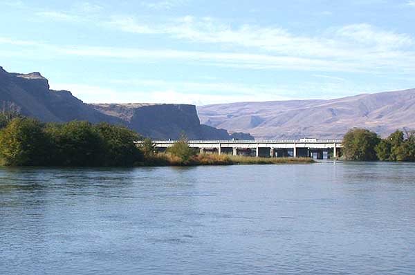
The run starts out at the uppermost put-in at Warm Springs Boat Ramp which is on the upstream river right side of the Highway 26 Bridge. Those who come in late and want to camp the night before often launch at Mecca Flat which is 1.8 miles downstream on river right (a dirt road parallels the river). Trout Creek is another potential access point which is 9.4 miles downstream of the put-in but less convenient to Highway 26 as the road along river right does not extend down that far.
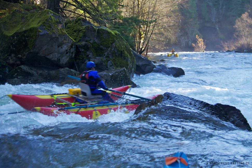
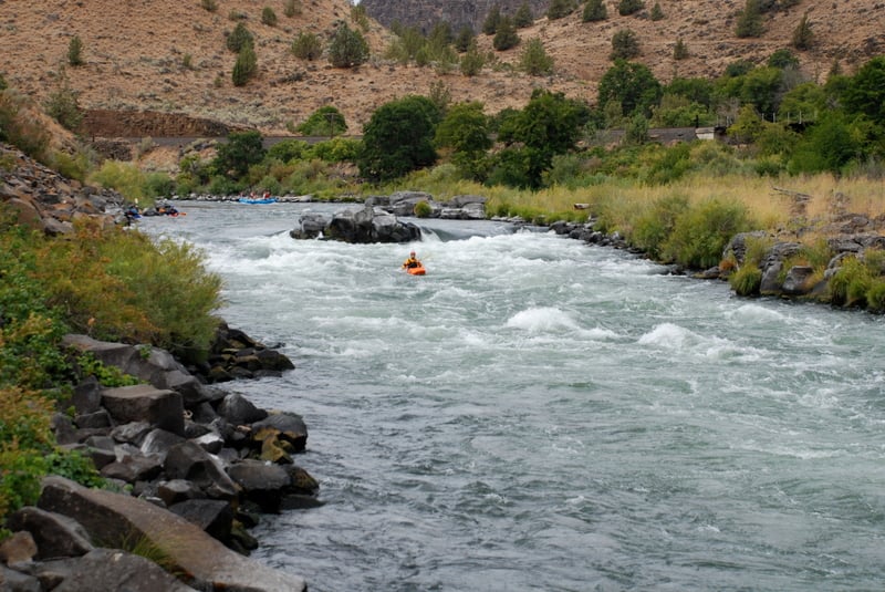
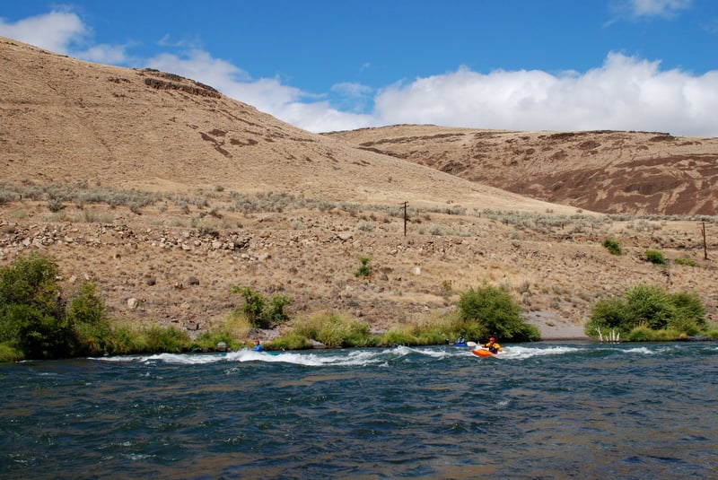
Whitehorse Rapids is the most challenging rapid on this section as it is nearly half a mile long. If you don't know the rapid it's a good idea to get out on river right for a look as there are a couple alternative lines depending on your skills and the flow. Many groups camp at Whiskey Dick which is a mile upstream of Whitehorse Rapids with camping areas for about four groups. This sets you up to run Whitehorse Rapids first thing the next day. Since many groups plan their trip this way however you might find yourself without a site, and foreced to run the rapid if you arrive late in the day. There are some great sites in the approximately three mile section below Whitehorse Rapids.
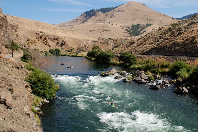
Buckskin Mary and Four Chutes Rapids are another fun set of drops on this section. You will know you are getting close when you pass the Dant Ferry. There are four campsites below Buckskin Mary and another two below Four Chutes. Shortly after these sites you enter the day section making them popular as a last night's camp. Consider a camp above Dant Ferry if its a busy weekend and your are approaching Buckskin Mary with plans for one more night on the river.
_Segment 2: Harpham Flat to Sandy Beach (10.4 miles, intermediate access points, group size limited to 24)_
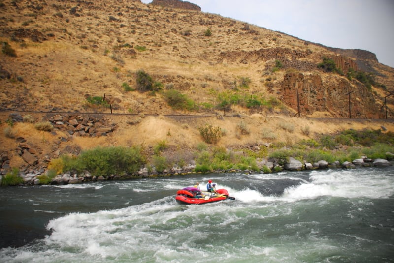
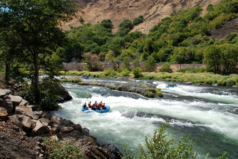
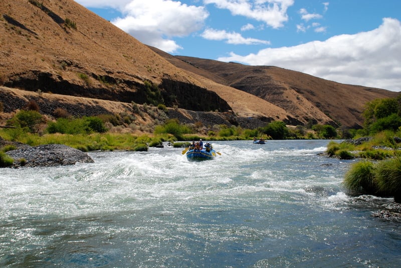
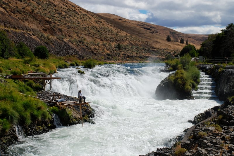
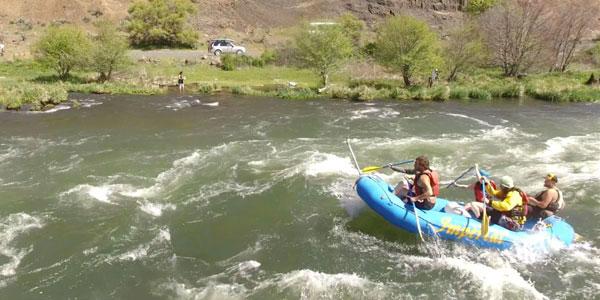
When you hear people talk about doing a day trip on the lower Deschutes this is the section they are running and if you are in the area this is a great run throughout the summer but be prepared to share the river with dozens of rafts. There are several great rapids on this section packed relatively close together. While there is nothing any harder than Whitehorse Rapids they come more frequently. Wapinitia Rapids and Boxcar Rapids can be easily scouted from the road on river right. Maupin City Park is another popular access site. Downstream of town you will come to a two mile action-packed section that includes Surf City Rapids, Oak Springs Rapids, White River Rapids, Upper Elevator Rapids, and Lower Elevator Rapids before you reach Sandy Beach which is the last take-out before the river plunges over Sherars Falls. Those continuing downstream need to take out here and transport boats 2 miles downstream around Sherrars Falls to Buckhollow.
LOGISTICS: The Lower Deschutes web site < https://www.blm.gov/programs/recreation/permits-and-passes/lotteries-and-permit-systems/oregon-washington/lower-deschutes \> has maps and information on the run. Permits are available through a reservation system administered by recreation.gov. The Prineville District BLM and Oregon State Parks also publish a Deschutes River Boater's Guide with mile-by-mile rapid descriptions, campsites (including relative size and accessibility to shade), human and geologic history of the river, and detailed maps.
Rapids in this Run (18)
 Rapid
Rapid
Trout Creek Access
 Rapid
II
Rapid
II
Upper Trout Creek Rapids
 Rapid
II
Rapid
II
Lower Trout Creek Rapids
 Rapid
III
Rapid
III
Whitehorse Rapid
 Rapid
Rapid
North Junction Railroad Bridge
 Rapid
Rapid
Reservation Boundary
 Rapid
Rapid
Dant Ferry
 Rapid
III
Rapid
III
Buckskin Mary Rapids
 Rapid
II
Rapid
II
Four Chutes Rapids
 Rapid
Rapid
Nena
 Rapid
Rapid
Long Bend Access
 Rapid
Rapid
Wapinitia Access
 Rapid
III
Rapid
III
Wapanitia Rapids
 Rapid
III
Rapid
III
Boxcar Rapids
 Rapid
IV
Rapid
IV
Oak Springs Rapids
 Rapid
II
Rapid
II
White River Rapids
 Rapid
II
Rapid
II
Upper Elevator Rapids
 Rapid
II
Rapid
II
Lower Elevator Rapids
Waterfalls (1)
Playspots (1)
Hazards & Portages (1)
Caution: The following locations may require scouting or portaging. Always check current conditions.
Difficulty
Class III
Length
52.8 mi
Gradient
12 ft/mi
Rapids
18
1 Hazard
Access Points
Difficulty Classes
I Easy
II Novice
III Intermediate
IV Advanced
V Expert/Extreme
VI Unrunnable
Permit Required
Boater pass available through online reservation system. Some dates have limited launches available.
Get Permit
Current Conditions
5-Day Forecast
Whitewater data from
American Whitewater
American Whitewater