Lackson Road to Sleepy Valley Loop (9 miles)
Linked via: Proximity 99% confidence Synced 6mo ago
Gauge Conditions
Runnable: 250.0 – 1,000.0 CFS
Probably too low for best whitewater run.
Data from American Whitewater & USGS
Run Map
Run Time Estimate
Select put-in and take-out to estimate time.
Unlock Advanced Trip Planning
See wind-adjusted speed maps, forecast planning, and detailed time estimates.
Sign in to generate an AI timing estimate for this run.
Whitewater timing varies with scouting, portages, and group pace. Use as a planning baseline.
Description
According to at least one reviewer: ' _Hands down ... a MUCH better run than the Bois Brule!_'
Click the following link for an eight-minute video showing some of the fine action on this run: Low-water run of the Middle River
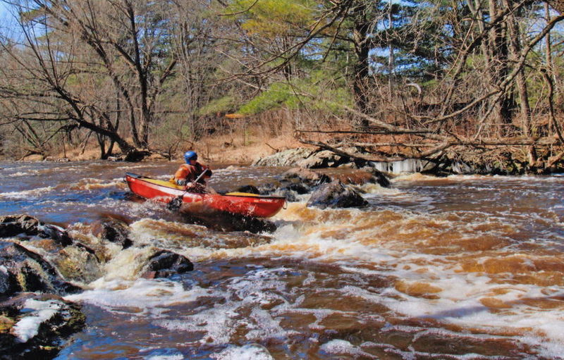
Situated midway between the Bois Brule (with its generally mild whitewater -- one section 3.9 Miles, Avg. Gradient 15 fpm, Max Gradient 28 fpm, the other section 9 miles, Avg. Gradient 23 fpm, Max Gradient 45 fpm) and the Amnicon (with its _wild_ sequence in the state park -- listed reach of 5.7 Miles, Avg. Gradient 54 fpm, Max Gradient 129 fpm), one might expect the Middle River to at least have SOME sort of gradient and potential for whitewater. Indeed, this listed section averages 30 FPM, never falls below 14 FPM, and nears 45-50 FPM for a mile-and-a-half. So, one should expect at least Bois Brule-esque action.
Further, analysis of rivers in this area shows that Wisconsin's tallest falls at 165', Big Manitou Falls on the Black River in Pattison State Park, drops from ~960' down into the gorge through the 800' contour. The falls on the Amnicon appear as that river passes through elevations from about 830' down to 730'. Bois Brule's Lenroot and May Ledges appear as that stream passes though 830' and 800'. (Seeing a pattern here, everyone?) The Middle River passes through these elevations in the vicinity of East Moonshine Road, where (indeed) its steepest gradient appears. With this analysis, we listed this reach and petitioned for anyone with first-hand knowledge to 'report'. Sure enough, we got a response.
MnktoDave reports:
_With the Bois Brule running at about 225cfs and dropping fast, we decided to try something new. We had often thought to run the Middle river over the last several years. After looking at the map we decided to do the short section from Lackson Road to Hwy.2. We drove along the river and checked out as much as we could see. The river was running low, but looked doable. When we crossed the river on Bayfield Road, we were surprised to see a river-wide class 2 ledge just upstream from the bridge. It had a nice hydraulic where all the water converged, and looked like it would be a nice play hole even at that low level._
_Just around the first left hand bend from our put-in, the river picked up gradient quickly and continued on with pretty much constant class 1 rapids -- nice continued gradient and plenty of larger rocks to dodge. Some of these rocks looked large enough to create play holes with the right amount of water. As we passed a house on the left, there were 2 sloping ledges that looked like they might provide a little action with more water. Where Bayfield Road goes way high up above the river and makes kind of a loop, the river became almost still, but that didn't last long. The gradient picked up again as we approached the farm house just upstream from the Bayfield road bridge. A class 1 rapids and some fast current fed into a tight left bend with a ledge -- shorter on the left, larger on river-right. There was a LARGE rock formation directly behind the river right side of this ledge that at high water would probably cause a lot of turbulence. This was the beginning of the straightaway just upstream of the Bayfield bridge. Below the bridge was a large rock on river left, and class 1 rapids and riffles which continued all the way to the Hwy 2 bridge, where we took-out._
_We both agreed, the scenery rivaled that of the Bois Brule. It's hard to tell if the features would wash out with higher water or get better. With the rapids/gradient that we saw, combined with more water, I have to believe that this river has a few more fun surprises waiting for us, and I can't wait to check out that lower section next._
* * *
And, a more recent update, from a run all the way to Hwy.13:
_...had a blast! Nothing bigger then Class II but I'd guess in 10 miles we didn't have more than 1 mile total that wasn't white water! Beautiful scenery, fairly narrow intimate river._
_Second day we put in same but took out at Hwy 2. Water had dropped about 6' so lots more rock dodging but still had good surf waves scattered along the way. If you're looking for a \[full-out\] surf/play river you'd be disappointed, but if you're looking for a beautiful, fun stretch with almost non-stop rapids this would be great._
* * *
_Last spring (March 21, 2010) my friend Jim and I ran the upper section of the Middle River at a 'minimal' level. We've been hoping ever since for an opportunity to run it again (along with the lower section) with a much better water level. That finally happened this last weekend._
_I got up there on Friday night. With recent rains, the Nemadji was rising from about 12' to 17.4' (1650 to 3600 cfs) and the Bois Brule had risen from 2.05'/220 cfs to about 2.9'/415 cfs. I had just enough time right before dark to see the level on the Middle River from the Bayfield bridge. The ledge was totally under water, with a large hole running from bank to bank, and looked quite awesome. There were large standing waves running under the bridge and down the next straight-a-way as far as I could see. The large rock just downstream from the bridge was completely under water except for a few inches of the small tip that just barely showed. It was really kicking, with very few eddys but it looked like it would be a real hoot to run, if nothing went wrong._
_I was a bit concerned about the lower section with the high water with about a mile and a half of river listed at 45' to 50' per mile, as we did not know anything about it. In our minds, the worst-case scenario was canyon walls on both sides, with no eddys or place to take out, feeding into a large, unscoutable drop, on a blind corner, etc._
_By the time Jim showed up at 10 AM the next morning, the level had already dropped at least a foot or maybe more (Bois Brule was backing off only slightly, to 2.85/400 cfs). This turned out to be a really sweet level, with eddys where you needed them, yet it still had lots of good holes/waves, etc. To answer the question I had as to whether the features would wash out, they definitely got better with the higher water. For a really good boater (with skills better than ours) there were tons of play opportunities that we dared not enter. The short upper section had several small ledges and many large rocks that made nice play holes if you dared to jump in. There was only one tree blocking the river on the whole run and that was totally across the mouth of the tunnel at Hwy 2. We portaged, on the right._
_After putting back in on the downstream side of Hwy 2, it was fairly fast moving water, but (as I remember) there were no real rapids and not much gradient until after a Golf Course on river left. A little while later the gradient picked up again and there were a few nice rapids. About a mile or so before the Moonshine Road bridge the gradient really seemed to pick up, let up shortly before the bridge, then started again immediately downstream of the bridge and continued most of the way to Hwy 13. It was a GREAT run: no falls or really big rapids, just pretty constant gradient and some nice long, class 2 rapids that seemed to go on and on. Hands down, we thought, a MUCH better run than the Bois Brule!_
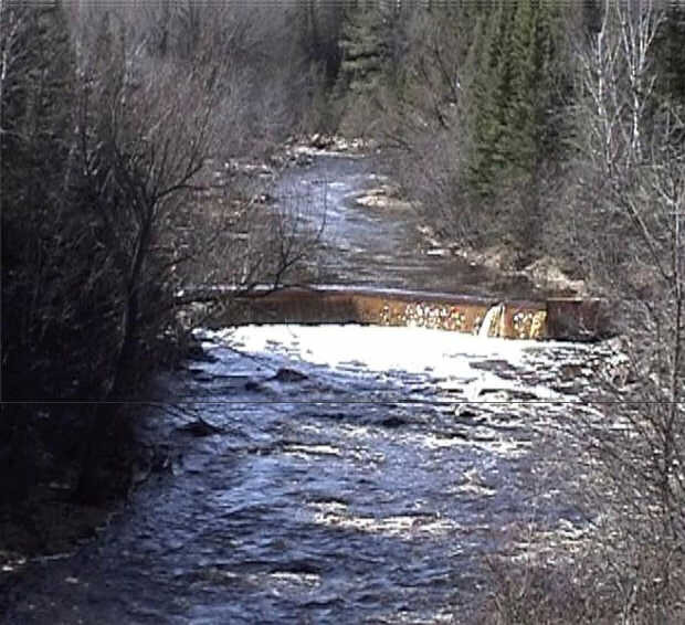
_When we came to the dam, we found a spot to take-out just about 20' from the lip of the dam on river-right. There was a trail to use for a portage, and it was easy to carry back down, about 50' or so past the dam, at a yellow marker for a fiber optic cable. We also found a gauge on the river-right downstream corner of the dam. You could walk right down to it, and it was easy to read from shore. It read about 1.2' on Saturday._
Again, we thank folks for reports on this or any other runs!
By the way, both of these reports were from runs starting at the listed put-in, but curtailed at Hwy.2. The stats on that run would be a length of just 2.2 miles, dropping about 75' (yielding about 35 FPM).
Rapids in this Run (3)
Playspots (1)
Hazards & Portages (2)
Caution: The following locations may require scouting or portaging. Always check current conditions.
Difficulty
Class I-II
Length
8.6 mi
Gradient
30 ft/mi
max 50
Rapids
3
2 Hazards
Access Points
Shuttle Info
If you have specific awareness of alternate access sites (or access issues/problems), please add a comment or report for your fellow paddlers!
For directions for the short run (just down to Hwy.2), enter the following coordinates into the text entry box below: 46.5954 -91.8229
You can also use the text-entry box to input your home or other starting location to get drive time, distance, and directions to the put-in.
Difficulty Classes
I Easy
II Novice
III Intermediate
IV Advanced
V Expert/Extreme
VI Unrunnable
Current Conditions
5-Day Forecast
Whitewater data from
American Whitewater
American Whitewater