Letchworth Gorge
Linked via: Proximity 16% confidence Synced 3mo ago
Gauge Conditions
Runnable: 9.0 – 14.0 FT
Data from American Whitewater & USGS
Run Map
Description
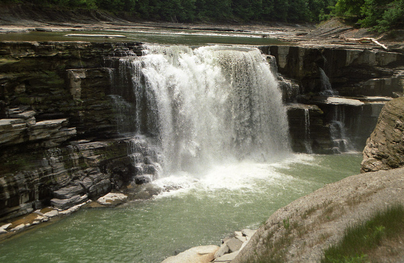
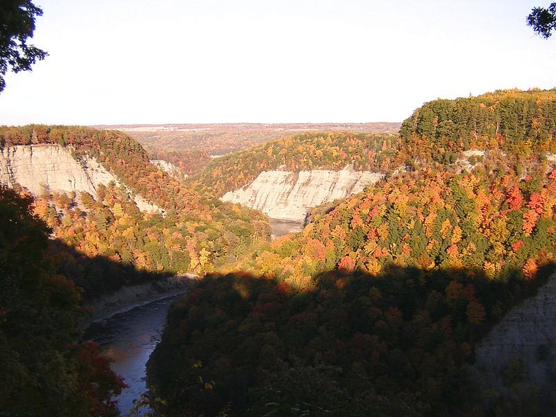
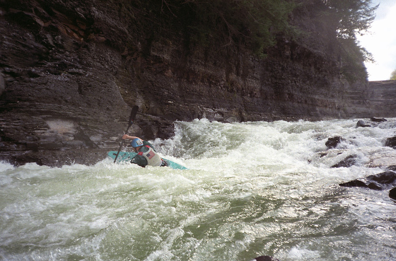
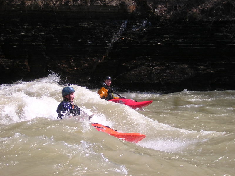
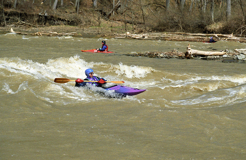
Letchworth State Park boasts a spectacular, meandering 550-foot deep river gorge lined with slate cliffs. It is called the 'Grand Canyon of the East.' Within the gorge, the Genesee River is class II run at low levels (9.0 feet) but becomes a respectable class III river with great surfing opportunities at higher water (stage 10.5 feet). The Genesee River is consistently at its highest during March and April. The river periodically floods between October and June. The highest recorded flood peak was 90,000 cfs on June 23, 1979. The river is closed to kayakers at stage 14.0 feet and higher. Every October, the draining of Rushford Lake augments river flow through Letchworth Gorge by about 1.0 foot.
Logistics: Sign the release and get an annual Waiver # at the Park Office Admin center near the South end of park. Get a map at the gate when you pay your $10 park Entry Fee so you can find everything. The revised permit ( 2019 ) has a river level limit of 11 ft. for recreational kayaks without spray skirts, float bags and proper personal whitewater clothes for cold water. Experienced kayakers & canoers are permitted to paddle above 11 ft. with proper whitewater equipment and clothing. Above 14 ft. the river is just a flood without any value.
Take Out: St Helena parking lot. From the visitors center turn right out of parking lot on park road (3.4 miles) Turn right at the sign for St. Helena and go to lower parking lot (0.2miles). Take out is down the gated restricted access road, river left (0.45 miles)
Put In: From check in at the main Park Office, Turn right out of parking lot on park road and take the park road to Lower Falls area and lower parking lot near A cabins. Look for a gate at the top of the dirt road near the CCC statue past the Adventure Calls Outfitters (Raft Co.) Lee's Landing, a 1/2-mile carry downhill from the parking lot. Follow the dirt road to the bottom of the hill, turn Right at the bottom, 100 yds to the first rapid called Red Ball.
If you run the Loop, no shuttle is necessary. The carry back uphill is about 1/2 mile from either Red Ball (airplane/helicopter warnings on power lines) or Lunch Rocks (the next rapid below Red Ball).
If you pass Lunch Rocks you are committed to about 4 miles of Canyon to St. Helena's. This is the last takeout before the dam. Go with somebody that knows how to find it. In early Spring, there may be a lake backed up above there from the dam--not likely to be a worthwhile trip. Stick to the Loop in those conditions. REPORT THAT YOU ARE OFF THE RIVER IN PERSON OR BY PHONE USING YOUR WAIVER # TO ADMIN CENTER. INSTRUCTIONS ARE ON YOUR WAIVER. DON'T FORGET UNLESS YOU WANT THE PARK POLICE SEARCHING FOR YOU.
Western New York Area Reaches
Beaver Meadow Creek Canadaway Creek (1.) Canadaway Creek (2.)
Canaseraga Creek Cattaraugus Creek Cattaraugus Creek, S. Branch
Cazenovia Creek, W. Branch (1.) Cazenovia Creek, W. Branch (2.) Chautauqua Creek
Clear Creek, N. Br. Conesus Creek Eighteenmile Creek
Eighteenmile Creek, S. Br. Ellicott Creek Genesee (Letchworth)
Honeoye Creek Keshequa Creek Little Chautauqua Creek
Murder Creek Niagara Oak Orchard Creek
Oatka Creek Rushford Lake Outlet Sugar Creek
Twentymile Creek
Hoppy's post on the FLOW Massage Board)
Google Map of New York Whitewater
New York Whitewater Paddlers Facebook Group
Rapids in this Run (3)
Playspots (3)
Difficulty
Class II-III
Length
5.0 mi
Rapids
3
Access Points
Difficulty Classes
I Easy
II Novice
III Intermediate
IV Advanced
V Expert/Extreme
VI Unrunnable
Current Conditions
5-Day Forecast
Whitewater data from
American Whitewater
American Whitewater