Little Manitou Falls to RR bridge off Station Rd (4.6 miles)
Linked via: Proximity 95% confidence Synced 6mo ago
Gauge Conditions
Runnable: ? – ? CFS
Approximate reading: This gauge is 4.3 miles away on Black (Nemadji Trib.). Use as a general reference only.
Data from American Whitewater & USGS
Run Map
Run Time Estimate
Select put-in and take-out to estimate time.
Unlock Advanced Trip Planning
See wind-adjusted speed maps, forecast planning, and detailed time estimates.
Sign in to generate an AI timing estimate for this run.
Whitewater timing varies with scouting, portages, and group pace. Use as a planning baseline.
Description
This really should be viewed as two individual runs: the 'upper' from Little Manitou Falls to Interfalls Lake, and the 'lower' from below (Big) Manitou Falls to the railroad trestle off of Station Road.
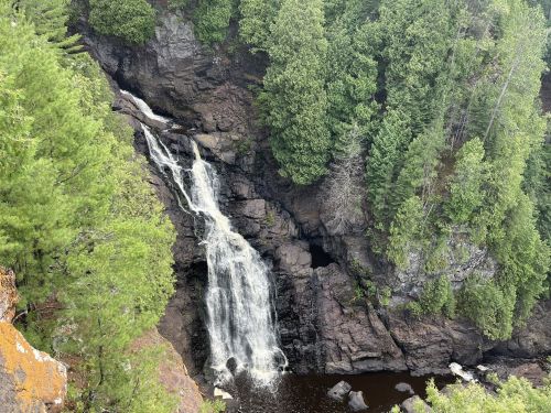
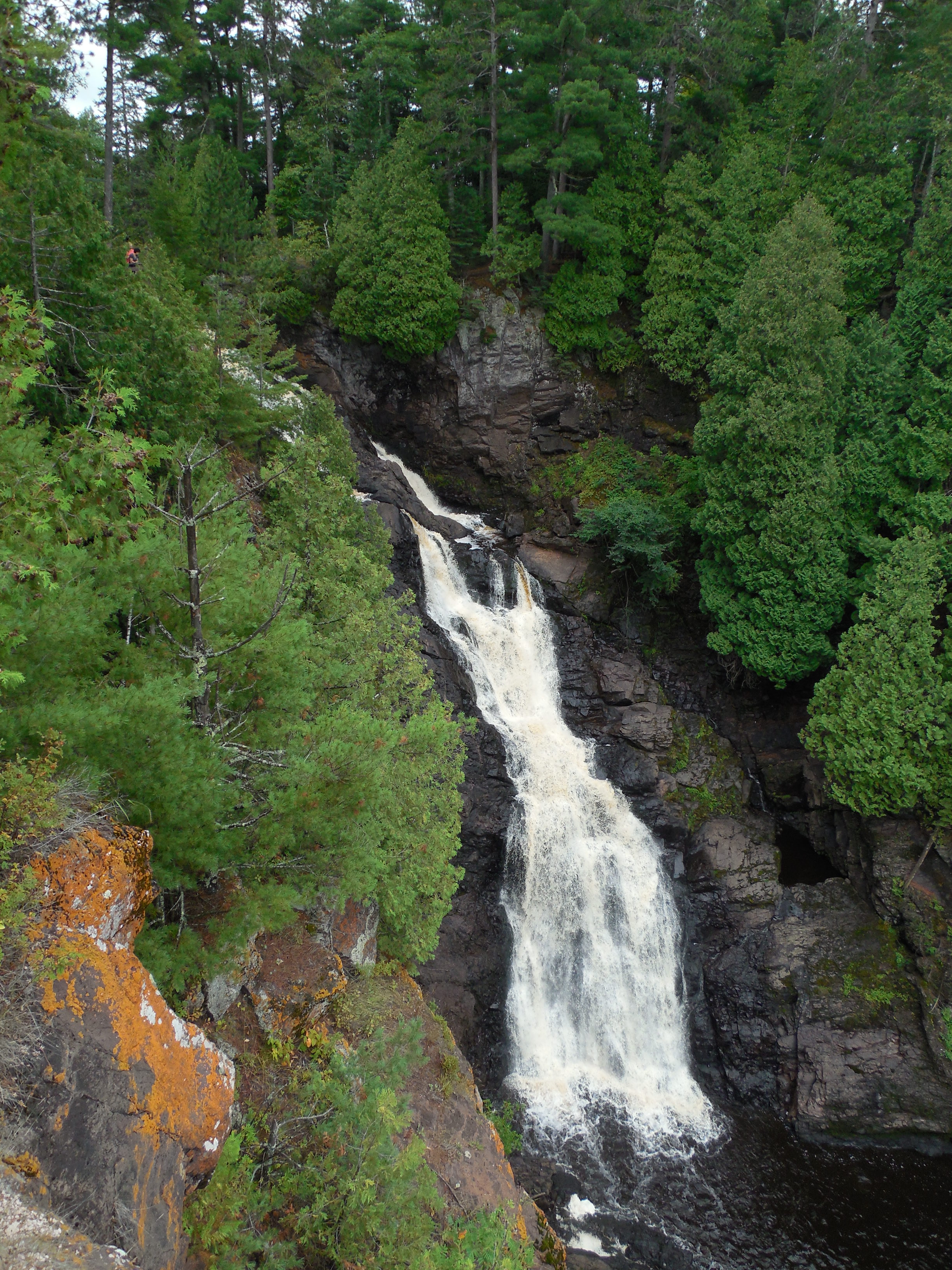
DO NOT paddle the section immediately below dam (and Hwy.35) as this is the lead in to Big Manitou Falls (165', not included in gradient figures). Portage on park trails to base of falls (perhaps a quarter-mile, but likely requiring significant scouting/reconnoitering in order to determine where to descent and resume river travel). And, by the way, while numerous sites list the height of Manitou Falls as 165', that figure (best I can tell from topo maps) seems to represent total drop from about the highway bridge to the end of the falls sequence, thus does NOT appear to be the actual height of any (the tallest) single vertical plunge.
SO ... breaking it into two runs:
The 'upper' is somewhat less than a mile of gradient (0.93 mile at something near 110 FPM) before the roughly half-mile paddle-out on Interfalls Lake. OR ... if you do NOT run Little Manitou, but put in below it, the remainder is about 45 FPM before the half-mile paddle-out.
The 'lower' is is about 3 miles at about 49 FPM, rather 'front loaded', with mile-by-mile gradients being 63, 48, and 35 FPM.
FROM NORTHWOODS WHITEWATER BY JIM RADA:
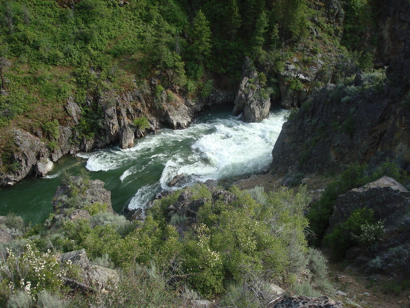
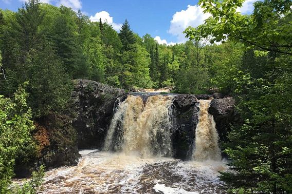
'The tiny Black, fifteen miles south of Superior, boasts the tallest waterfall in Wisconsin, Big Manitou Falls. Big Manitou drops 165 feet into a short, enchanting gorge, the centerpiece of Pattison State Park. An interesting run can be done by putting in about a mile upstream of Big Manitou Falls at the base of Little Manitou Falls, a twenty footer also in Pattison State Park.
A trail coming in to Little Manitou from WI Hwy 35 allows easy access. The half mile from Little Manitou to Interfalls Lake contains some class II and a class III ledge. Paddle across Interfalls Lake a half mile to the Hwy 35 bridge, take out on the left and portage Big Manitou on the left.
As you wander along the left gorge rim you'll find a trail that descends into the gorge. The closer you can put in to the base of Big Manitou, the better water you'll get to run. A little III right below Big Manitou quickly fades to class II and then I. The whitewater is by no means exceptional, but it is a pretty place to explore and can easily be included with a run on the Amnicon, which certainly is runnable of the little Black is boatable.
To reach the takout, drive north on WI 35 just under two miles from Big Manitou and turn west on 'Station Road.' In a mile this road will lead you to a railroad track, which will be your takeout. On the river, proceed 1.5 - 2 miles on the Black downstream of Big Manitou Falls. You'll encounter a few small class I-II ledges along the way. Climb out of the valley on the right side at the railroad trestle and follow the tracks to your car.
Don't confuse the Black near Superior with the Black in the Upper Peninsula or the Black in southern WI. This Black is not a primo whitewater run, but a cute little river and a chance to do some exploring relatively close to home.'
Rapids in this Run (5)
Waterfalls (4)
Hazards & Portages (1)
Caution: The following locations may require scouting or portaging. Always check current conditions.
Difficulty
Class II-III(V+)
Length
4.4 mi
Gradient
55 ft/mi
max 70
Rapids
5
1 Hazard
Access Points
Difficulty Classes
I Easy
II Novice
III Intermediate
IV Advanced
V Expert/Extreme
VI Unrunnable
Current Conditions
5-Day Forecast
Whitewater data from
American Whitewater
American Whitewater