Meadow Creek to Moyie Falls Dam
Linked via: Proximity 92% confidence Synced 6mo ago
Gauge Conditions
Runnable: 500.0 – 6,000.0 CFS
Data from American Whitewater & USGS
Run Map
Run Time Estimate
Select put-in and take-out to estimate time.
Unlock Advanced Trip Planning
See wind-adjusted speed maps, forecast planning, and detailed time estimates.
Sign in to generate an AI timing estimate for this run.
Whitewater timing varies with scouting, portages, and group pace. Use as a planning baseline.
Description
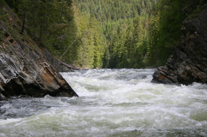
This is an amazing river and one of my personal favorites. Pretty continuous, class 2-3 whitewater that keeps all boaters on their toes through the entire ride.
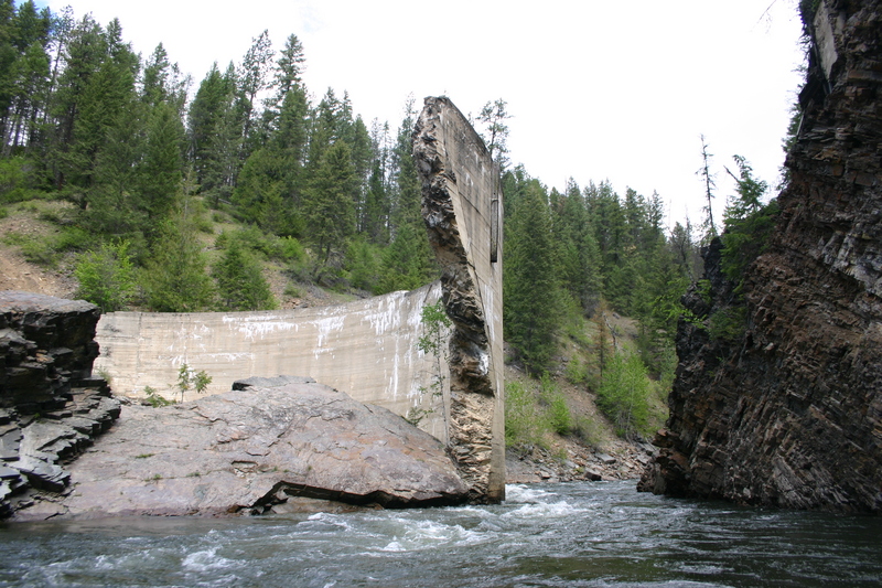
Anything above 5,000 CFS is pretty high for this river and boaters should use caution going through the Dam and Hole in the Wall as logs have historically become wedged in these narrow canyons. Between 3-5,000 CFS is my personal favorite levels. Most rocks are covered, waves get big and it's a fun ride. Careful at the dam, the lateral and boil lines can flip a 14 foot boat. More rocks and holes start to come out below 3,000 CFS but Eileen Dam becomes more manageable. 1,000 CFS and below is really bony. Avoid swimmers above and immediately below Eileen Dam at all times. The river flows underneath it and there are strong under-currents. Lenore; 2011-06-26
See G. Amaral, _Idaho: the Whitewater State_ (Watershed, 1992).
Lat/Longitude data are _very_ approximate.
Rapids in this Run (1)
Hazards & Portages (1)
Caution: The following locations may require scouting or portaging. Always check current conditions.
Difficulty
Class III-IV
Length
7.9 mi
Rapids
1
1 Hazard
Access Points
Difficulty Classes
I Easy
II Novice
III Intermediate
IV Advanced
V Expert/Extreme
VI Unrunnable
Current Conditions
5-Day Forecast
Whitewater data from
American Whitewater
American Whitewater