Melvin Mills to Warner
Linked via: Proximity 97% confidence Synced 6mo ago
Gauge Conditions
Runnable: 275.0 – 1,450.0 CFS
Data from American Whitewater & USGS
Run Map
Description
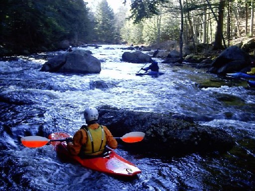
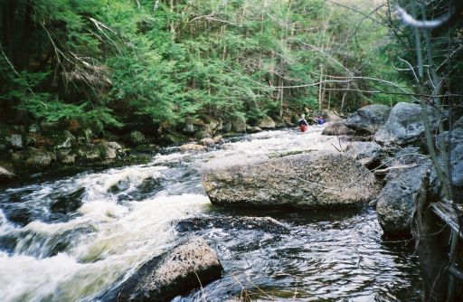
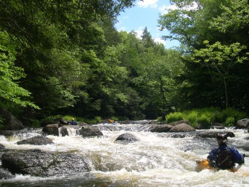
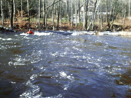
The Warner is a popular river located in central NH about a 20 minute drive northwest of Concord. It has a huge watershed resulting in a long season that starts in March and can last thru the end of May (or longer). The large wetlands in the headwaters also sometimes delay the effects of rain as well as extending the length of time the river is running. This river is not what you think of in a typical New England whitewater river. It is drop-pool for much of the run with flatwater paddling between each of the major whitewater sections. The water is also darker then typical New England streams since much of the upper parts of the river pass thru wetlands. The geology is likewise a bit different; the rocks are sharp and solid, not the usual collection of loose piles of stones.
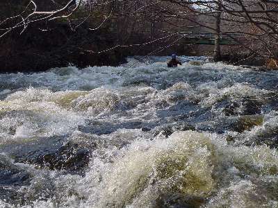
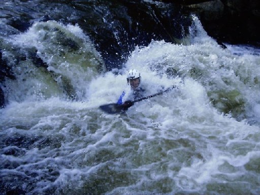
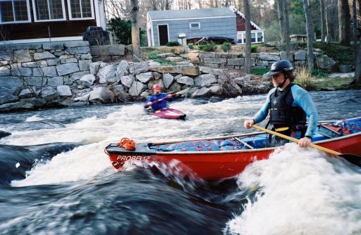
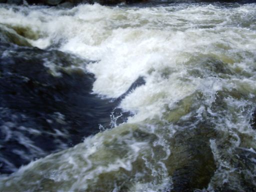
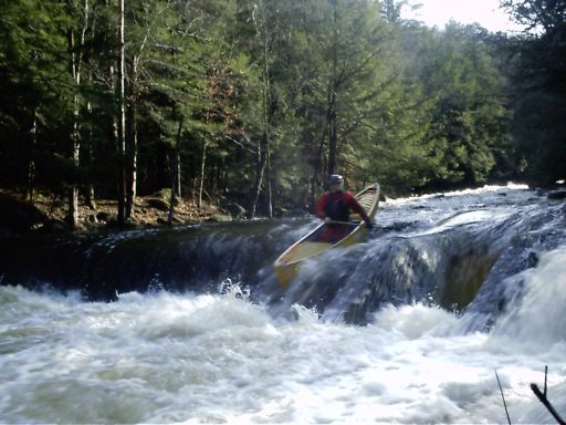
This is a highly technical river, narrow and shallow in the whitewater sections. The upper two-thirds of the run is mostly class III difficulty mixed in with several surfing waves and some class II sections. As you approach the gorge the pace quickens. Pinball Rapid is class IV at medium and higher levels, as are the Sluice Dam and Bridge Abutment sections immediately after. These however are just a warmup for the gorge.
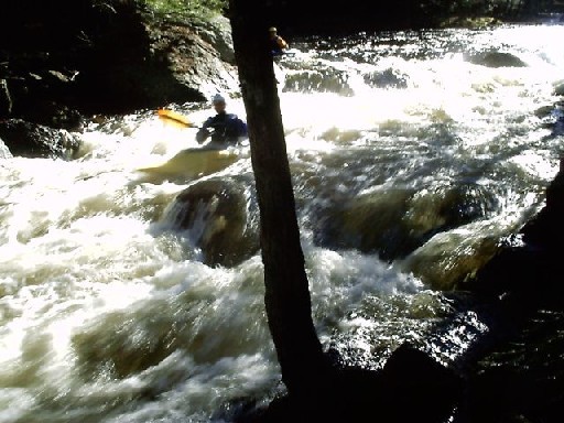
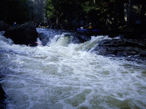
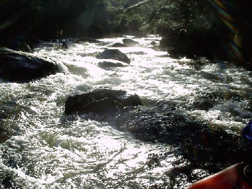
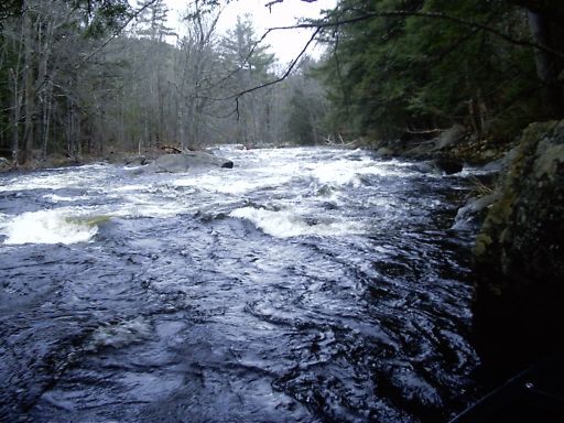
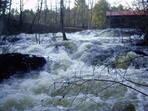
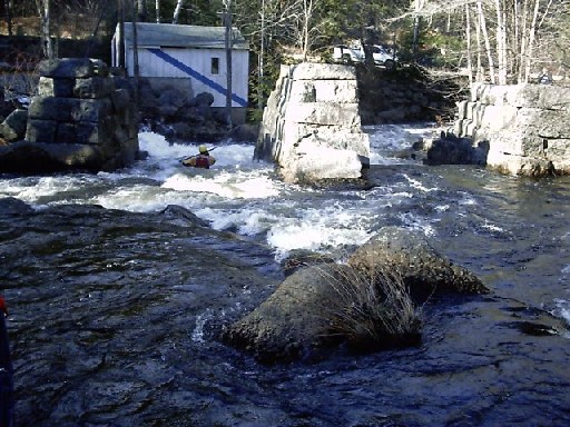
One-and-a-half miles below the put-in is the Warner Gorge. The gorge is a wonderful series of tight drops one-immediately-after-the-other packed into a short-but-intense quarter mile. This section is the _main event_ and the primary reason this river is so popular!!! Scouting is recommended for the first-timer; the gorge is easily reachable from the road. Just park at the Upper Take-out and walk upstream along an old road bed.
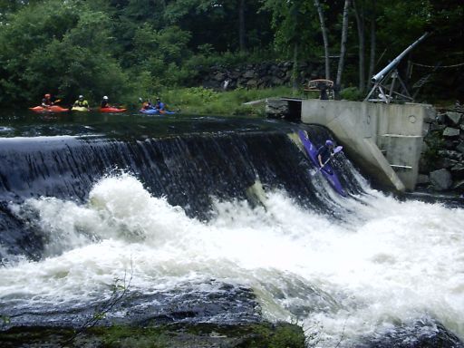
Immediately below the gorge is the Upper Takeout, followed by a 15 minute flatwater paddle to a runnable dam (closed boats only, too shallow for open boats), and then more flatwater paddling to reach a long, enjoyable class III rapid just above the middle takeout. \[ Note 4/25/07: The cable stretched across the top of the runnable dam has been removed by the owner (Thanks Pete!!!). It will be replaced during the summer months only.\]
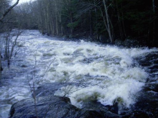
Beyond the last class III rapid is another 30 minute quickwater/flatwater paddle to the Waterloo takeout located by the old railroad station and a covered bridge. Starting just below the covered bridge is the final class IV section formed by the remains of another old mill and dam.
A typical run to the gorge takes an hour-and-a-half. The lower sections (Middle, Waterloo takeouts) add about 30 minutes each, the bottom section adds another 15 minutes. At medium or high river levels the lower sections are well worth the extra flatwater paddling.
```
-----------------------------
```
Below info courtesy Brooke Sofferman (7-Jan-2023)
Dangerous wood on Warner River! There is a river wide tree across the bottom of the gorge. Paddler's should take-out below the Meltdown Hole (first gorge drop). Taking out below there is possible depending upon river level. Additionally, the divergent channel for possible power generation is now open and channeling water away from the main flow.
Paddlers on recent trips agree the river felts very different from past. The Meltdown Hole seems like part of the ledge fell in because the seam is different.
The sluice is a direct drop down, less of a ramp, its now very steep and there’s a hole at the bottom where there just used to be a flush towards bridge abutments.
```
-----------------------------
```
This video shows the entire run from Melvin Mills to Waterloo at 6ft:
https://youtu.be/rBvRMYdvmc0
### Technical info
```
Put in elevation........635'
Take out elevation......492'
Total drop..............143'
Average drop/mile.......60'
Distance................2.4 miles
River width average.....25'
River geology...........schists small boulders some ledge
River water quality.....Good, clarity neutral to good.
Scenery.................Old overgrown mill and dam ruins; a number of
old bridge abutments from roads and railroads.
Wildlife................Deer, merganzers, hawks.
```
### Amenities
```
Gas/Convenience Stores..Several just off I-89 exit 9 interchange.
Nearest Restrooms.......McDonalds, just off I-89 exit 9.
Camping.................Many in region; none very close by.
Restaurants/Pizza/etc...Follow 103 north of I-89 into downtown Warner.
```
### Regional Weather
Go here for a NOAA weather forecast.
Regional Map - Rivers of the lower Contoocook region
_Rivers of the lower Contoocook region__Map by Mark Lacroix_
Rapids in this Run (16)
 Rapid
III
Rapid
III
Melvin Mills
 Rapid
III
Rapid
III
Second Class III
 Rapid
III
Rapid
III
Third Class III
 Rapid
III+
Rapid
III+
Pinball (Upper Half)
 Rapid
IV
Rapid
IV
Pinball Rapid
 Rapid
Rapid
Gage
 Rapid
IV
Rapid
IV
Gorge Drop 1
 Rapid
IV
Rapid
IV
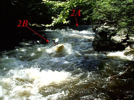
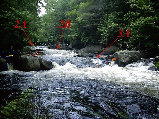
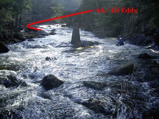
Gorge Drop 2A
 Rapid
III
Rapid
III
Gorge Drop 2B
 Rapid
IV
Rapid
IV
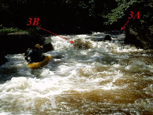
Gorge Drop 3A
 Rapid
III+
Rapid
III+
Gorge Drop 3B
 Rapid
IV
Rapid
IV
Gorge Drop 4A
 Rapid
IV
Rapid
IV
Gorge Drop 4B
 Rapid
III
Rapid
III
Last Class III
 Rapid
I
Rapid
I
Typical River Character in Lower Section.
 Rapid
IV
Rapid
IV
Bottom Class IV
Waterfalls (1)
Playspots (3)
Hazards & Portages (5)
Caution: The following locations may require scouting or portaging. Always check current conditions.
Difficulty
Class IV
Length
5.4 mi
Gradient
86 ft/mi
max 118
Rapids
16
5 Hazards
Access Points
Shuttle Info
### Put in
From the south, take Interstate 93 to Interstate 89 (south of Concord). Follow I-89 approximately 18 miles to exit 9 (the second Warner exit).
There are gas stations, McDonald's, etc, at this exit so it's an easy place to meet up with people.
Go southwest (right off the exit ramp) on NH 103 approximately 4.25 miles to Melvin Mills road. Turn and follow the road approximately 1/2 mile to the put-in where the road comes close to the river next to a small bridge. There is ample parking.
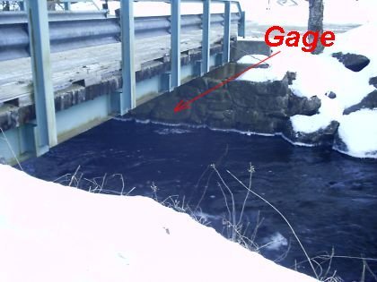
### Paddler's Gage
Pull off Route 103 by Laing Bridge Lane (in between the Put-in and the Gorge). The gage is under the bridge painted on the river-right bridge abutment.
### Upper take out
For a shorter run, that includes the best whitewater, turn off Rt 103 onto West Roby District Road just below the Gorge. Park here at the bottom of the hill a couple hundred feet from NH 103 along the river.
### Middle take out
From NH 103, turn onto Morse Loop, a dirt road approximately 2.5 miles downstream from the Put-in. The takeout is a short distance down the road where an old bridge \[closed\] crosses over the river.
For an alternate access to the middle take-out turn right approximately 2.0 miles downstream from the put-in and cross over the river on East Roby District Road. Follow approximately 1/2 mile where the road (dirt at this point) turns away from the river and climbs a hill. There is a short washed-out and overgrown road that leads down to the river and the take-out. East Roby District Road also offers excellent access and viewing of the river for the entire length of the long class III rapid.
### Waterloo take out
Follow NH Route 103 to Waterloo (Near and just a short distance southwest of the I-89 interchange); turn off 103 at New Market Road and follow the signs to the covered bridge. Put-in/take-out just upstream of the bridge.
### Bottom take out
From the Waterloo take-out, cross over the covered bridge, turn left immediately past the bridge. Follow the road for approximately 1/2 mile going up a hill then back down towards the river. The take-out is immediately past the guard rail where the road approaches the river again.
Difficulty Classes
I Easy
II Novice
III Intermediate
IV Advanced
V Expert/Extreme
VI Unrunnable
Current Conditions
5-Day Forecast
Whitewater data from
American Whitewater
American Whitewater