Near 15-Mile Marker to Matthews Creek River Access Scenic
Linked via: Proximity 99% confidence Synced 6mo ago
Gauge Conditions
Runnable: 2,000.0 – 4,500.0 CFS
Data from American Whitewater & USGS
Run Map
Put-in
Take-out
Rapids/Hazards
Scenic
Recreational
Description
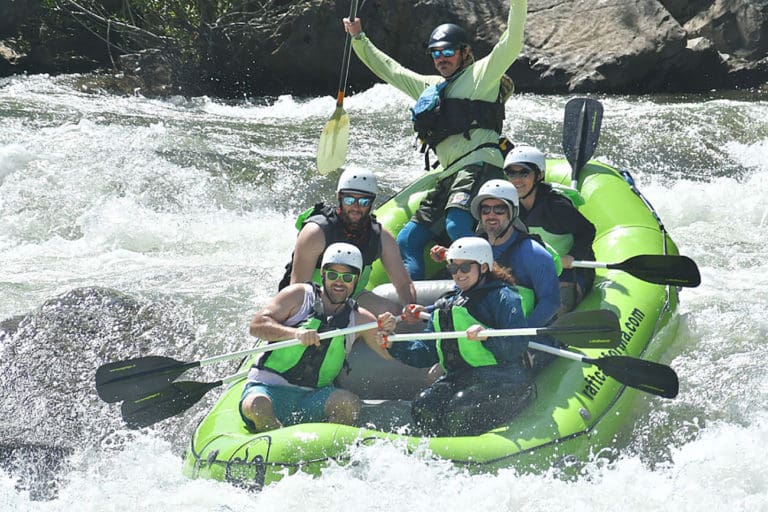
One of the more challenging and scenic runs in the watershed, the South Fork Gorge has technical and powerful Class IV-V rapids intermixed with easier rapids all the way from the Lagarde river access put-in immediately upriver of the 15-mile marker on Cecilville Road to the take-out at Matthews Creek upstream of the nine-mile marker. It can be run at a wide range of flows and its character ranges from tight and technical at low water to stout and powerful at medium to higher flows.
Wood hazard warning: the river left side of this entire run burned in the 2021 River Complex and the 2020 Red Salmon Complex. You'll see signs of the burn along the river. Be aware that there's a significant increase in wood entering the river here after the fires. The wood is dynamic and moves frequently. There's an abundant amount of wood lining the banks that will move at high spring runoff flows. Be alert!
There's a nice warm-up section below the put-in that builds slowly as the river winds its way toward the soaring Limestone Bluffs. The pace begins to pick up as the river flows toward the base of the bluffs with riverside walls that offer challenging rock climbing on the river right bank. Look for the white chalk marks and bolts that climbers have left behind on this overhanging pitch known as the Fly Froggie Wall.
About a half mile below the put-in, the river squeezes through a very narrow micro-gorge with a fun but short set of drops. Locals sometimes put in here using a path that comes right to the micro-gorge from Cecilville Road. Smaller rapids and moving pools are interspersed for the next bit. Be sure to turn around to look upstream in this stretch: the biggest views are behind you and you don't want to miss them!
The pace continues to build in alternating rapids and pools until the rapids start getting longer and you've reached the first significant Class IV/IV+ drop. This rapid involves a long lead-in and culminates with a five-foot ledge drop with a nice launch flake right of center. The approach can be technical and there's a hazardous undercut rock right above the ledge that has sadly claimed the life of a kayaker.
A number of intermediate-sized rapids follow in a quick series until you reach Plummer Creek, which is the obvious large creek that comes in on the river left. This is the one spot on this run where the Trinity Alps Wilderness Area reaches all the way to the river. You may catch views of the hillside on river left below Plummer Creek that is full of gray pine trees. This is near the northernmost extent of this tree's range, and the area is designated as a U.S. Forest Service botanical area. Some botanists theorize that Native Americans may have brought gray pine to this area from the Sierra foothills for the abundance of pine nuts that form in the tree's massive and dense cones.
Back to the whitewater: just below Plummer Creek the river mellows for a bit then turns left through a bumpy boulder garden that signals the next significant rapid. Eddy left at the bottom of the boulder garden and check out the prominent horizon line ahead: this one is worth a scout if you don't know the run, especially at medium or high flows. There's a stout hole at the bottom, backed up by a rock that aids recirculation. The whitewater continues immediately below this drop in a long, fun little gorge full big but managable holes.
The action picks up for a while with a fun pool-drop series of Class III to IV/IV+ rapids. The pace ebbs and flows a bit with a couple short stretches of Class II+ thrown in.
Eventually the pace becomes more sustained and you arrive at Fake Amusement Park, a zig-zag of currents that ends in a long pool. The real Amusement Park awaits at the end of this pool. Scout left. This river is very narrow here and the current ricochets off the gorge walls, creating folds, pillows, and nasty corner pocket eddies. Stay in sync with the water and the ride is fun. Being out-of-sync can be less fun and spending time in the room-of-doom eddies is best avoided. Interestingly, these are the only two rapids with established names on this run.
A few more Class III and Class IV rapids follow, alternating with pools some short Class II+ in-betweens.
The final gorge in the South Fork Gorge run is a stand-out and contains three back-to-back rapids that will get any boater excited. This gorge is just upstream of the Matthews Creek Campground and it can be seen in part from Cecilville Road as you drive from the take-out to the put-in. The gorge is essentially a must-run section of river as there is no real way to get out from its vertical walls. The good news is that the rapids are all runnable and that they can be pretty exciting.
Some boaters do a second lap of just the bottom two miles of the run, packing in the action. To do this, look to re-enter the river using an unmarked road near the 11-mile marker on Cecilville Road. You'll get all the action from Fake Amusement Park to the take-out.
Flows & Season
This run can be boated at a surprisingly wide range of flows. At flows below 2,000 cfs at Somes Bar, it is tight and technical and shallow on the reaches between the main drops, which channelize and remain fun. Above 3,000 cfs the run begins to get powered up more but it isn't until closer to 4,000 cfs that it begins to push. At flows above this, holes grow in size, Amusement Park gets a bit hectic, and the run takes takes on a juicy feel. This is a run to be reckoned with at flows above 6,000 cfs at Somes Bar. The Somes Bar gage is 25 miles downstream so its correlation to this run is not always direct and varies according to rain/snowmelt dynamics and whether you're paddling on a rising or falling flow.
This run is usually boatable in winter, spring, and into very early summer in a big water year.
Logistics
*Put-in*
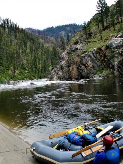
The put-in is down a steep, unsigned dirt road that is about 150 feet upriver of the 15-mile marker on the paved Cecilville Road. Park at the obvoius flat area and don't try to drive the steep path all the way to the river.
You must be driving in the upriver direction on Cecilville Road to be able to take the dirt road to the put-in: it's too sharp and tight of a turn to make when driving in the downriver direction. Fortunately, there's a decent pullout a short distance downriver of the dirt road (on a curve) and you can u-turn here. It's also possible to park in an unmaintained pullout on Cecilville Road about 300 feet upriver from the 15-mile marker (this is a good option for low clearance vehicles).
Nearly all riverside land upriver of of this access point is private property, including the various undeveloped flats in and downstream of Cecilville. Please help avoid conflict with landowners by using this established put-in; there is no loss of whitewater in doing so. The name of this spot, known to very few, is Lagarde.
*Take-out*
The take-out is at the signed Matthews Creek River Access, about 1/4 mile downstream of the Matthews Creek Campground. There's drive-up access to river level via the short dirt road (#54D022) that departs Cecilville Road near the downriver side of the bridge over Matthews Creek.
Some paddlers choose to continue past the Matthews Creek take-out to paddle the Middle South Fork Run, finishing at the Methodist Creek River Access. This adds 3-½ miles of easier whitewater with one short class IV+ gorge just upstream of the Methodist Creek River Access that packs as much punch as anything upstream. There are some fun playspots and the usual stunning scenery in this extended run.
Amenities
*Camping*
The Matthews Creek Campground next to the take-out is a great riverside campground but it is usually closed from October until mid-May. The free Hotelling Campground, about five miles downriver of the take-out, is open all year. There are a couple dispersed camp sites along the run if you know how to find their unmarked and unmaintained access roads.
*Saloon*
It's the Wild West out here, and sometimes you just need a saloon after a day on the river. Although rarely open, you can always hope that you'll get lucky and the off-grid Salmon River Saloon in Cecilville will have its doors open. It's just two miles upriver of the put-in, so it's easy enough to go check after boating. Sometimes their gas pumps are open too!
Additional Information
Salmon River Restoration Council's Whitewater Recreation Page - great overview and detail on the whitewater of the Salmon River drainage
Salmon River Hazard Map - map of known hazards in the river and tributaries
The best guidebook for this run is Dan Menten's 2016 classic, *The New School Guide to Northern California Whitewater*, p. 103.
Rapids in this Run (12)
Rapid
III+
Narrow Gorge Rapid
Rapid
IV+
First Significant Rapid
Rapid
IV
Ledge Hole Rapid
 Rapid
IV
Rapid
IV
Steep Microgorge Rapid
 Rapid
IV
Rapid
IV
Unnamed Rapid
Rapid
III+
Fake Amusement Park
Rapid
V-
Amusement Park
Rapid
IV
Landslide Boulder Garden
Rapid
IV-
Final Gorge Entry Rapid
Rapid
V-
Final Gorge #1
Rapid
IV
Final Gorge #2
Rapid
IV+
Final Gorge #3
Difficulty
Class IV-V
Length
5.6 mi
Rapids
12
Access Points
Difficulty Classes
I Easy
II Novice
III Intermediate
IV Advanced
V Expert/Extreme
VI Unrunnable
Current Conditions
5-Day Forecast
Whitewater data from
American Whitewater
American Whitewater