Northwood to Gossville
Linked via: Proximity 99% confidence Synced 6mo ago
Gauge Conditions
Runnable: ? – ? CFS
Approximate reading: This gauge is 4.7 miles away on Little Suncook. Use as a general reference only.
Data from American Whitewater & USGS
Run Map
Description
# Fall Drawdown Release
Typcially 400 cubic feet per second (cfs) will be released into the Little Suncook River from the Northwood Lake Dam off Rt 4 in Epsom. Remember that dam releases are not guaranteed, check the NHDES site for updated information.
This release will start at or near 8 AM on a date specified by DES and will be reduced to near normal levels by 4 PM that same day. It is best to allow a full 2 hours for the rising water to flush debris all the way to the bottom take-out. The pond in the middle of the run has to swell before the flow is adequately high after the dam. DES reminds people that canoeing and kayaking have inherent risks, and paddling the state’s lakes and rivers is at the paddler’s own risk.
The Little Suncook is located in south-central New Hampshire, flowing into the Suncook River east of Concord. This small exciting creek starts at a dam forming the outlet of Northwood Lake in Northwood. There are three distinct boatable sections. The upper two separated by Bixby Pond halfway between Northwood Lake and the lower takeout in Gossville at the Cumberland Farms convenience store and gas station. Be courteous and only park in allowable public places that do not infringe on private property. Carpooling is encouraged!
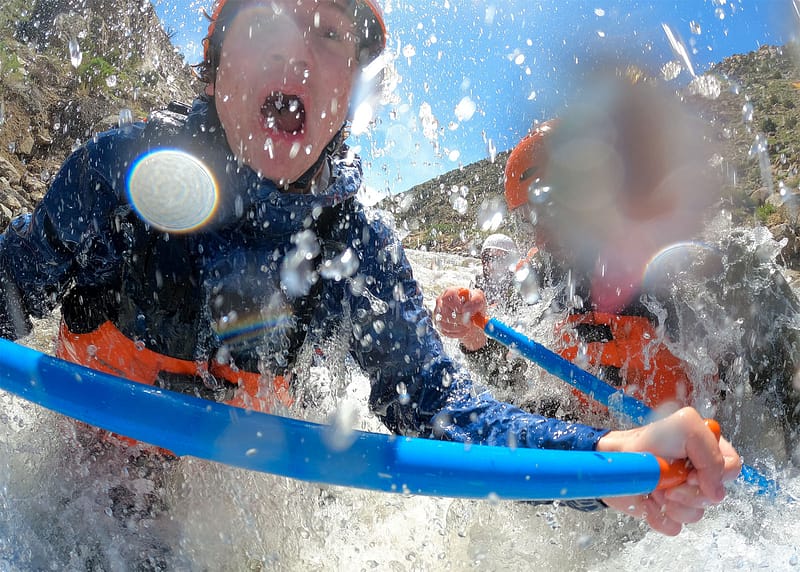
This river is runable during the spring runoff, after periods of heavy rain, and occasionally in the fall during the annual drawdown of Northwood Lake. It is difficult to catch the river at a runnable level; too little water and it can't be run, a little too high and the water extends into the trees with no eddys available for stopping or scouting. It is also extremely narrow for it's entire length. Boaters must be constantly on their toes due the constant twists and turns. Strainers are always a hazard here, additionally open boaters are constantly having to duck to avoid the low hanging trees and branches.
#### Upper Section, Class IV (0.6 miles) (Video by Clinton Begley: https://www.youtube.com/watch?v=w-xDZB7GiRI&ab\_channel=clintonbegley)
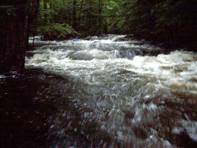
Put in near the intersection of Routes 202/107 (approximately 13 miles east of Concord) at the Route 107 bridge a few dozen feet below the Northwood Lake dam. The first section is a hairy narrow class IV rapid with numerous tight turns and few eddys. The rapid is steep and full of rocks and trees requiring the paddler to react quickly. Any swim or roll is likely to be dangerous even at high levels due to the high water velocity and shallow stream bed. Towards to bottom of this rapid are two river-wide holes in quick succession (or ledges at low water levels). At a medium or higher level the first hole slows you down so much it can be difficult to get through the second. You can sneak past the holes along river-right. Scout the entire length of this rapid before you put on to check for clear passage.
If the first rapid seems a bit much, put in several hundred yards down Route 4/202 by a major roadside pulloff. Below here the river is a combination of quickwater and rocky class III rapids. One spot to be aware of is where the river splits around a small island the size of a medium house. Go RIGHT around the island as the left is an impassible channel thru some large rocks.
You can take out next to a road-side pull off one-half mile upstream from an offical state rest area. The the river follows along the road closely here.
#### Bixby Pond (0.8 miles)
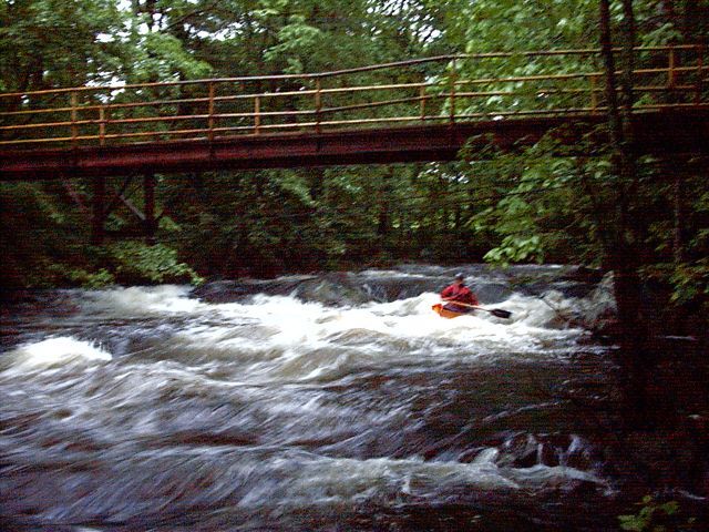
Bixby Pond (also called Cass Pond) is not entirely flatwater. It has enough of a current to help you quickly get across it. The first part of the pond is a maze of different channels thru a wetlands. Stay left for the first part then cut right before entering the main part of the pond. At the bottom of the pond is the lower put-in (43.22293, -71.31739). Cass Road is where the outflow from the pond flows over a dam. This section must be scouted for debris before paddling. At normal levels for this release, a strong boof over the LEFT side of the dam is reasonable. Portage over the dam on far river right is recommended as the safest option, as a hydralic forms in the dam at anything higher then a low level flows.
#### Lower Section, Class III (1.7 miles)
The rapids continue here, there is no flatwater, and the entire river moves. You'll be surprised at how big a blast this dinky little stream is. There are three class III rapids here. The first a short technical rapid a quarter mile below the put-in. At lower levels go far right to pass thru the rocks. There are tree strainers that may require a portage around a blind corner between the first and second rapids on this section. About another quarter-mile furthur on the river approaches a bridge at Center Hill Road. Here you'll find a fun class III rapid full of little twists and turns. The river continues on for another mile or so, the third rapid passes under a small footbridge. Here there are several holes, drops and big waves (especially at higher levels). The difficulty of this rapid can approach class IV at the higher water levels. A little furthur on you'll reach the takeout before the bridge on Black Hall Road.

Difficulty
Class III+(IV)
Length
3.3 mi
Gradient
49 ft/mi
max 61
Rapids
5
Access Points
Difficulty Classes
I Easy
II Novice
III Intermediate
IV Advanced
V Expert/Extreme
VI Unrunnable
Current Conditions
5-Day Forecast
Whitewater data from
American Whitewater
American Whitewater