Old Georgetown Pike (Route 193) to Potomac R.
Linked via: Nhdplus gnis 95% confidence Synced 6mo ago
Gauge Conditions
Runnable: 110.0 – 5,000.0 CFS
Upper limit for best boatability uncertain. Please help your fellow boaters with a comment or report.
Data from American Whitewater & USGS
Run Map
Run Time Estimate
Select put-in and take-out to estimate time.
Unlock Advanced Trip Planning
See wind-adjusted speed maps, forecast planning, and detailed time estimates.
Sign in to generate an AI timing estimate for this run.
Whitewater timing varies with scouting, portages, and group pace. Use as a planning baseline.
Description
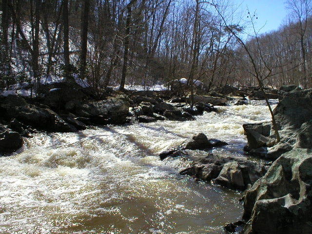
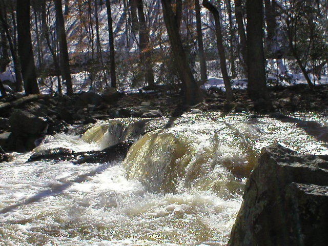
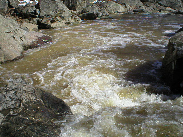
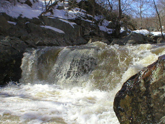
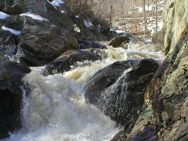
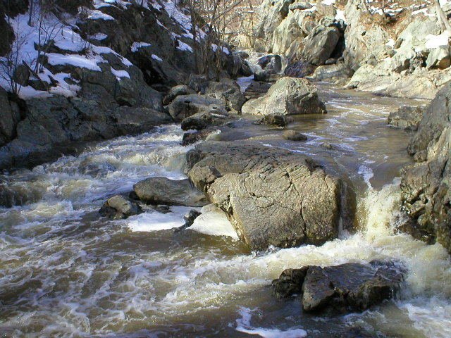
David Mackintosh, on Boater Talk: It is possible to get out on river right after the last drop above the canyon (at moderate levels). You really, really wouldn't want to swim out of that one, and the portage on the right is poor. It's a sticky pourover hole with closed ends; the usual line is to boof hard right into the eddy. If not running the canyon, I strongly suggest getting out on the left in the little cove immediately above that drop. I've run from the 193 bridge down into the river around a dozen times. I always hike up first and scout everything; there's a good chance of new wood since it runs so infrequently. Even so, on one run the level had come up significantly between the time I scouted and when I made it back down to the gorge, and another line would've been better. There are three class 3+ drops above the gorge section, and a couple of good spots to take out on river left after these. There is a 4' drop on the approach to the gorge that can get very sticky, I've been surfed there once or twice. The gorge is nasty, and I wouldn't really 'recommend' it to anyone. However, I'm not a cutting-edge creeker, and I've made it through about a dozen times. Not always pretty, though. It's more technical than any of the normal Great Falls lines, not really comparable since it's really a creek and Great Falls is much bigger water. Much more difficult than anything you're going to find on the Yough, more comparable to drops on the Upper B or Green Narrows (but uglier than most). I haven't seen anybody get shoved into the cave on the left, but it looks fairly terminal. Gordon Dalton: One more thing about 'D.R.' I've run this creek at several different water levels and the water quality is always heinous! A better name for this stream might be 'Dysentery Run.' As I make that final boof in the lasy big rapid i'm always clamping my lips and eyes together to try to minimize exposure to this nasty H20! I'd hate to roll in there.
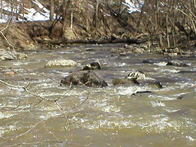
Ed Evangelidi testifies: For those out for a nice scenic trip on relatively tame water (Cl. 1), try the stretch from Rte. 7 to Rte. 193. This is surprisingly pretty for a semi-urban stream. Due to constant construction in the watershed, the stream occasionally gets log-jammed. There is a trail along the whole way (bring Âriver shoes for stream crossings) & I suggest scouting it days ahead. The creek is usually runnable down to Seneca Creek @ Dawsonville at 2.4 but note that Difficult Run is a south-to-north run and Seneca Creek (to the north) is a north-to-south run. So the rain patterns may differ quite a bit.
Note: listed gradient is approximate. It's tough to read the topo map in that vicinity.
See Also:
_Virginia Whitewater_, Roger Corbett (2000 ed.), p. 41.
_Exploring Virginia's Waterways_, Ed Gertler (2022 ed.), p. 90.
Difficulty
Class III-IV(V+)
Length
0.8 mi
Gradient
110 ft/mi
Rapids
7
Access Points
Difficulty Classes
I Easy
II Novice
III Intermediate
IV Advanced
V Expert/Extreme
VI Unrunnable
Current Conditions
5-Day Forecast
Whitewater data from
American Whitewater
American Whitewater