Oregonia Road to Flat Fork Boat Ramp
Linked via: Nhdplus discovery 90% confidence Synced 6mo ago
Gauge Conditions
Runnable: ? – ? CFS
Approximate reading: This gauge is 1.1 miles away on Caesar Creek. Use as a general reference only.
Data from American Whitewater & USGS
Run Map
Description
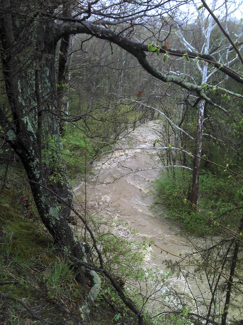
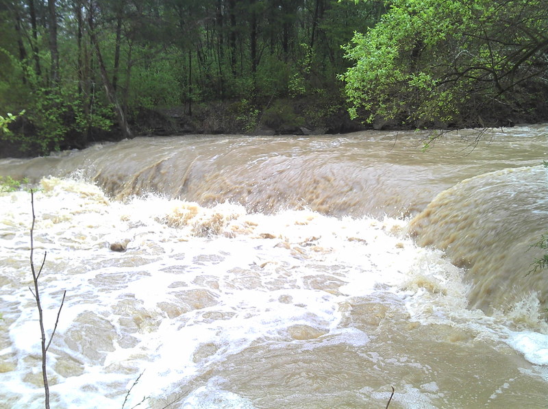
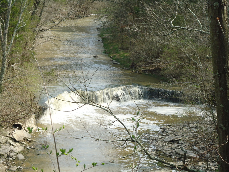
This short creek runs to Caesar Creek Lake. The gradient is deceiving since it drops about 50 feet in the half mile. Most of this is over tilted riverbed with flat shale. The main attraction is Horseshoe Falls. This small waterfall is the scenic attraction for Caesar Creek hiking trails and is often photographed. The drop is fairly simple with multiple lines. The Flat Fork of Caesar Creek takes a big storm to get enough water to run. I've seen it go from boatable, to huge, to scrapy, and then unrunnably low in about 24 hours. Overall this is probably a draw only for local boaters and it can easily be combined with Caesar Creek Gorge. If the Flat Fork is running then the Army Corps will probably be holding water back on Caesar Creek. Be watchful for strainers.
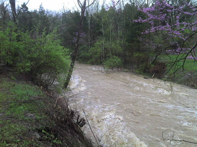
I ran this after about 2 inches of local rain. The river was bank-full in low flood. The water is brown but does not smell. There were no river wide strainers. Be careful, however, since there are trees in the river. Once you get on, the flow is fast and there are a few good wave trains. The stream picks up speed and hits a few easy class II rapids. However, your skills should actually rank solid Class III or higher, because if you swim you are not getting your stuff back till the falls or the lake. Pay very close attention to the cliff walls. Once the massive shale cliff appears on the left you are a few hundred yards above the big drop. There is a right of way that crosses where the foot bridge was. I would suggest stopping here. Even if you decide to run Horseshoe Falls you will want to look. It is easier on the left than the right. The falls at high water was crazy scary with a MASSIVE hydraulic. The only line was on the far left. After the falls, the best rapids on the river pick up immediately till the lake. It made me wonder what got buried in the lake. The takeout is on the left. I did it solo and walked the shuttle. It takes about 10-15 min.
Enjoy the following YouTube headcam video of the run:
Rapids in this Run (1)
Waterfalls (2)
Hazards & Portages (2)
Caution: The following locations may require scouting or portaging. Always check current conditions.
Difficulty
Class II-III
Length
1.4 mi
Gradient
100 ft/mi
Rapids
1
2 Hazards
Access Points
Shuttle Info
The shuttle is easy. Park on the pull out on Oregonia Road to put in. Go back toward Caesar Creek Visitor Center but pull over at the fossile collecting area or the Flat Fork Recreational Area parking lot. The shuttle will take you 5 minutes or less.
Difficulty Classes
I Easy
II Novice
III Intermediate
IV Advanced
V Expert/Extreme
VI Unrunnable
Current Conditions
5-Day Forecast
Whitewater data from
American Whitewater
American Whitewater