Otto to Gowanda
Linked via: Nhdplus discovery 90% confidence Synced 3mo ago
Gauge Conditions
Runnable: 1,560.0 – 5,660.0 CFS
This corresponds to a range of 2-3.5 ft. See the Mainstem Catt for the current gauge reading in ft.
Data from American Whitewater & USGS
Run Map
Description
Lat/longitude coords verified from GPS.
It's five miles to the Main Branch Catt, and then 6 miles to the Gowanda takeout. Don Cochran adds:
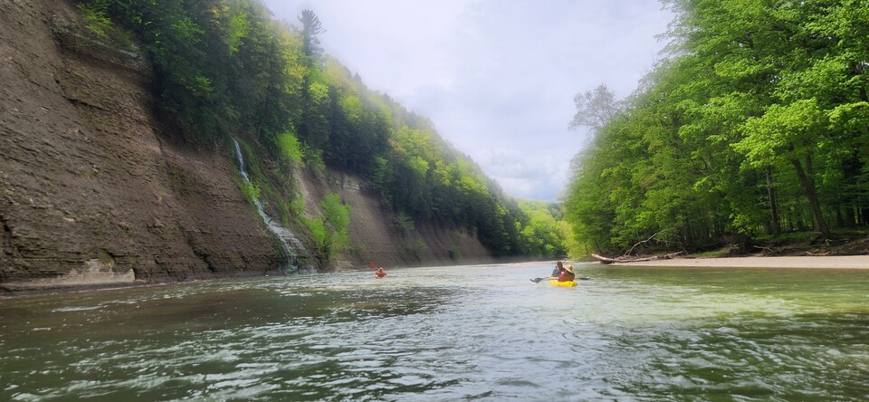
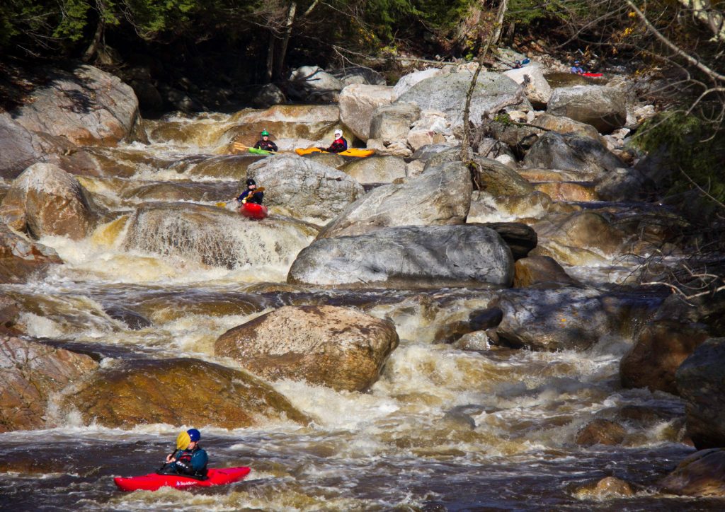
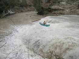
"With an average gradient of 40 ft per mile, the South Branch is Class III at normal levels with a Class IV Falls and 3 Class III+ ledges. The 3rd ledge is about 3.5 miles from the put in, the Falls are 2 miles from the putin, or 6 left turns of the canyon after the first ledges. The first and last ledges are normally boat-scoutable, but be cautious with the drop after the Falls with the slot. At low levels the whole river twists through a 6-ft.-wide crack of riverbed with undercuts and potholes--fine for a canoe, but not low-volume kayaks.
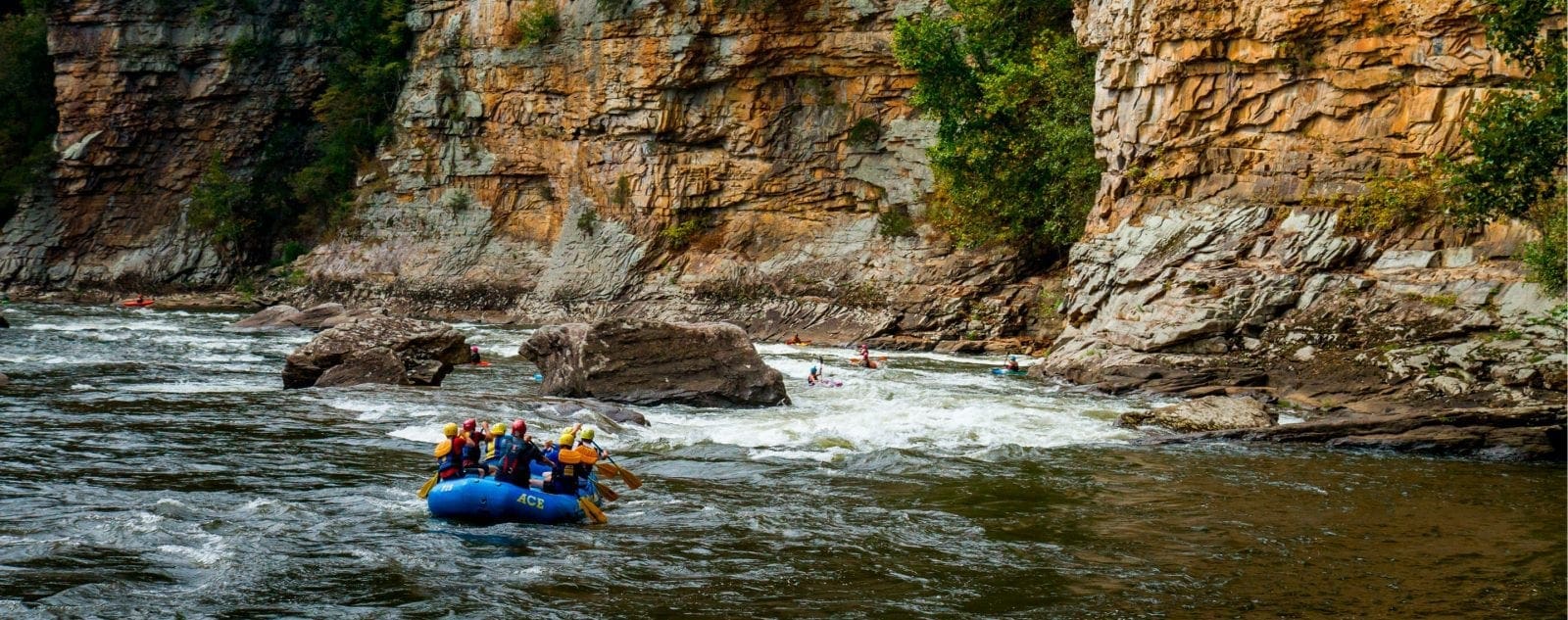
"What an awesome canyon. In some sections the canyon walls soar 400 ft. almost straight up, and in some places the river is only 15 yds. wide. A New York version of paradise, there are trickle waterfalls spilling over the canyon walls all over, with many making 100-ft. freefalls--much like Letchworth Gorge on the Genesee, but the canyon is much narrower. Plenty of surfing spots like you would expect if you have been to Fish Creek or South Sandy, but the pools aren't as deep because of the shale rock."
This reach has some significant access issues, as the preferred putin is on private property--most of the land is posted along both sides. Local clubs have worked out an agreement with the landowner which has resolved the issues, so far. If you're interested in this reach, which has great remoteness and scenery, and which has a great waterfall, you might want to join the Zoar Valley or F.L.O.W. club. If you don't want to join one of these groups in order to gain legal access to the preferred putin, there's another spot which is legal access (in Otto, NY), but which will cost you six extra miles of less interesting Class I-II stuff.
Western New York Area Reaches
Beaver Meadow Creek Canadaway Creek (1.) Canadaway Creek (2.)
Canaseraga Creek Cattaraugus Creek Cattaraugus Creek, S. Branch
Cazenovia Creek, W. Branch (1.)Cazenovia Creek, W. Branch (2.) Chautauqua Creek
Clear Creek, N. Br. Conesus Creek Eighteenmile Creek
Eighteenmile Creek, S. Br. Ellicott Creek Genesee (Letchworth)
Honeoye Creek Keshequa Creek Little Chautauqua Creek
Murder Creek Niagara Oak Orchard Creek
Oatka Creek Rushford Lake Outlet Sugar Creek
Twentymile Creek
Google Map of New York Whitewater
New York Whitewater Paddlers Facebook Group
Rapids in this Run (4)

Waterfalls (1)
Playspots (1)
Difficulty
Class II-IV
Length
9.6 mi
Gradient
40 ft/mi
Rapids
4
Access Points
Shuttle Info
If you aren't a member of the [Zoar Valley](http://www.zoarvalley.com/) or [F.L.O.W.](http://www.flowpaddlers.org/) club, you'll have to put in in Otto. [Click here](http://maps.google.com/maps?f=q&hl=en&geocode=&q=42.46812N,+78.94199W+to+42.34116N,+78.84784W&sll=37.0625,-95.677068&sspn=31.095668,62.666016&ie=UTF8&z=11) for that shuttle map.
Difficulty Classes
I Easy
II Novice
III Intermediate
IV Advanced
V Expert/Extreme
VI Unrunnable
Current Conditions
5-Day Forecast
Whitewater data from
American Whitewater
American Whitewater