Paint Creek Reservoir to old Rt. 50 rest area
Linked via: Nhdplus discovery 90% confidence Synced 3mo ago
Gauge Conditions
Runnable: 3.1 – 8.0 FT
Low to moderate flows. Suitable for novice and recreational boaters.
Data from American Whitewater & USGS
Run Map
Description
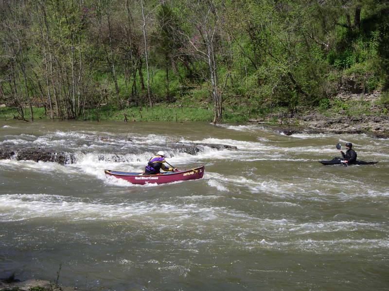
This run has only one rapid of any interest to any but the most novice boaters, but the rapid is rather long and fun and the run is pretty quick. This run is ofen combined with a scenic trip down Rocky Fork, however Rocky Fork does not run as often.
The most common put in for this stretch is right below the dam at Paint Creek State Park. There are two class I ledges right next to the parking area that provide novices the opportunities the chance to practice eddy turns and warm up.
The next mile or so is totally flat. Once Rocky Fork creek enters on the right things start to pick up. The river drops gradually over wide shoals ending just above a bridge (Rapid Forge road). Look for a few play spots against the right shore. At higher levels some nice waves kick up.
Underneath the bridge there is a short pool or, at higher water, slower current. The river narrows slightly, goes over another shoaly area with a nice playspot, a few waves, then goes over a definite ledge drop - class 2. Good eddy on the right, fun or squirly eddy line, depending if you have a squirting mindset, on river left.
After this first "real" drop there is a short slack section (which disappears at higher water) leading to a midstream rock called "Turtle Rock". Water washes over the rock at 2000 cfs and it disappears at levels over 2500. Run either side of Turtle rock, but the right side is somewhat easier. Good eddies exist behind the rock and on river right.
Be sure to try the automatic power ferry across the right hand chute. This is a great place for newer boaters to practice ferrys across a jet of water. There are also a nice couple of playspots here. It is also easy to walk back up to this spot from the bottom of the rapids.
Below Turtle Rock is very fast current leading to the third drop. This is a ledge extending from the right shore 2/3 to 3/4 across the river. This ledge is trashy at low level and forms a very powerful hydraulic at higher levels. It is best avoided by taking the obvious line to the left. After the ledge is a fun wave train, then one can take out on the right and easily return back to Turtle Rock.
Most boaters take out on the roadside rest area (on Rt. 50) about 3/4 mile downsteam from the chutes. This rest area is no longer operated by the state but permission has been attained from the land owner to park on the creek side (north side) of the loop. Do not park on the inside of the loop.
Rapids in this Run (2)
Playspots (1)
Difficulty
Class I-II(III)
Length
3.1 mi
Rapids
2
Access Points
Difficulty Classes
I Easy
II Novice
III Intermediate
IV Advanced
V Expert/Extreme
VI Unrunnable
Current Conditions
5-Day Forecast
Whitewater data from
American Whitewater
American Whitewater