Partridge Lane to Harper Rd (3.3 miles) *Access Issues*
Linked via: Proximity 97% confidence Synced 6mo ago
Gauge Conditions
Runnable: ? – ? CFS
Approximate reading: This gauge is 6.2 miles away on Rat. Use as a general reference only.
Data from American Whitewater & USGS
Run Map
Run Time Estimate
Select put-in and take-out to estimate time.
Unlock Advanced Trip Planning
See wind-adjusted speed maps, forecast planning, and detailed time estimates.
Sign in to generate an AI timing estimate for this run.
Whitewater timing varies with scouting, portages, and group pace. Use as a planning baseline.
Description
This Peshtigo tributary is very near to the usual put-in for the popular "Roaring Rapids" section, so could make a good 'creeky' companion piece for that run.
The listed put-in, Partridge Lane, has reverted to a private road at the request of local property owners. All property near this point on both sides of the river is privately held so please DO NOT ATTEMPT TO ACCESS THE RIVER HERE WITHOUT ASKING AND OBTAINING PERMISSION! (In my experience, many property owners here and elsewhere are friendly if you humbly respect their property ownership. Introduce yourself, and what you would like to do, and politely ask permission to park and access the river. While Wisconsin affirms your right to be on the water, you have no right to trespass to get to the river! And, technically, without prior permission, you most likely have no right to set foot on privately owned dry land to scout or portage!) As of this time, the closest known public access is seven miles upstream at the Valley Lake Rd bridge. This distance is reportedly a pretty paddle but is quietwater.
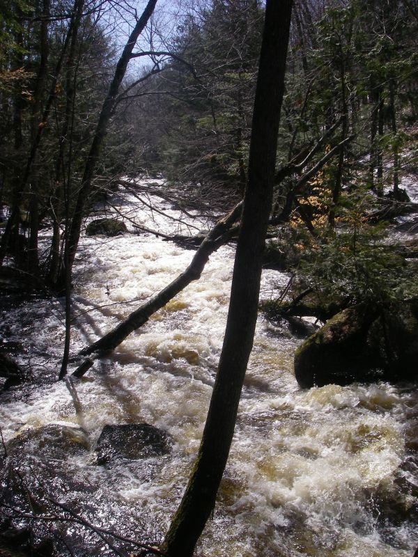
There are three sections of gradient featuring continuous whitewater through several definable drops each.
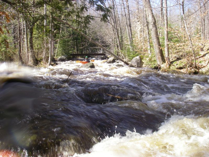
The first area of gradient rates class III at moderate flows (and could push into IV range when cranked). The river drops 51' in 1/3 mile here starting with a fast technical maze through some big boulders, then feeding into a fast flume around an island. At the present there are several trees blocking all or part of the river and a pair of low footbridges at the island so caution is advised. As mentioned in a comment below, " _the island is deeded land and there are burial sites on it, so stay off the island to respect those sites. We were told some previous kayakers had heeded natures call at one of the burial sites"_. (Added editorial comment: Think, people! How would you feel if you saw someone do that on your parent's or grandparent's graves?)
The second area of gradient rates II-II+, and is somewhat reminiscent of the "Dells" rapid on the Upper Pesh (downstream of Michigan Rapids).
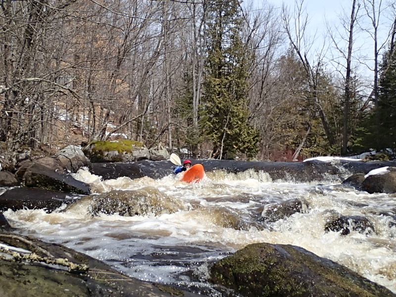
The third area of gradient rates class II-III with more technical boating and one ledge of about 3-4' that creates a fairly big hole that will wake you up.
The sections of gradient are separated by moving water with some riffles and a fair-sized beaver dam with a runnable notch. The final mile down to Harper Rd is quietwater (as is the 1.3 miles from there to the Peshtigo, the almost precisely another mile to the mouth of Otter Creek, and the 0.4 mile more down to the Farm Dam rapids. For any paddlers who opt to set shuttle to run the Rat and the Peshtigo together, your total run length will be nearly 11 miles).
Enjoy the following 'tour' of this run: https://youtu.be/gR0yxQqmLco
Difficulty
Class II-III(IV)
Length
3.4 mi
Gradient
29 ft/mi
max 58
Rapids
5
Access Points
Difficulty Classes
I Easy
II Novice
III Intermediate
IV Advanced
V Expert/Extreme
VI Unrunnable
Current Conditions
5-Day Forecast
Whitewater data from
American Whitewater
American Whitewater