Placerville to SF American confluence
Linked via: Nhdplus discovery 90% confidence Synced 6mo ago
Gauge Conditions
Runnable: ? – ? CFS
Approximate reading: This gauge is 4.8 miles away on Weber Creek. Use as a general reference only.
Data from American Whitewater & USGS
Run Map
Run Time Estimate
Select put-in and take-out to estimate time.
Unlock Advanced Trip Planning
See wind-adjusted speed maps, forecast planning, and detailed time estimates.
Sign in to generate an AI timing estimate for this run.
Whitewater timing varies with scouting, portages, and group pace. Use as a planning baseline.
Description
River Description
Weber Creek is often boatable in the wet season during and after heavy rains. It seems to be popular with locals who don't mind dealing with the challenges of low elevation Sierra creeks: trees, portages, logs, bushes, manky rapids, etc. The rewards of overcoming such challenges, are the interesting scenery and many fun rapids. This run has some fun rapids but isn’t a typical high quality California run. It is low sierra adventure boating -- worth doing if you are in the area or local, but not worth a significant drive.
This creek is a low elevation tributary of the SF American River. It originates to the south east of Placerville and flows into the Gorge of the SF American at Bouncing Rock Rapid.
There are several sections of Weber that can be run by starting and stopping at different road bridges.
Elevations:
Big Cut Road - 1700 feet
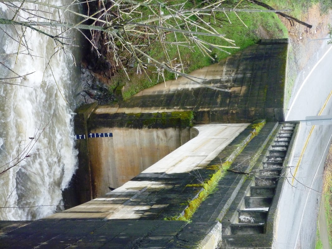
Green Valley Road - 1460 feet (Painted Gauge Here – see picture tab)
Lotus Road - 890 feet
Confluence with SF American - 450 feet
Sections:
Big Cut Road (1700ft) to Green Valley Road (1460 ft) – IV
Summary: Boof.com forum - Big Cut Rd to Green Valley Road.
Green Valley Road (1460) to Town of Cold Springs (~1200ft) – IV+/V
Character: This is the steepest of the Weber Creek sections. Bedrock rapids interspersed by in stream willows with wood commonly in play. First 3-4 rapids are (IV) with some hazards in the landing zones. Rapids continue to increase in size with a 10-15’ slide, followed by a 20-25’ double drop, followed immediately by a portage (3 tier slide, 50-60’ vertical, main hazard = questionable landing zone.
Flow: Look for 1’ to 3” on the painted gauge on the Green Valley Road bridge (downstream river right)
Hazards: Logs, willows, and poor water quality. 1-2 portages depending on flows and personal comfort with risk
Cold Springs (1200 ft) to Lotus Road (890’) – IV/IV+
Character: Much more consistent gradient and continuous nature and less pool drop compared to the section above. Thus, more willows and danger of wood. There are a few rapids that standout but nothing compared to the section above but most boaters would
Flow: Look for 1’ to 3” on the painted gauge on the Green Valley Road bridge (downstream river right). Flow will likely double or triple from the Green Valley bridge to Lotus bridge.
Hazards: Logs, willows, and increasingly poor water quality. There is a river right tributary where the water quality noticeably degrades.
Lotus Road (890 ft) to Confluence w/ SF American (450 ft) – IV/V
Kim & Geof: Lower section to SF American
Other Information Sources:
Weber Reservoir is a small diversion reservoir in the upper reaches of the main fork of Weber Creek. Water is sent through a canal to Placerville. The reservoir is owned by El Dorado Irrigation District.
Kim & Geof: Lower section to SF American
Boof.com forum - Big Cut Rd to Green Valley Road.
Boof.com 2010 Weber topic
El Dorada Irrigation District \- Weber Reservoir
Difficulty
Class IV-V
Length
18.5 mi
Gradient
104 ft/mi
Rapids
8
Access Points
Difficulty Classes
I Easy
II Novice
III Intermediate
IV Advanced
V Expert/Extreme
VI Unrunnable
Current Conditions
5-Day Forecast
Whitewater data from
American Whitewater
American Whitewater