Pond in the River to Lake Umbagog
Linked via: Nhdplus discovery 90% confidence Synced 3mo ago
Gauge Conditions
Runnable: ? – ? CFS
Approximate reading: This gauge is 9.7 miles away on Rapid. Use as a general reference only.
Data from American Whitewater & USGS
Run Map
Description
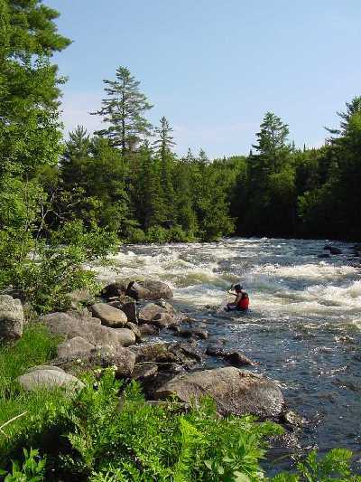
The Rapid river is located in a secluded part of Maine close to the NH border. It used to be difficult to get to this river because of limited accessable public roads. Boaters used to paddle several miles across the open waters of lake Umbagog out of Errol NH then carry upstream to the put in. Others hired a seaplane bush pilot out of Errol to fly them into Pond in the River then pick them up several hours latter in Lake Umbagog. There is a private dirt road on the north side of the river but this is gated and inaccessable to all but a few camp owners and one rafting company. In the late 80's a group of Maine Appalachian Mountain Club (AMC) members found put in and take out spots through a maze of logging roads on the south side of the river. These logging roads have improved over the years and are now suitable for any vehicle to make it to the put in. The take out is still a little rougher towards the end and it is still recommended to take a high clearance vehicle there.
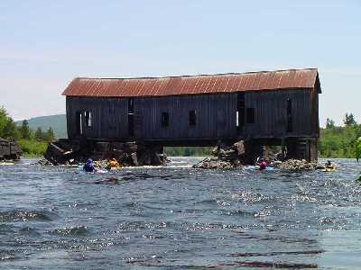
From the put in boaters must paddle 1-1/2 miles across the lake hugging the left shore to the remains of Lower Dam. Lower dam looks like an old delapitated covered bridge with the ends removed. This is the start of the river portion of the trip.
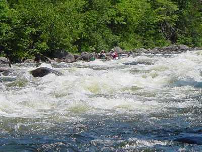
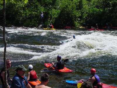
'The river itself is worth the trip. Clean, great scenery, some nice relatively easy and safe III-IV with maybe one of the best playspots in New England. The river ends in Lake Umbagog. It is then necessary to paddle 3/4 of a mile to a well hidden take out trail in a cove on the left side of the lake. Look for streamers in the trees and a few small paddle boats lying up on the shore. It is best to have someone familiar with the take out location with you. After all this is finished, you can then get in your second car and spend the rest of the day trying to figure out how the heck to get back to your first one.Most people who run the Rapid will tell you it's worth the trip. If you are lucky while you're there you might be able to run the Magalloway, which is also nearby.
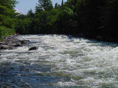
Some people disagree with the 'easy and safe' designation, because the river is very shallow in places. I'd hate to have to call in an ambulance after a flip on one of the many 'long, powerful, and shallow' pitches on this run. In an emergency a couple years back a power boat was 'borrowed' from the Cedar Stump campground just downstream from the end of the river as it enters Lake Umbagog. From here it is a 30 minute power boat ride to Errol then another 45 minutes to the nearest hospital in Berlin NH.
### Access Issues
Access to the Rapid is via private land and private logging roads. The land is mostly owned by local paper mills and a few individual land owners. There have been grumblings from the land owners about traffic, camping, and ATV's. Please try to car pool as much as possible, pull vehicles well off the road. Logging trucks have the right of way so yield to them and give them a wave. Stick to a reasonable speed on all roads especially around sharp corners. Slow down to a crawl when you approach a logging operation in progress to avoid 'dusting' the workers. Please do not camp in the area especially if it is posted. There are several campgrounds in the Errol area. Carry out all trash. The land owners I've talked to seam to be more upset by ATV use than boaters so please keep a good boaters image. There is one access point to the logging road network from Upton that already has a gate that can easily be closed and locked. Let's hope this does not happen.
### Technical info
```
Put in elevation........1398'Take out elevation......1243'Total drop..............155'Average drop/mile.......68'(river portion only) Distance................2.25 miles (river), 2.3 miles lake 1st mile drop...........35'2nd mile drop...........80'2.25 mile drop..........20ÂÂ
Â
80 ' averageRiver width average.....50'River geology...........medium granite boulders and some ledge River water quality.....Good, clarity good.Scenery.................Excellent, a few camps on river right. Wildlife................Deer, moose, loons, eagles.
Release Schedule: https://amcbostonpaddlers.org/documents/river-releases/
```
Rapids in this Run (6)
Playspots (1)
Difficulty
Class IV
Length
3.8 mi
Gradient
68 ft/mi
max 80
Rapids
6
Access Points
Difficulty Classes
I Easy
II Novice
III Intermediate
IV Advanced
V Expert/Extreme
VI Unrunnable
Current Conditions
5-Day Forecast
Whitewater data from
American Whitewater
American Whitewater