Ripogenus Gorge to Debsconeag
Linked via: Nhdplus discovery 90% confidence Synced 6mo ago
Gauge Conditions
Runnable: ? – ? CFS
Approximate reading: This gauge is 24.9 miles away on Penobscot. Use as a general reference only.
Data from American Whitewater & USGS
Run Map
Run Time Estimate
Select put-in and take-out to estimate time.
Unlock Advanced Trip Planning
See wind-adjusted speed maps, forecast planning, and detailed time estimates.
Sign in to generate an AI timing estimate for this run.
Whitewater timing varies with scouting, portages, and group pace. Use as a planning baseline.
Description
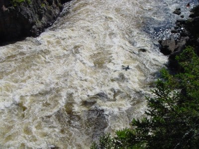
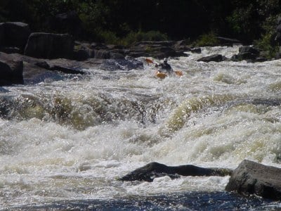
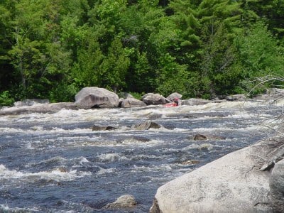
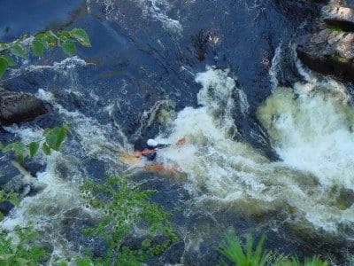
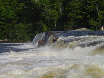
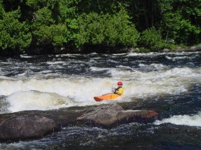
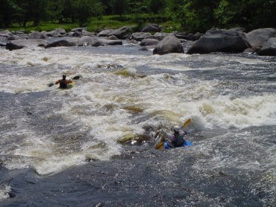
After a long drive by logging roads dodging Moose, put-in at McKay station. There is usually dependable flow here all Summer. The section from the dam to Chewonki's Big Eddy (about 2 miles) is considered a class IV-V run. Just below the put-in is Exterminator hole. At normal summer levels punch the hole on the left. Below exterminator is Staircase rapid. Shallow class IV with a nice wave train at the end. Just downstream you will notice the main flow of the river goes to the left around a shear rock wall go to the left for Big Heater rapid. To the right a narrow channel leads to a nice little drop (Little Heater). Just below the heaters on river right is Troublemaker hole, a nice powerfull playhole. Pull out on river left just above a bridge. Downstream lies one of the most difficult rapids in all New England. The Cribworks should be scouted from "Vulture rock" which lies on river left where the river turns left. The move should be obvious to any veteran boater. Drop through the Turkey Chute on river left then move toward river right through Final Chute. Avoid going river left after Turkey Chute; the river runs through a boulder pile that could broach/pin a boat or swimmer.
Below Prays Big Eddy the river alternates between long stretches of flatwater and sudden large drops. Some of the rapids in this section are "Big Amberjackwockamas" (Big A), Neswadnehunk (Soudyhunk) Falls, and Abol.
The West Branch of the Penobscott has been compared to the Upper Gauley and many New England boaters will come here for a warm-up before venturing to West Virginia.
## Camping
Camping can be found at Chewonki's Big Eddy Campround, located just below the Cribworks, and Abol Campground, by the Abol bridge. There are other individual campsites scattered about the area that are maintained by the Department of Conservation. They work on a first come, first serve basis.
## Directions
### To The Lower River Put-in Class III-IV
From Portsmouth NH take Interstate 95 through Maine 244 miles. Take exit 244 (Millinocket/Medway) Maine route 157/11 Take a left (West) on 157/11 towards Medway. Drive throuhg Medway and East Millinocket. In Millinocket look for and follow signs for Baxter State Park. Drive on the Millinocket Lake Rd for 8 miles towards Baxter State Park. When you see the sign for Penobscot Adventures take a left onto the Golden Road, The Big Moose Inn will be on your right. If you get to The North Woods Trading Post you've gone too far. Once your on the Golden Road drive 8 miles to Abol Bridge. Take the next left after Abol Bridge onto the Gravel Pit Road. Put-in at the first turn out on your left, just above Abol Rapid.
### To The Lower River Take-out
Retrace your route back to just before the bridge over the river and take a right onto Nevers Corner Rd, a smaller, rougher dirt road, approximately 1.5 miles to the base of Pockwockamus Falls. Rafting companies should have vehicles parted here for shuttle.
### To The Upper River Put-in McKay Station Class IV-V
Drive up the Golden Rd past Telos bridge then up Powerline Hill. McKay Station is on your rigth 3/4 of the up the hill. If Ripogenous Dam is running you can go further upstream to the dam and put-in on the Dryway, but be ready for big white water. The dryway is a continous mile of Class V+ whitewater followed by Ripogenous Gorge.
### To The Upper River Take Out
Some paddlers are only interested in running the Rip Gorge through Cribworks section. For those people, take out just downstream from Chewonki's Big Eddy Campground at the DOC provided site.
Rapids in this Run (5)
Waterfalls (2)
Difficulty
Class III-V
Length
13.0 mi
Gradient
22 ft/mi
max 80
Rapids
5
Access Points
Difficulty Classes
I Easy
II Novice
III Intermediate
IV Advanced
V Expert/Extreme
VI Unrunnable
Current Conditions
5-Day Forecast
Whitewater data from
American Whitewater
American Whitewater