Route 614 to James R.
Linked via: Unknown Synced 6mo ago
Gauge Conditions
Runnable: ? – ? CFS
Approximate reading: This gauge is 4.1 miles away on Jennings Creek. Use as a general reference only.
Data from American Whitewater & USGS
Run Map
Run Time Estimate
Select put-in and take-out to estimate time.
Unlock Advanced Trip Planning
See wind-adjusted speed maps, forecast planning, and detailed time estimates.
Sign in to generate an AI timing estimate for this run.
Whitewater timing varies with scouting, portages, and group pace. Use as a planning baseline.
Description
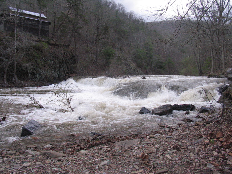
Jennings Creek is most popular locally for trout fishing and summer time swimming holes. But when the rain hits and the flow jumps you wont see either here. The majority of the run is located with in National Forest and mostly roadside.
There is always a bunch of wood in this creek, but most of it should be avoidable. You should watch for and note places needing portaging on the ride up.
After your laps here slide up North Creek for a tighter, faster, more technical creek with even more wood!
Rapids in this Run (1)
Difficulty
Class II-III
Length
5.3 mi
Gradient
68 ft/mi
Rapids
1
Access Points
Shuttle Info
Put In:
The entire run is roadside within nat'l forest. Drive upstream, as far up Jennings Creek Rd. (614) as you want to go. Multiple parking options and pull offs. They are often being used by trout fishermen as this creek is stocked.
Take Out:
The take out is a bit more tricky. Going downstream you eventually leave nat'l forest right at the river wide ledge (HOC ledge). If your group is small you may get away with parking near there, but there is a small parking lot (recommended) only a couple hundred yards upstream at the blue hole (which is just upstream of the HOC ledge). You can also continue all the way to the confluence with the James River and then 5 mins down the James to the public boat landing at the Arcadia bridge over the James.
Difficulty Classes
I Easy
II Novice
III Intermediate
IV Advanced
V Expert/Extreme
VI Unrunnable
Current Conditions
5-Day Forecast
Whitewater data from
American Whitewater
American Whitewater