S.Ravine St. to S.Milwaukee St. (0.5 mile)
Mineral Springs Creek
Linked via: Unknown Synced 6mo ago
Gauge Conditions
Runnable: 400.0 – 999.0 CFS
Almost certainly too low to boat.
Data from American Whitewater & USGS
Run Map
Run Time Estimate
Select put-in and take-out to estimate time.
Unlock Advanced Trip Planning
See wind-adjusted speed maps, forecast planning, and detailed time estimates.
Sign in to generate an AI timing estimate for this run.
Whitewater timing varies with scouting, portages, and group pace. Use as a planning baseline.
Description
Quick Facts:
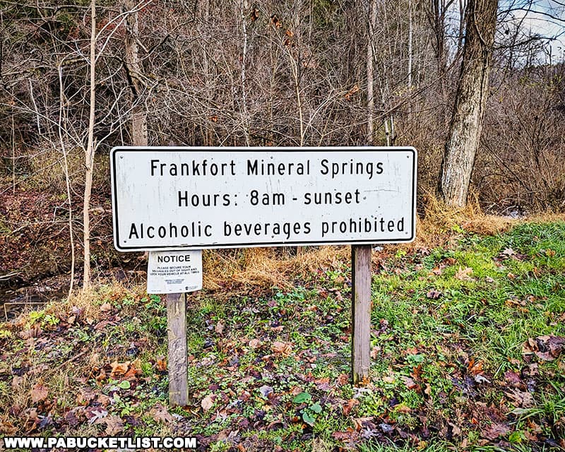
Location: SE Wisconsin, just south of downtown Port Washington.
Shuttle Length/DriveTIme: 0.6 miles/3 minutes
Put-in elevation is approximately 640'.
Take-out elevation is approximately 600'.
Thus total elevation change is approximately 40', in just under a half-mile (for an *equivalent* gradient near 80 FPM!)
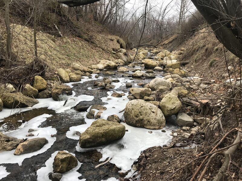
Drainage area at put-in: 2.75 square miles (Yes, tiny!)
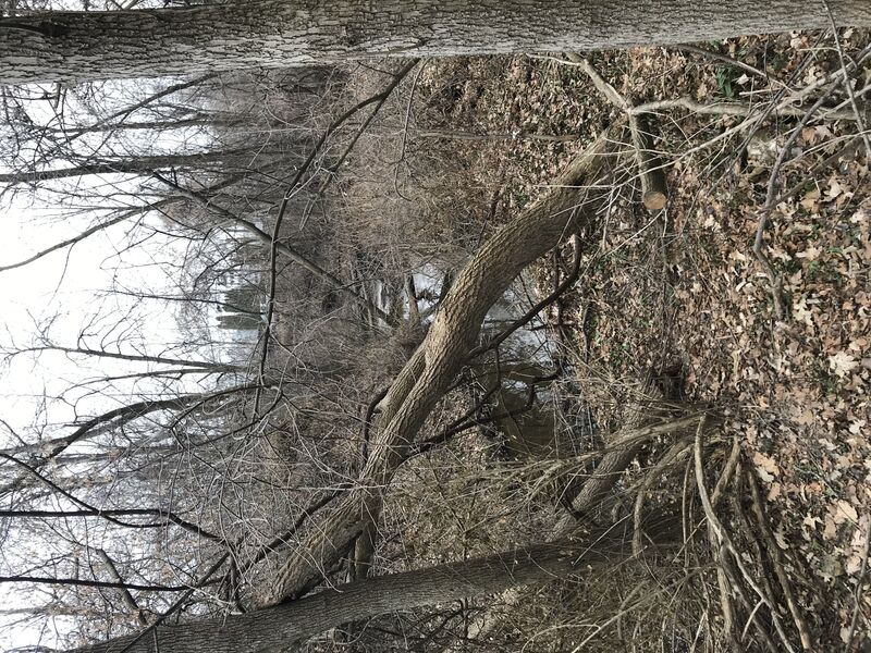
Character: Tiny, intimate, super-micro-creek; twisting, turning, brush dodging, rock slamming, steep banks, ... and *virtually guaranteed deadfall and strainer issues*.
IMPORTANT NOTE: Gradient values should always be used for *general comparative purposes only!* Differences (even up to 15-20% and more) mean very little in the grand scheme of all things whitewater! Far more important (than either gradient *or* class/rating) should be other less-quantifiable *'character factors'* such as: (1) continuous versus pool/drop, (2) wide-channel with multiple routes versus narrow channel with essentially one route, (3) straight-shot routes versus complex technical maneuvering-required routes, (4) gradual river banks versus rocky shores or steep-walled gorges, et cetera. Never rely solely on class/rating to decide if you should run a river/rapids!
General Overview
A tiny, intimate 'stupid boater tricks' run with likely snags, 'clothes-lining' deadfall, and tight maneuvering. With a drainage area of 2-3 square miles, this will require significant rain and will have a very short 'window of opportunity'. However, high-water debris I have seen on numerous occasions suggests that it should happen with some relative frequency (at least a few times a year).
Scroll down to the 'Rapids' for (slightly) more details why anyone might even look at this stream. In truth, it is recommended as little more than a 'fantasy run'.
In the event anyone actually decides to check it out and run it, scout as much as possible before putting on! Walk the banks through Oakland Avenue Green (Park) from S.Ravine Street to Oakland Avenue, to be aware of what you are getting into! (And, be aware that any time you aren't on mowed lawn, you are (sooner or later) walking through poison ivy!)
A stream this narrow, with such steep banks, will have *virtually no eddies* and plenty of strainers and sweepers to mess you up. At 'boatable' levels, even this little creek may have powerful forces of flow which could kill you if you are pinned against an obstacle and end up getting flipped under. So, while the actual rapids contain absolutely nothing which exceeds class II-II+, the boater skill-level to successfully negotiate this twisty intimate (and likely snag-filled) stream is much more in the class III-IV range!
Most emphatically, this is NOT something to try in a vinyl raft, air mattress, inner tube! You can almost certainly count on having it popped, or at the least being ejected from it as it wraps or snags on some obstruction. Just as emphatically, this is not a stream for a standard (non-whitewater) canoe or 'recreational' kayak (with no spray deck). You will not be able to maneuver a relatively long craft in this narrow creek, your boat will filll with water and you will have a tough time retrieving it from the flow. Even worse, if you end up in the water, and are downstream of your craft, you could easily get crushed against a tree or rock by your own boat! (This is not to discount the possibility that someone might be able to successfully make it down in such a craft, but such success is far more likely a sign of pure luck than evidence of actual boating skill.)
Note: DO NOT go beyond the listed take-out. The stream splits just before it gets to the power plant. The left (north) 'natural channel' encounters numerous hazards (significant plant growth, impassably low pipes spanning the stream, a low bridge and other obstructions). There is an 'overflow' channel along the south of the power plant building. Entrance into this channel is completely blocked by railings affixed atop a short cement diversion wall. This channel is lined with large quarry rock which will take substantial flow to cover sufficiently for passage by canoe/kayak. There are no likely features (other than perhaps as the outflow hits the lake). All property around the power plant is posted against unauthorized access (trespass) other than a new lake access south of the power plant. As a result, we cannot recommend proceeding beyond the listed take-out at S.Milwaukee Street.
Recommended 'Companion Runs'
\------------- Approximate ----- Approximate
River ------- Distance ---------- DriveTime
Sauk Creek -- 1 mile --------- 2 minutes
Cedar Creek - 11 miles ---- 17 minutes
Rapids in this Run (6)
Waterfalls (2)
Playspots (1)
Hazards & Portages (2)
Caution: The following locations may require scouting or portaging. Always check current conditions.
Difficulty
Class II+
Length
0.5 mi
Gradient
80 ft/mi
Rapids
6
2 Hazards
Access Points
Shuttle Info
As mentioned in the description, we most strongly recommend walking (scouting) this entire (short) reach before even thinking about running it. Since it is rather short, it is entirely likely that anyone who does decide to actually boat this absurdly small creek is likely to just walk their shuttle.
You may wish to use the text-entry box below to input your home or other starting address to get drive time, distance, and directions to this reach. (It will accept zipcode, as stated, or a full address: street city state, or lat/lng coordinates, ....)
Difficulty Classes
I Easy
II Novice
III Intermediate
IV Advanced
V Expert/Extreme
VI Unrunnable
Current Conditions
5-Day Forecast
Whitewater data from
American Whitewater
American Whitewater