Sandy Bottoms to Tilley Bend
Linked via: Proximity 83% confidence Synced 6mo ago
Gauge Conditions
Runnable: 300.0 – 10,000.0 CFS
Data from American Whitewater & USGS
Run Map
Description
The Toccoa and the Ocoee are the same river; it is the "Toccoa" from its headwaters on the Blue Ridge in Georgia until it crosses north into Tennessee.
Rob Butera has provided extensive documentation of this run. Logistics can be viewed at http://toccoa.butera.org , and trip reports and journal entries are available at http://toccoajournal.blogspot.com
Over the last few years the river corridor has become increasingly populated. Private property is more of an issue. Review Rob's access points map linked above to plan a first-time trip.
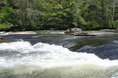
This lower run (also see River Reach 509) is a pushy class I-II with a few II+ drops. It is an excellent choice for novices, cruisers, fishermen and those wishing a more leisurely play river. Look for 350cfs or above on the gauge; below that is boney and less fun. The river comes up very quickly with rain; it can go from a scrapey 300cfs to a very fat 1500cfs in the space of a few hours.
Sandy Bottoms is the official Forest Service access; there are camping sites, a pit toilet and a developed boat launch area. The USFS charges $3 per car for parking. You will find a nice shoals right upstream that lets you get a good warmup and some eddying, ferrying and attainment practice.
Class I-II shoal-and-drop action proceeds to just upstream of Tilley Bend, where a longish uphill portage will put you back out at the corner of Old Dial Road and Shallowford Bridge Road, from where it is a one-mile downhill walk back to Sandy Bottoms. This affords a strange opportunity; the 'shuttle-free river run'. You can actually park in one place, run 6+ miles of river, and then portage back to your car. Satellite photos tell the tale - this reach is actually a big horseshoe bend around a low mountain.
A gauging station that reads in feet is on river right less than a mile from Sandy Bottoms - easily read from your boat.
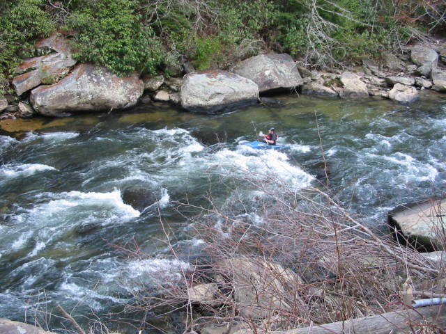
The first significant play opportunity is 'Training Wheels', just downstream from the gauge, a series of ledges that are ideal for learning basic moves: front surfs, back surfs, side surfs, flat spins.
The second whitewater feature of notice is called 'Anything Goes' since there are so many playable features, easier and harder. This is a good place for beginners to learn basic play moves. Approach is marked by the appearance of an island to the right of center. Pull out river right above the island or eddy behind the island to scout. The main chute runs left of the island. There are two more drops below the first, both similar in configuration. Small play spots are riverwide.
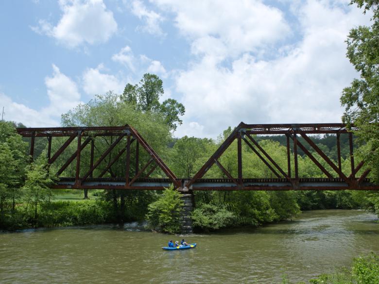
Shallowford Bridge, half a mile below Anything Goes, affords another access point and features a snack bar. Toccoa Valley Campground's rafting take out is just upriver from the bridge on river left.
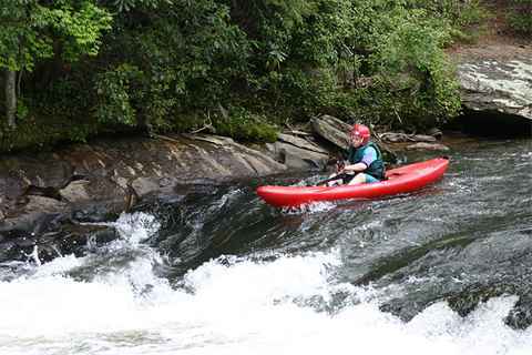
Another couple of miles downriver, Aska Road is visible from a few hundred yards upstream; you will spot auto traffic. As you approach, move to river left, eddy out in the rockpile, and climb out to scout the next rapids - 'One For The Road' aka 'Party Rock'. Be aware of the trespassing issue mentioned below. You may want to set a couple throw ropes on the boulders below the drops to rescue any swimmers before they wash into the lower shoals, a hundred yards of power eddy hopping through a constriction that is known as 'Little Nantahala' by some paddlers.
MARCH 2008 - THE PARKING LOT AT PARTY ROCK HAS BEEN POSTED AGAINST TRESPASSING BY THE LANDOWNER. There is a new owner who is actively seeking to restore to pristine condition this heavily-impacted area, which in the past has been a madhouse of drunken partyers in summertime, and have served notice on the local outfitters to cease and desist pickups and dropoffs at this point. In other words - the party's over. Several violators have been fined for trespassing by local law enforcement. Please respect landowner rights, avoid potential legal action and DO NOT PARK your car here for takeout. If you must take out at this point, arrange for a bandit pickup by a designated shuttle bunny, preferably at roadside below Little Nantahala. Do not linger and as usual please, no nudity or overt substance abuse.
There are two more named rapids below Aska Road - 'Skippy 'and 'BFH'. Skippy is a short, low double drop starting from far river right and cutting back to the left. BFH is a more serious double drop over a riverwide ledge in front of a very obvious Big FFFffffffrightening House (BFH). The best chute is left of center directly in front of the house.
Continue another mile or 2 after BFH into the tailwaters of Lake Blue Ridge and look for a 90' bend to the left following a long, straight, wide flatwater section. You know you are there when you see a row of houses with boat docks on river right after the bend. Pull out on the right bank at the bend and find the trail up in the woods. Walk uphill approximately 1/3 mile to get back to the junction of the dirt roads. The road back to Sandy Bottoms is the one that is like a continuation of the trail in the same direction.
If you have time it's good idea to scout the trail and takeout before making this run.
To avoid the uphill takeout at Tilly Bend, one can paddle another 15-20 minutes of flatwater and take a "right turn" up Persimmon Creek where it meets with the Toccoa. The dirt road comes nearly down to the river edge. The road is a little hard to find - it is less than 1.5 miles north of the intersection of Dial Rd and Shallowford Bridge Rd. A green box marking in-ground cables exists right where the road is. A 4x4 is recommended but not required.
Rapids in this Run (3)
Playspots (3)
Difficulty
Class I-II
Length
7.0 mi
Rapids
3
Access Points
Shuttle Info
From Atlanta, go north on I-575 to Blue Ridge, GA. Pass the McDonalds on the corner where you would turn left if you were going to the Ocoee. Go another 2 lights (about a mile) and turn right at Kentucky Fried Chicken. That road goes a hundred feet and T-bones onto Old Highway 76. Turn left, go past Ace Hardware, and turn right on Aska Road. Drive for a very long time. At about the 7 or 8 mile mark you will see the river off on your left; that is the Party Rock rapid. Get out if you must and have a look at the rapids, but be aware you are trespassing on private property - do not park or linger. Continue along Aska Road past the Riverside Restaurant, up hill and down dale until you see an iron bridge on the left; that is Shallowford Bridge. Cross the bridge and turn right. Follow Shallowford Road to the junction with Old Dial Road. The trailhead to the left (west) of that intersection is where you will walk out if you are running all the way to Tilly Bend; park and go down and scout the takeout if so. Continue 1 mile to the right on Old Dial Road to get to Sandy Bottoms. You know you are there when you see the outhouse across the road from the parking lot on the right, with a nice canoe carry ramp down to the river.
Difficulty Classes
I Easy
II Novice
III Intermediate
IV Advanced
V Expert/Extreme
VI Unrunnable
Current Conditions
5-Day Forecast
Whitewater data from
American Whitewater
American Whitewater