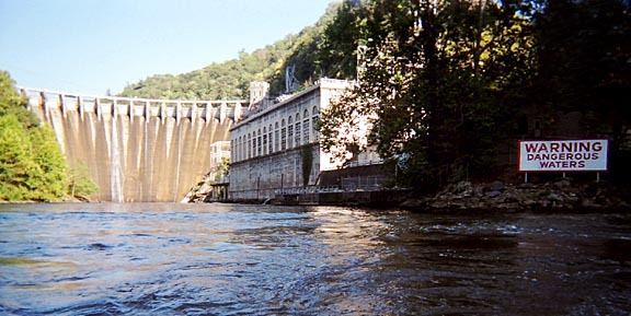
Santeetlah Dam to Calderwood Lake Boat Launch
Linked via: Proximity 98% confidence Synced 6mo ago
Gauge Conditions
Runnable: 400.0 – 3,000.0 CFS
Data from American Whitewater & USGS
Run Map
Run Time Estimate
Select put-in and take-out to estimate time.
Unlock Advanced Trip Planning
See wind-adjusted speed maps, forecast planning, and detailed time estimates.
Sign in to generate an AI timing estimate for this run.
Whitewater timing varies with scouting, portages, and group pace. Use as a planning baseline.
Description
The Cheoah River is located in the extreme southwestern corner of NC, near Robbinsville. For 77 years the nine-mile section between the Santeetlah Dam and Lake Calderwood was dewatered. American Whitewater along with the Western North Carolina Paddlers advocated for releases for over 6 years. Whitewater releases on the Cheoah began in the fall of 2005. Each year there are at least 18 releases for paddlers to enjoy for the next 40 years.
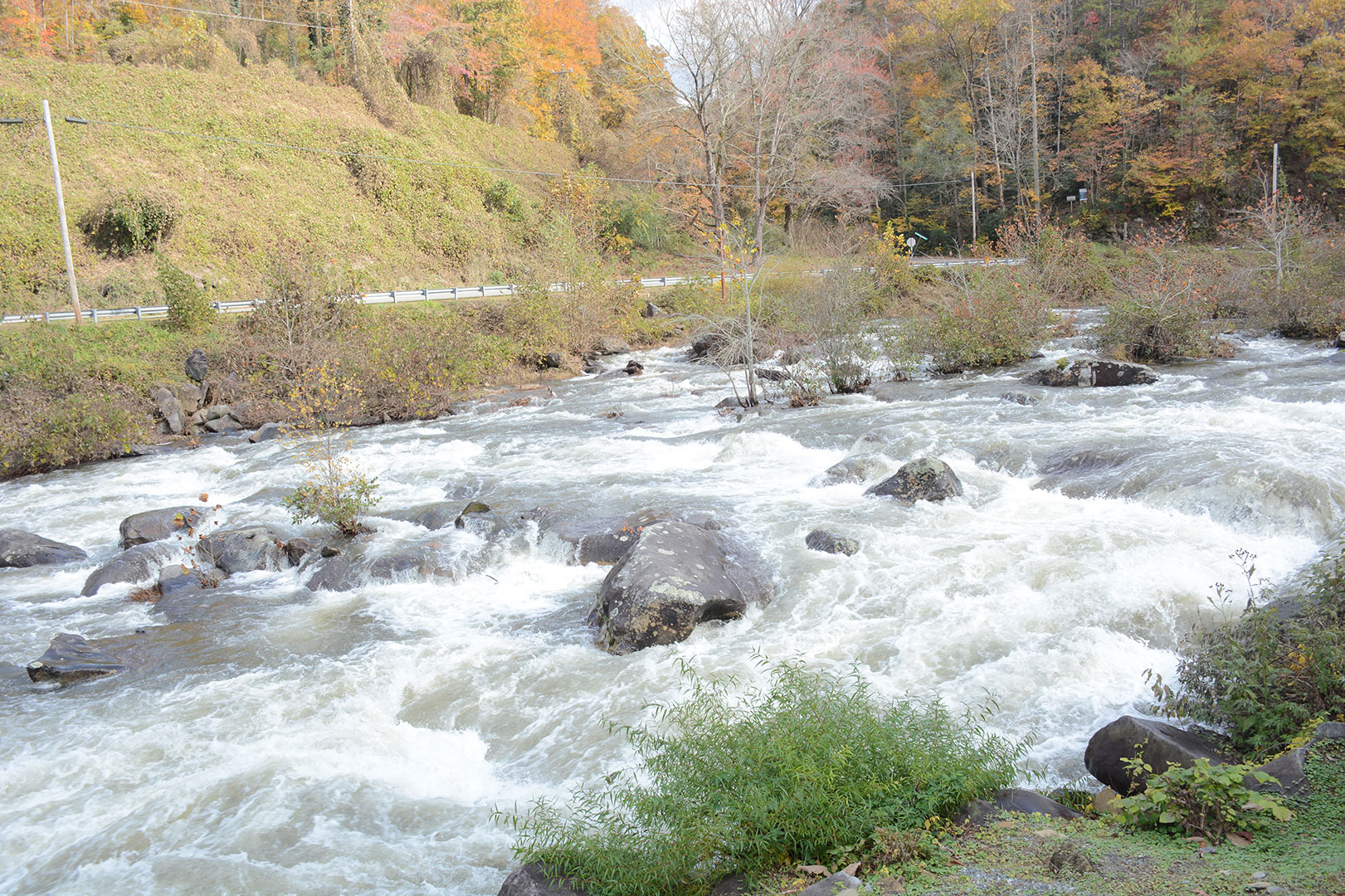
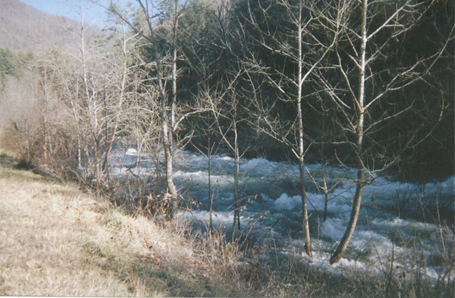
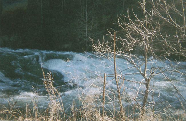
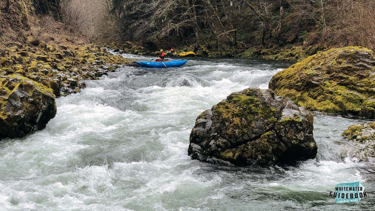
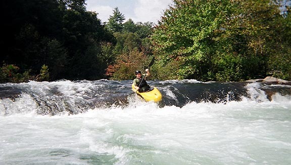
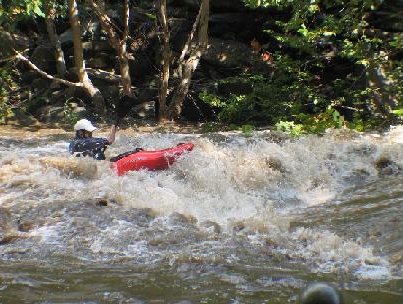
The Cheoah is unusual for rivers of its volume in the Southeast in that its gradient is relatively constant. This means that with the exception of 2 or 3 half mile or so sections, it is unusually continuous, more so than anything else with a similar volume of water in the Southeast. Some call it 'warm western-style paddling;' those paddling it at the higher winter 2002 flows continued the Western analogies, comparing it to Pine Creek on the Arkansas and the Lochsa at high water. No doubt contributing to the analogies was the water quality, which was crystal clear during the winter flows. It has become a classic southeastern run.
The portion of the Cheoah from Outland Gas and Grocery to Lake Calderwood can be broken into three sections: a 1.5 mile brushy and tree-clogged upper section with a number of sticky holes and a potentially troublesome river-wide ledge a bit downstream of the hydroelectric bypass pipe, a 4 mile relatively open and mild middle section that features some nice wave trains at higher water levels, and a 1.5 mile lower section with the most gradient and the best defined drops. Efforts have been made to clear channels in the upper sections of the river, however there are large root balls scattered throughout the stream bed and swimmers should be extremely careful.
At flows of about 1000 cfs or under, the upper section is about a half grade and the middle section a full grade easier than the lower section, with the first two sections similar in difficulty to the Ocoee. The risks are greater, however, as much of the channel is heavily lined with trees and brush, giving the run a nature akin to paddling during a flood. The main technical challenge is presented by the frequent series of offset holes. Because of the trees and brush, it is not a good place to paddle if you don't have a rock-solid roll and the ability to read water well on the fly (bank scouting would not be fun).
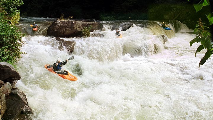
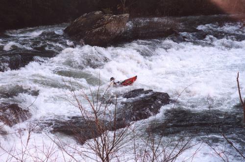
The lower section is the best defined, with a number of classic drops. It begins at the bridge on which the Bearpen Gap gauge is located. My favorites were the sequence of four drops with the biggest single drop on the river (a ledge about 8 feet high) being the third and the drop beginning at the bridge downstream of the Tapoco Lodge. There were many, many waves to surf and a number of very playable holes, including two potential rodeo sites: one at Tapoco Lodge and one at the end of the drop beginning at the bridge downstream of the Lodge.
At the highest level paddled during the summer test releases (4.7 feet / 1,130 cfs), the upper and lower sections were much closer in difficulty as the offset holes were beginning to get sticky. The hole below the river-wide ledge was beginning to look scary at this level; recovery after a swim would be challenging due to the thickets of trees growing in the water and on both banks for a considerable distance downstream. The lower section didn't change much, so the result was a run that was a lot more fun but not any scarier (assuming strong class IV skills, and keeping in mind that the Ocoee only requires strong class III skills). If more of the trees and brush were removed, the upper run would almost certainly get easier at every level as paddlers wouldn't be forced to run through the meat of the holes and the entrapment danger would be lower.
For the upcoming schedule of releases see: http://www.smokymountainhydro.com/content/about/santeetlah-35694.html.
Be sure to stop by the store near the put in and buy a US Forest Service wrist band for each day you paddle.
See also Chris Bell's Asheville-Area Boating Beta Page.
Class
Flow
Gauge
III-IV (IV+)
4.15' / 670 cfs
The Cheoah River near Bearpen Gap near Tapoco, NC gauge is located at the bridge that marks the beginning of the lower section of the run. The cfs values for flows over 4.70 feet are estimates; the USGS has not calibrated the gauge for flows greater than those observed during the July, 2000 test releases. The river can be run at 670 cfs, but I would need at least 800 cfs to be willing to make the two hour drive from Asheville. As reflected in the ratings, the Cheoah gets harder as it rises -- especially the upper section, which is reported to be very dangerous at 6.8'. 5.3' is a very exciting, challenging level providing a thrilling ride unlike anything else to be found in the Eastern US; levels over 6' are probably too high for mere mortals on all but the middle section.
III+-IV+
4.50' / 950 cfs
IV-IV+
4.55' / 1010 cfs
IV-IV+
4.70' / 1130 cfs
IV-V
5.3' / 1840 cfs?
IV+-V+
6.8' / 4000 cfs?
Video Podcast about the Cheoah Relicensing
AW's Kevin Colburn and Jeff Paine talk with John Grace of Lunch Video Magazine about the Cheoah relicensing project.
LVMTV :: Monday Morning Madhouse 3/16; American Whitewater's successes with Cheoah Releases from Lunch Video Magazine on Vimeo.
Rapids in this Run (12)
 Rapid
Rapid
First diversion pipe
 Rapid
III+
Rapid
III+
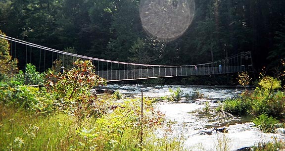
Swinging Bridge Rapid
 Rapid
IV
Rapid
IV
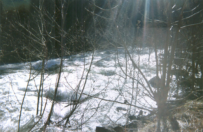
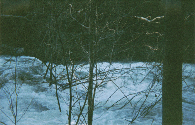
Typical Upper Cheoah Scene
 Rapid
IV
Rapid
IV
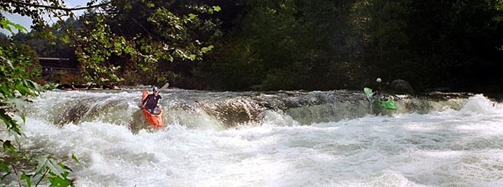
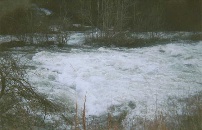
Typical Rapid on the Middle Cheoah - Yellow Creek Rapid.
Rapid
IV
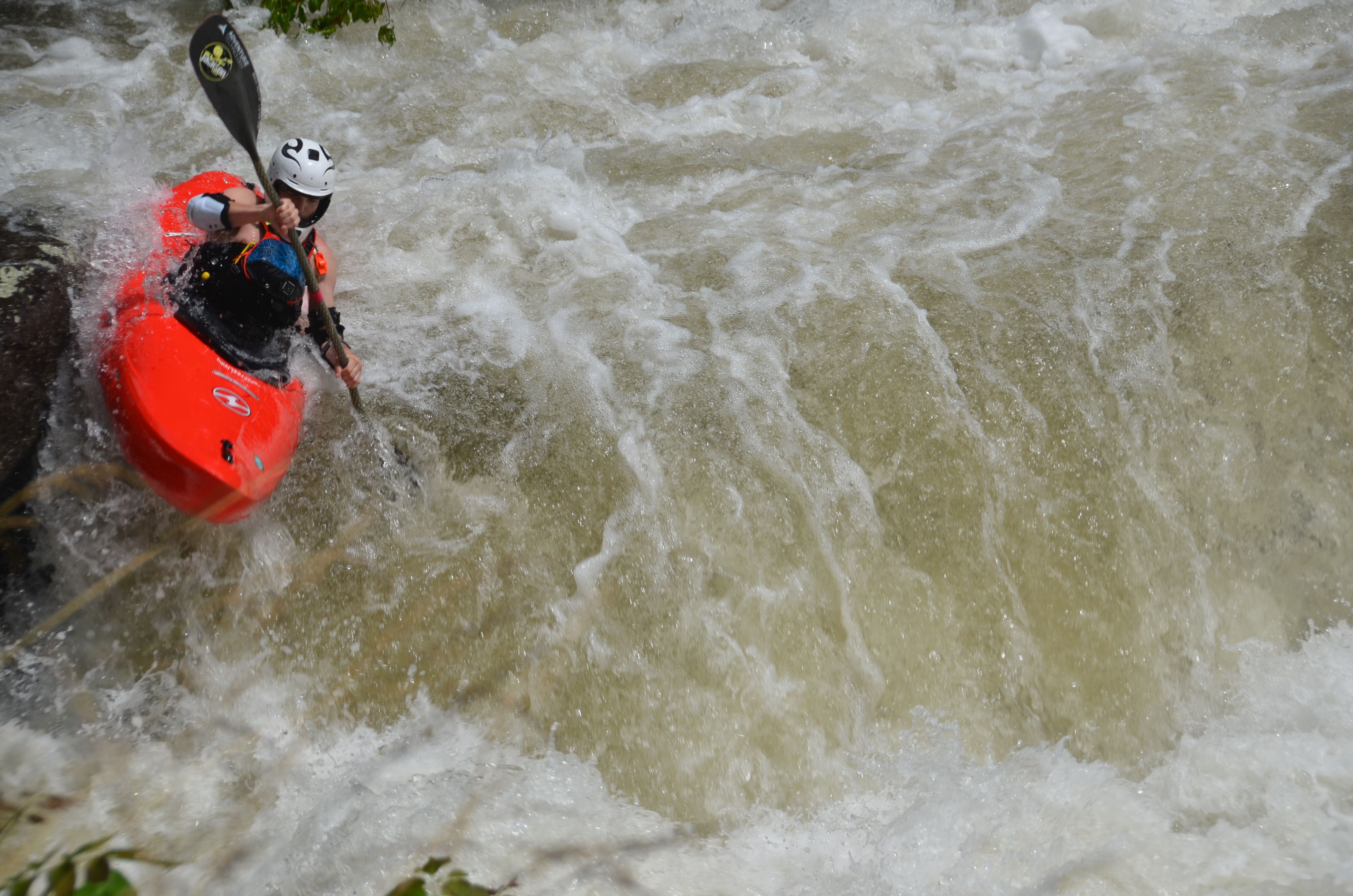
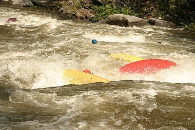
Land of Holes
 Rapid
I
Rapid
I
The deadend pool
 Rapid
III
Rapid
III
The easy stuff
 Rapid
Rapid
The Forest Service Bridge
 Rapid
IV+
Rapid
IV+
Entrance to Bear Creek Rapid
 Rapid
IV+
Rapid
IV+
Bear Creek - The left side of the Island.
 Rapid
IV
Rapid
IV
Rapids below Bear Creek
 Rapid
Rapid
The Lake
Waterfalls (1)
Playspots (4)
Hazards & Portages (9)
Caution: The following locations may require scouting or portaging. Always check current conditions.
Difficulty
Class IV-V
Length
9.1 mi
Gradient
83 ft/mi
max 146
Rapids
12
9 Hazards
Access Points
Shuttle Info
**Directions from Asheville:** Take I-40 West to Exit 27 (US 19 /23/74/Great Smoky Mountains Expressway). Take US 74 West 46 miles to the point NC 28 splits off to the right toward Almond and Robbinsville and US 74 continues on to the Nantahala Gorge. Take NC 28 11.5 miles to the left onto NC 143. Follow NC 143 8.7 miles to Robbinsville. In Robbinsville turn right onto US 129, following it 16 miles to the take-out at the boat ramp at the end of the little road off US 129 on the far side of the bridge over the Little Tennessee at its confluence with the Cheoah. The river you'll be following the last 9 miles or so of your drive will be the Cheoah.
**Shuttle:** The run is road side so the shuttle is self explanatory.
**Parking**: There is a new parking area at the put-in for the run that is owned by the USFS. There are other parking areas along the river. Many paddlers use the O'Henry parking area, parking there costs a few dollars, but the money is well spent. O'Henry is a great local man who openned a parking area and is very paddler friendly.
**User Fees**: The USFS has a $2 user fee that can be paid at O'Henry's parking area or at Outland Gas and Grocery.
Difficulty Classes
I Easy
II Novice
III Intermediate
IV Advanced
V Expert/Extreme
VI Unrunnable
Permit Required
Band Required! Stop by the store near the put in to purchase a $5 US Forest Service band. A new band is required for each day. The bands help the Forest Service track paddling use on the river, which ultimately may help justify additional releases. A portion of the proceeds also helps maintain access and pay for agency staffing related to the river.
Current Conditions
5-Day Forecast
Whitewater data from
American Whitewater
American Whitewater