Shawhan Road to Hall's Creek Road
Hall's Creek
Linked via: Unknown Synced 6mo ago
Gauge Conditions
Runnable: ? – ? CFS
Approximate reading: This gauge is 8.1 miles away on Hall's Creek. Use as a general reference only.
Data from American Whitewater & USGS
Run Map
Run Time Estimate
Select put-in and take-out to estimate time.
Unlock Advanced Trip Planning
See wind-adjusted speed maps, forecast planning, and detailed time estimates.
Sign in to generate an AI timing estimate for this run.
Whitewater timing varies with scouting, portages, and group pace. Use as a planning baseline.
Description
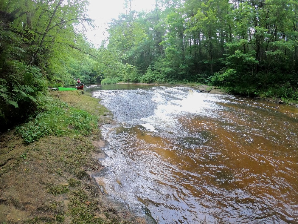
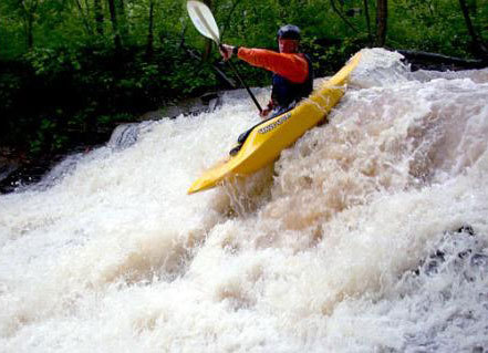
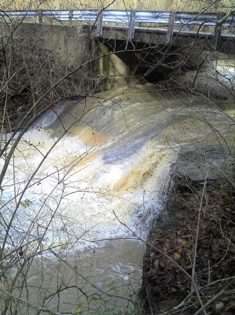
A tributary of the Litle Miami, Hall's Creek drops nearly 150 ft in about a mile and a quarter. Due to the amount of rain it takes to get this one going, most paddlers only run the lower part of this creek, dropping about 60 feet in a half mile. It starts with a ledge in the 8-9 foot range on the main (or east fork) and a seven foot drop coming in on the west fork. Within a hundred yards, the next ledge appears, and there are several other rapids just below that one with some more big, riverwide, irregular ledges from 4 to 7 feet. At good water levels there are play spots at the end of some of these rapids. As soon as you go under the next bridge, the creek really flattens out.
Currently, there is a bad strainer downstream and around the bend below the bridge, so the bridge would be a good takeout. A hundred yards below the strainer is the Morrow-Milgrove Road bridge and then the confluence with the Little Miami.
Halls Creek is located on Halls Creek Road and empties into the Little Miami River on river right, about 1 mile west (downstream) of Morrow, Ohio, and 2 miles upstream of South Lebanon, Ohio. Morrow-Milgrove Road runs alongside the Little Miami River from South Lebanon to Morrow.
Parking is an issue at this creek. There are a minimum of parking spots, especially at the put-in. Please respect the local property owners land and nature preserve land.
Shuttle:
The road runs right alongside of the creek (you can scout 80% of the main run from your car while running a shuttle), But
Alternate shuttle:
If you happen to be there at the right time, and want to run the upper section (which is actually the west fork, not the main fork), just follow Hall's Creek Road up the hill and turn left onto Shawhan Road. The put-in is ahead 3/4 mile on the West Fork of Hall's Creek. Watch out for strainers.
Rapids in this Run (1)
Waterfalls (2)
Difficulty
Class III+(IV)
Length
1.7 mi
Gradient
120 ft/mi
Rapids
1
Access Points
Difficulty Classes
I Easy
II Novice
III Intermediate
IV Advanced
V Expert/Extreme
VI Unrunnable
Current Conditions
5-Day Forecast
Whitewater data from
American Whitewater
American Whitewater