Shirley Mills to Blanchard
Linked via: Nhdplus discovery 90% confidence Synced 6mo ago
Gauge Conditions
Runnable: 900.0 – 4,000.0 CFS
High end flows are unknown. This gets into serious class 5 at higher flows.
Data from American Whitewater & USGS
Run Map
Run Time Estimate
Select put-in and take-out to estimate time.
Unlock Advanced Trip Planning
See wind-adjusted speed maps, forecast planning, and detailed time estimates.
Sign in to generate an AI timing estimate for this run.
Whitewater timing varies with scouting, portages, and group pace. Use as a planning baseline.
Description
Source: Greg and Sue Hanlon's Steep Creeks of New England, which has more info on this run. Text used with permission.
Directions: From Greenville, head South on Rte. 6/15 about 6 miles to Upper Shirley Corner. Bang a right onto Shirley Mills Rd. and continue 1.4 miles to Shirley Pond. The pond is on the right; the dam, on the left. Put in below the dam on river left.
To takeout: head back toward 6/15. About 50 yards from the dam, take your first right onto an old railroad bed / logging road. Drive about 2.3 miles to a small stream crossing under the road and a cabin on the left. The low-water takeout is where this stream meets the East Branch. To get to the high-water takeout, which adds 1.3 miles to the trip, continue on the logging road and take a right down a steep washed-out logging road. Park and take out in the clearing where a small trail leads to the river.
UPDATED DIRECTIONS: The logging road (B&A Railroad Road) and North Blanchard/Shirly Road are rarely passable in the Spring when the Piscataquis is running, due to poor road conditions, snow mounds and gates. Hiking out through the snow and mud is long and tedious, though possible. Instead of hiking out or getting stuck in the mud, drive to the center of Blanchard via route 15 through Monson. Takeout at the bridge in the center of town (Blanchard Road). There is a long flatwater paddle to get to Blanchard, but if you prefer to ride your boat rather than have your boat ride you, this is the way to go. Put-in is still below the dam at Shirley Lake. Here is a GoogleMap.
Note: The first complete run of the East Pis was made in 1992 by Scott Murray, Greg Hanlon, Bill and Joan Hildreth.
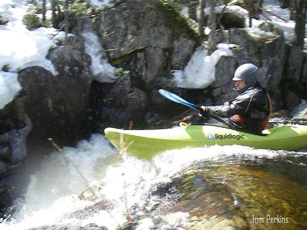
River Description by Nate Warren: Best run with more than 1000 CFS on the Piscataquis Gauge. The first few miles is filled with great class IV+ ledge drops with plenty of good boofs. The aptly named Crack Drop (V-) is towards the end of this section. It can be boat scouted from the pool. Drive left.
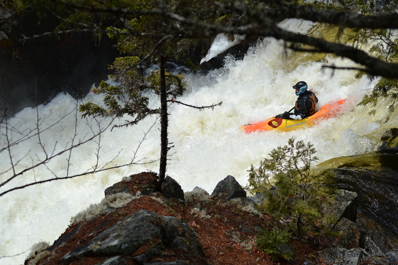
Soon below is Big Balls Falls (5.1), a 20 foot drop followed by a 5'er that gets sticky at higher flows. The river turns 90 degrees left above the drop. You can scout from either side, but walking is easier on the right (though not easy). The main drop has been run almost everywhere. I prefer center right working left to avoid a bouncy reconnect in the middle.
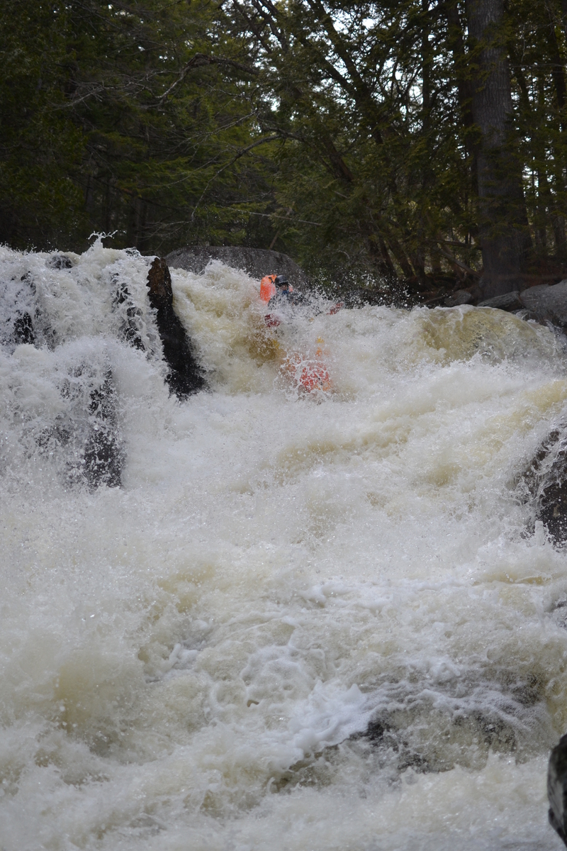
There is a small class 3-4 rapid below Big Balls, then the entrance to Slap Ya Mama (5.1). This is the hardest rapid on the river. Scout and portage on the left. The most common line is down the center spout with a little left angle - boofing will hurt, as will pitoning. Hold on down the slide and catch the eddy on the left to watch your friends. If you are hiking out, start here.
Below slap is a bit of wood choked class 3-4, eventually petering down to the long flatwater paddle out to Blanchard.
Rapids in this Run (1)
Waterfalls (2)
Hazards & Portages (1)
Caution: The following locations may require scouting or portaging. Always check current conditions.
Difficulty
Class V
Length
2.6 mi
Gradient
105 ft/mi
Rapids
1
1 Portage
Access Points
Difficulty Classes
I Easy
II Novice
III Intermediate
IV Advanced
V Expert/Extreme
VI Unrunnable
Current Conditions
5-Day Forecast
Whitewater data from
American Whitewater
American Whitewater