Siskiwit Falls (PnH, 0.25 mile)
Linked via: Proximity 98% confidence Synced 6mo ago
Gauge Conditions
Runnable: 250.0 – 1,000.0 CFS
Almost certainly too low. We need your input to verify correlations. Please add a comment or report.
Data from American Whitewater & USGS
Run Map
Run Time Estimate
Select put-in and take-out to estimate time.
Unlock Advanced Trip Planning
See wind-adjusted speed maps, forecast planning, and detailed time estimates.
Sign in to generate an AI timing estimate for this run.
Whitewater timing varies with scouting, portages, and group pace. Use as a planning baseline.
Description
Bayfield County has purchased about 100 acres of land north of Siskiwit Falls Road. Parking lots and privvies have been installed. Boardwalks have been built and trails established to facilitate viewing all the falls. A fine 'flyover' video exists at YouTube: Siskiwit Falls (NOTE: you may wish to speed it up by clicking the 'Settings' icon (the 'gear', bottom right), then clicking 'Playback Speed' and selecting 1.5 or 2 (to double speed), since the drone footage is long and slow otherwise.)
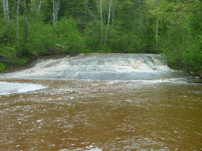
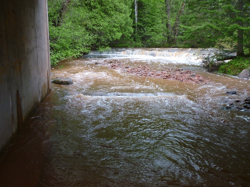
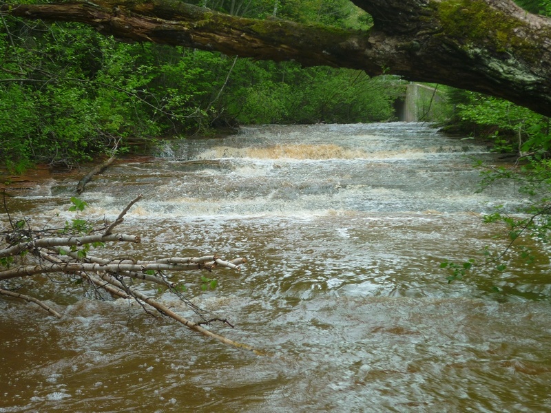
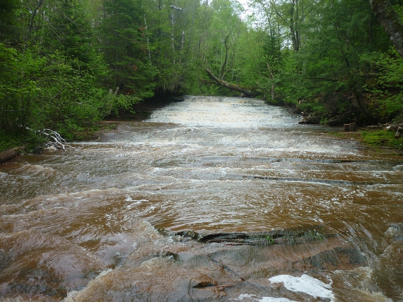
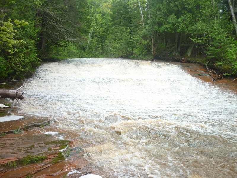
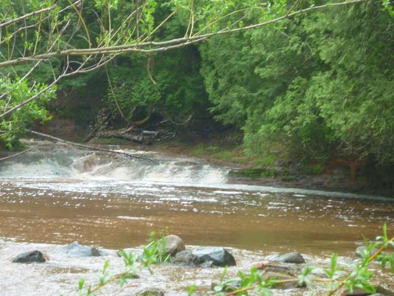
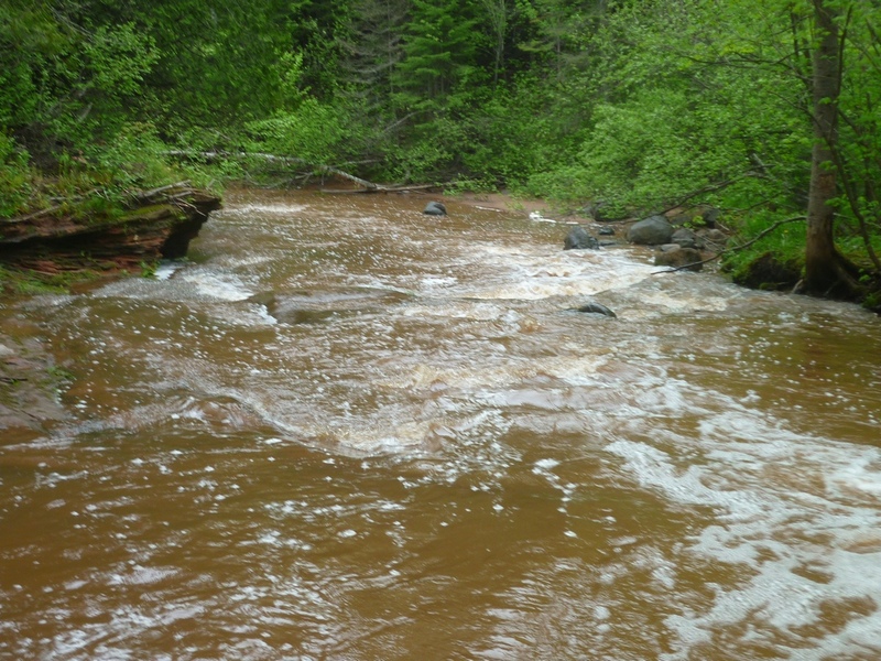
This reach is going to be difficult to catch by anyone who does not live in the immediate area (Bayfield/Ashland/Duluth/Superior boaters) because it has such a small watershed (extremely short 'window of opportunity' for adequate flow). Add to that the extremely short length, and the proximity to the known and more popular 'North Shore' (MN) rivers, and you'll quickly see why few boaters ever catch this one. However, anyone who manages to catch it with boatable flow is likely to be pleasantly entertained if not intimidated! Why? If there is anything above bump-and-scrape flow, rather than being separate slides, everything below the bridge will essentially be very nearly one continuous high-speed-whoopie slide, as the river drops about 50-60 feet in about a quarter-mile!
The section is almost entirely smooth bedrock sliding drops, with almost no inherent hazards (other than concerns for hangers, strainers, and snags -- trees still anchored to shores, but extending over and/or into the water). In fact, local folks and tourists 'slide' the falls (some use air mattresses or inner tubes, others just slide parts of it on their butts!) during the summer. The objective difficulty of any individual drop is likely no more than class II (possibly _marginally_ up to class III). However, with adequate flow, having this much gradient, this many drops, back to back to back . . . the overall 'feel' will be far more class IV-ish. Proper whitewater gear (helmets, elbow pads, maybe gloves to avoid massive knuckle abrasion if you flip or swim), and a solid team of experienced boaters with safety skills may be recommended for any flows above bare-bones bump-and-scrape.
A fine photo-essay is available at: http://www.gowaterfalling.com/waterfalls/siskiwit.shtml
By the way, there is a fair amount of gradient upstream of our listed put-in. However, virtually anywhere upstream of there, you will have major problems with deadfall and snags (with extremely limited opportunity to eddy-out to scout or portage them). Minimize your frustration and hassle by focusing on the shortest section with the biggest gradient, as listed here.
Rapids in this Run (10)
Hazards & Portages (1)
Caution: The following locations may require scouting or portaging. Always check current conditions.
Difficulty
Class II-IV
Length
0.2 mi
Gradient
60 ft/mi
Rapids
10
1 Hazard
Access Points
Shuttle Info
The put-in/ take-out is located on Siskiwit Falls Road near Cornucopia. There is a small grass pull off near the bridge. Heading upstream, stay close to the river on river-left. (There is a driveway not far from the river, but you can't see the river from it.) Downstream, a short trail follows the river on river-right from which you can inspect the drops. 'Shuttle' is generally carrying up this path to return to your vehicle.
For that reason, instead of showing the 'shuttle', the directions below are defaulted to show the drive from your home zipcode. Use the text-entry box below to input your home (or other starting) address to get more specific drive time/distance/directions to this reach. (Despite the label of 'zip', you can enter lat/lng, street/city/state or most any meaningful location info.)
Difficulty Classes
I Easy
II Novice
III Intermediate
IV Advanced
V Expert/Extreme
VI Unrunnable
Current Conditions
5-Day Forecast
Whitewater data from
American Whitewater
American Whitewater