Snake Falls
Linked via: Proximity 100% confidence Synced 6mo ago
Gauge Conditions
Runnable: ? – ? CFS
Approximate reading: This gauge is 31.8 miles away on Snake. Use as a general reference only.
Data from American Whitewater & USGS
Run Map
Run Time Estimate
Select put-in and take-out to estimate time.
Unlock Advanced Trip Planning
See wind-adjusted speed maps, forecast planning, and detailed time estimates.
Sign in to generate an AI timing estimate for this run.
Whitewater timing varies with scouting, portages, and group pace. Use as a planning baseline.
Description
The older description of this run clearly implied you would access the site at the Snake Falls Sportsman Club and they are not interested in having people walk down to the falls.
The access as it appears if you intend to do this is to put in just below the dam at Merritt Reservoir. The river would need to have high flow so it would be a good idea to at least look at the falls from the private $1 pay access.
The only real takeout option that seems legit is the Niobrara River at HWY 97.
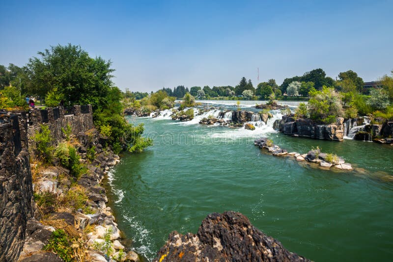
There are rapids above the Snake River falls including some shoals less than 100 yards above the falls. At higher flows many of these are just going to wash out but you definitely do not want to swim over the falls. The waterfalls has a launch pad style lip that would kick a boat out into the pool at the base. It is both an undercut waterfall, it has a “cave” behind the drop, and there are rocks at the base in some locations. So you really do want to know where it land, I assume if you are running this.
The falls probably are between 8 and 10 feet of vertical drop.
Having been here at low water I can assure you that the land owners will not want to see a bunch of kayakers. It appears that this has been boated in the past but I assume it was a stealth trip?
Also, there is a comment by Kevin Colburn about talking to the National Park Service. This waterfall is not near a National Park so he is almost certainly referring to Smith Falls near the Niobrara. That waterfall really is a 20+ foot crashing drop onto rocks.
Take Rt. 97 south from Rt. 20 N in Valentine for 22.5 miles toward Merritt Lake to the sign to Snake Falls. Take the road to Snake Falls to the right (west) for .6 miles to the Snake Falls Sportsman Club. Pay the small admission fee (there was a Pay Box - mailbox - for the $1.00 fee for adults, .75 for children). The trail to the falls starts at the pay box to the right of the restaurant. Follow the trail back and to the left to the top of the cliff to see the falls.
Waterfalls (1)
Hazards & Portages (1)
Caution: The following locations may require scouting or portaging. Always check current conditions.
Difficulty
Class II-III(IV)
Length
22.0 mi
Gradient
10 ft/mi
Rapids
0
1 Hazard
Access Points
Shuttle Info
Shuttle will most likely be on foot, carrying upstream for whatever amount of gradient one chooses to run befoe and after the falls.
Use the text-entry box below to input your home or other starting address ('city,state', 'address, city, state', or 'lat long' in just about any format) to get drive time, distance, and directions to this spot.
Difficulty Classes
I Easy
II Novice
III Intermediate
IV Advanced
V Expert/Extreme
VI Unrunnable
Current Conditions
5-Day Forecast
Whitewater data from
American Whitewater
American Whitewater