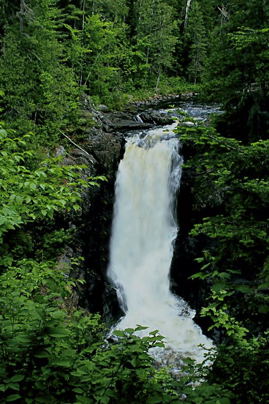
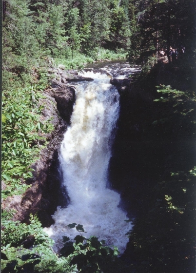
Snowmobile bridge to Moxie Falls
Linked via: Proximity 97% confidence Synced 3mo ago
Gauge Conditions
Runnable: ? – ? CFS
Approximate reading: This gauge is 2.9 miles away on Moxie Stream. Use as a general reference only.
Data from American Whitewater & USGS
Run Map
Description
Source: Greg and Sue Hanlon's Steep Creeks of New England, which has more info on this run.
Directions: On Rte. 201, head South from Berry's General Store in The Forks about 200 yards and cross the Kennebec River. Bang the first left and head 3.3 miles to a small dirt road on the left. Turn left and follow this road 'til you come to a clearing on the left. Park here and carry down the road 0.2 miles to a washed-out snowmobile bridge which crosses Moxie Stream.
To takeout: head back to the paved road and turn right. Drive 1.2 miles to a better dirt road on the right. Follow this road until the Moxie Falls trail crosses the road and park here. Take the trail on the right about 0.3 miles to the takeout.
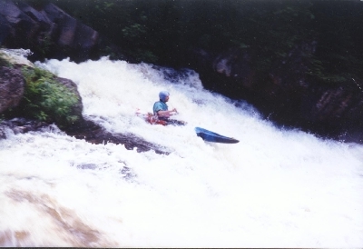
Be sure to take out above 80-ft Moxie Falls! Check out the takeout before running the river, just to be sure. You don' wanna be takin' on that BadBoy, I figure.
### Technical info
```
Put in elevation........924'
Take out elevation......720'
Total drop..............204'
Average drop/mile.......116'
Distance................1.75 miles
River width average.....30'
River geology...........Slate ledge
River water quality.....Good, clarity good.
Scenery.................Excellent, isolated wilderness river
Wildlife................Deer, moose, osprey, eagles.
```
Posted by Ran Currier on 7/6/05
if you noticed the release of one sluice
slightly open, it is barely enough to paddle. If desperate for
creeking you are better off carrying your boat to the takeout and
hiking up the last 1/3 mile to hit the good drops, the beginning is
too bony.
Rapids in this Run (2)
Waterfalls (3)
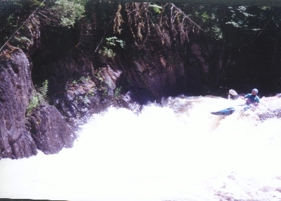
Difficulty
Class V
Length
1.8 mi
Gradient
116 ft/mi
Rapids
2
Access Points
Difficulty Classes
I Easy
II Novice
III Intermediate
IV Advanced
V Expert/Extreme
VI Unrunnable
Current Conditions
5-Day Forecast
Whitewater data from
American Whitewater
American Whitewater