Spearfish Canyon (7.6 miles)
Linked via: Proximity 97% confidence Synced 6mo ago
Gauge Conditions
Runnable: ? – ? CFS
Approximate reading: This gauge is 4.0 miles away on Spearfish Creek. Use as a general reference only.
Data from American Whitewater & USGS
Run Map
Run Time Estimate
Select put-in and take-out to estimate time.
Unlock Advanced Trip Planning
See wind-adjusted speed maps, forecast planning, and detailed time estimates.
Sign in to generate an AI timing estimate for this run.
Whitewater timing varies with scouting, portages, and group pace. Use as a planning baseline.
Description
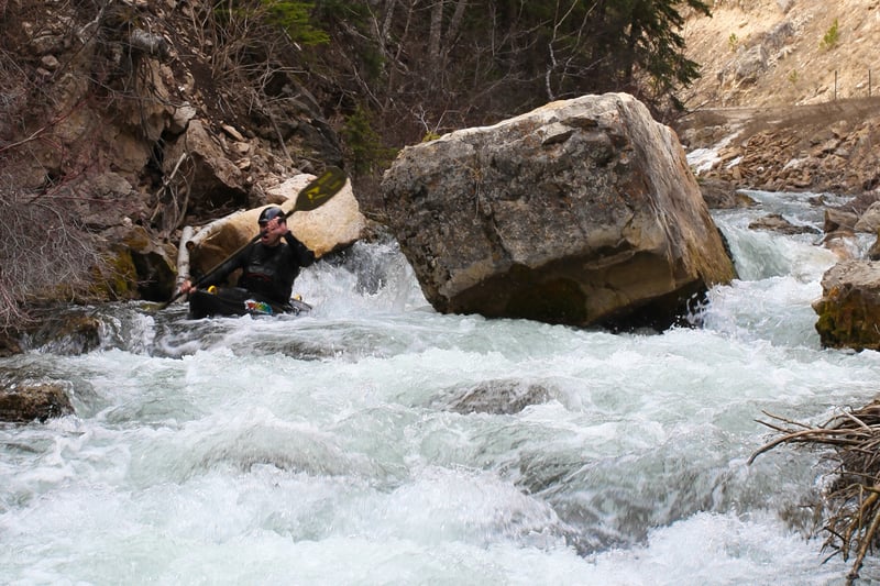
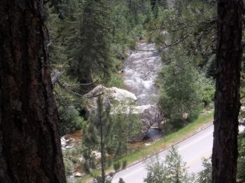
The Spearfish Creek canyon section is a pleasant surprise for those looking for a step up from the through-town paddle. It is roughly 7-8 miles long depending on which put in option you choose. One is to put in at the roadside pull-out directly after Calamity Gulch Rd. The other is to continue a short distance, turn left at the lodge and put in a mile East of Spearfish Falls. This option is a bit more up-paced with several boulder sections that have been known to cause a pin induced swim or two. Which ever route you choose, the scenery along the way is gorgeous and the action is nonstop. Being a roadside creek, it is almost entirely scoutable during the shuttle. But please take the time to walk back into those few hidden areas and check for fresh strainers just to be safe. A few of the main rapids are listed below but expect several other small drops in the 3-4 ft range throughout the run. Hint: one is immediately before passing by the Spearfish Falls viewing area and another will get you warmed up for the Elbow Room stretch. Have fun and stop in to Base Camp on Main St. in Spearfish for beta on this and other local runs.
Hazards & Portages (3)
Caution: The following locations may require scouting or portaging. Always check current conditions.
Difficulty
Class II-III
Length
7.6 mi
Gradient
90 ft/mi
Rapids
0
3 Hazards
Access Points
Shuttle Info
From Spearfish, take the scenic Spearfish Canyon Hwy south for aprox. 7 miles and drop a shuttle vehicle at the large fishing pond/dam on the left side of the road. This location is actually where the creek is then diverted underground to the City's Hydro Plant, thus ending the canyon paddle route (except when high flows permit). Continue up the canyon with your boats, take a left where the road forks at the lodge and restaurant and drive another 1.5 miles until you reach the road-level pond and parking lot on the right. Put in directly below the bridge.
Difficulty Classes
I Easy
II Novice
III Intermediate
IV Advanced
V Expert/Extreme
VI Unrunnable
Current Conditions
5-Day Forecast
Whitewater data from
American Whitewater
American Whitewater