SR 1309 Bridge to US 64 Bridge
Linked via: Nhdplus gnis 95% confidence Synced 6mo ago
Gauge Conditions
Runnable: 350.0 – 1,000.0 CFS
Upper limit for best boatability uncertain. Please help your fellow boaters with a comment or report.
Data from American Whitewater & USGS
Run Map
Description
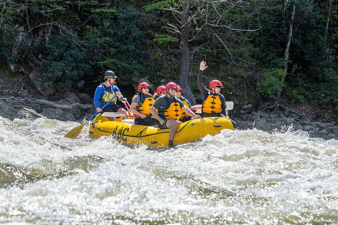
The West Fork is something different for those jaded by the North Fork. It has a slightly different character, and offers the chance to go big more than once. Three times in fact, in a row.
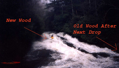
This different and slightly bigger character comes with some consequences though, as this river has taken a life, unlike it's brother. There is a dangerous pothole in the first slide, small but significant seives in the boulder garden, and some bad lumber all through the run.
Takeout:
From Headwaters Outfitters at 64 and 215, go West on 64 and look for a small factory immediately before the small bridge. Turn L into the "Shipping and Receiving" drive and park near the picnic tables.
Putin:
Turn L (West) on 64, and climb the grade. Turn R immediately past the CITGO gas station. Follow this road (SR 1309) until it crosses the river. Park on the left or right.
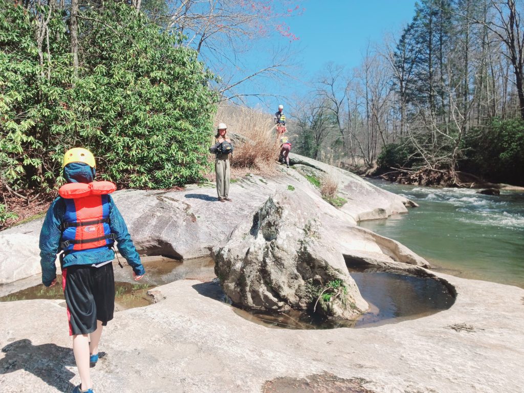
You can hike down the river left bank to the first drop to get a feel for the flow. It's about a quarter of a mile.
Rapids in this Run (2)
Waterfalls (1)
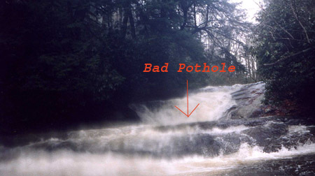
Hazards & Portages (3)
Caution: The following locations may require scouting or portaging. Always check current conditions.

Difficulty
Class IV-V
Length
2.5 mi
Gradient
100 ft/mi
Rapids
2
3 Hazards
Access Points
Difficulty Classes
I Easy
II Novice
III Intermediate
IV Advanced
V Expert/Extreme
VI Unrunnable
Current Conditions
5-Day Forecast
Whitewater data from
American Whitewater
American Whitewater