SR 56 to Stonycreek River
Linked via: Nhdplus discovery 90% confidence Synced 6mo ago
Gauge Conditions
Runnable: 5.5 – 10.0 FT
Data from American Whitewater & USGS
Run Map
Description
## Description:
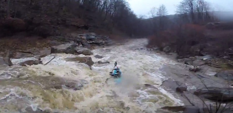
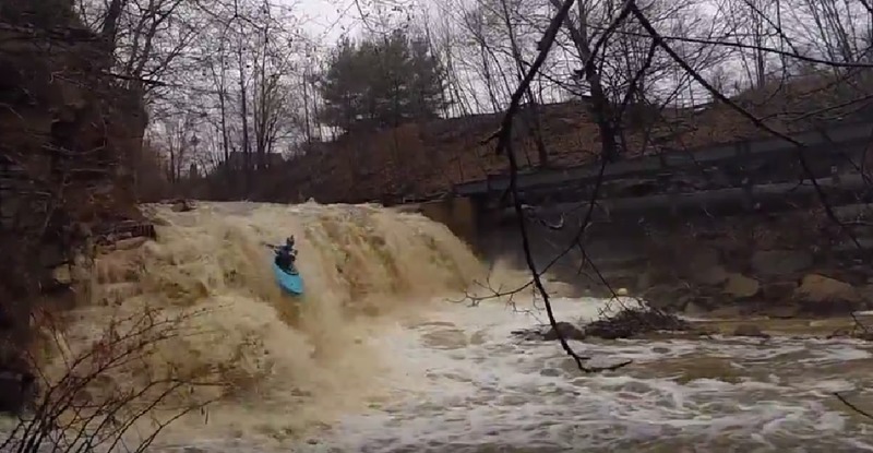
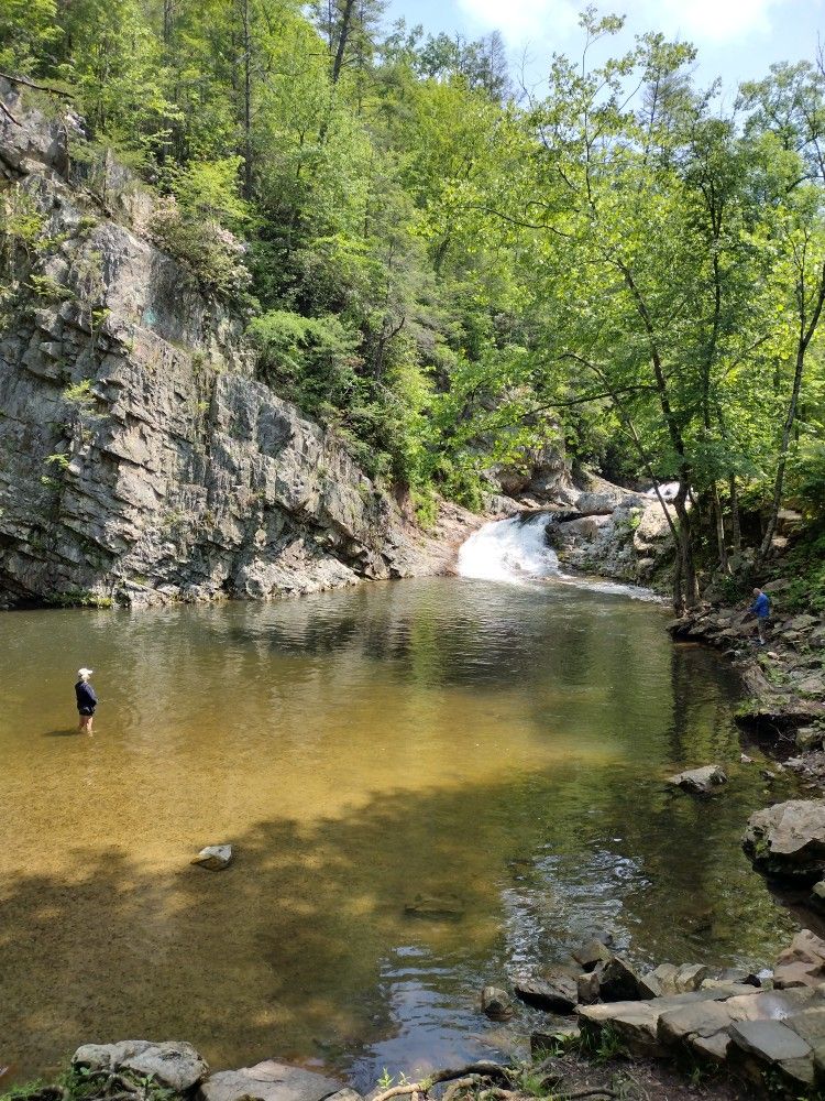
This is the Paint Creek in Johnstown PA. The creek itself is highly damaged and polluted by AMD and other things. Each year there is a Paint Creek pick-up to fish trash from the creek. The creek can be a class IV to V run depending on levels. On a low day you can find teenagers swimming in a few holes on paint creek soaking up that AMD glory.
Paint creek flows after heavy rain and run's more often than the gauge is listed. Typically if the Little Conemaugh gauge takes on rain, then paint more than likely runs, or if the Stonycreek gauge hits 5.5ft, its more than likely paint is running.
There is a painted gauge at Carpentars Park. The levels are as follows:
- Bare minimum (really jonesin' for it): now -16", was -12"
- Low-med (most mortal's minimum): now -12" to -9", was -6" to -3"
- Med (worth driving from a distance for): now -9" to -6", was -3 to 0"
- Med-high: now -6" to 3", was 0-6"
- High: now 3-6", was 6-9"
- Connoisseur: now 6+", was 9+
```
```
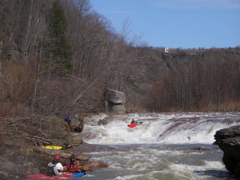
There are times Paint Creek can hit 3 feet. Recent video footage shows Road Hole turns deadly at this level, and probably even below that. I would cut off Paint at 1.5 feet using extreme caution if attempting this creek at 1.5 feet.
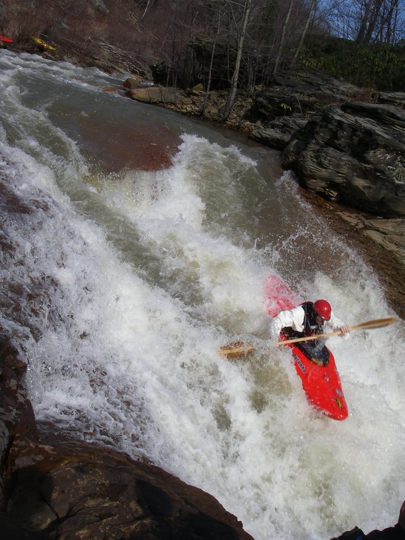
Paint put in is typically just up from route 56 where Little Paint Creek meets Paint Creek. There are 2 waterfalls just above put in that can also be ran. Little Sandy's Falls (Little Paint) is the easier of the two and more rocky, but have witnessed both being ran successfully. Hit your boof.
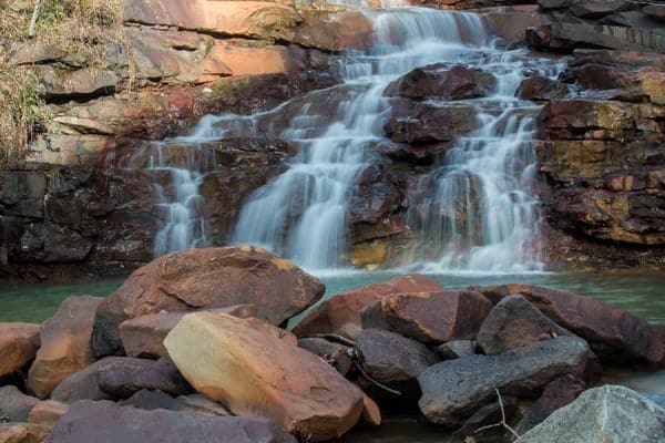
Paint starts with "Deal-Breaker" and continues its steep decent under route 56 all the way down to the Stonycreek. After deal breaker tons of ledges and drops all the way down to the first named rapid, Mousetrap. You will go over catwalk falls, big falls, big sluice and road hole on your way down (descriptions in rapids). Carpenter's park serves as its take out and has a gauge on the railroad bridge that spans it.
After Catwalk falls, there is a path all the way alongside via river left. I believe it is a sewer pipeline. Anything can be easily portaged via this route.
A 15 minute hike from Carpentar's Park will also put you at the top of Big Falls, if you are feeling a littly ansy after your canyon run and Paint is running.
* * *
## When to paddle:
Paint Creek season peaks in the Spring. March and April are good months but it can run after significant rainfall. Look for the Stonycreek Gauge to hit 5.5 feet or over 1.8K cfs. The Little Conemaugh gauge may be better to go off of, if the Little Conemaugh is 9.5ft or higher, or rainfall peaks, Paint may be low runnable. Paint runs more often than most people think, due to where it sits between the two watersheds. Either watershed can take on water for paint to run.
* * *
## Release timing:
There are no releases on this creek.
* * *
## Hazards:
Major AMD and other pollution in this creek. Don't drink the water. Also be aware of potential strainers after stormy events and the winter.
* * *
## Events:
Potential for "paint creek race".
## Directions: You can access paint creek in Windber/Paint area. If you are travelling via 56 south, take the Paint exit and make a right towards windber. You should see on your left a bigger church with a nice parking lot that trucks sometimes park in. You can park here and walk down to the area where Paint meets Little Paint, or run one of the two waterfalls on either stream. Take out is at Carpenter's Park, where the Stonycreek Canyon take out is.
* * *
## Shuttle:
From Carpenter's Park, follow SR 4022 (Cottage Ln.) all the way into Windber/Paint. Make a left as it turns into main street and park at the church as your cross 56. Cottage Ln. follows the entire length of Paint Creek.
* * *
Coordinates:
Paint Putin: 40.245079, -78.847503
Carpenter's Park Take-Out: 40.244544, -78.884373
* * *
Elevation Profile:
Put In: 1615.6
Take Out: 1301.9
Total Drop: 1615.6-1301.9 = 313.7ft
Mile 1: 1615.6 - 1489.1 = 126.5
Mile 2: 1489.1 - 1419.7 = 69.4
Mile 3: 1419.7 - 1301.9 = 117.8
* * *
Video:
https://www.youtube.com/watch?v=7wMZLaKoZE0
* * *
For other streams in this watershed, check out:
Stony Canyon (III-IV)
Stony Gorge (IV)
Roaring Fork (IV)
Shade Creek (III-IV)
Dark Shade Creek (IV-V)
Clear Shade Creek (III)
Quemahoning Creek (III)
Little Conemaugh River - North (II-III)
Little Conemaugh River - South (II-III)
Little Conemaugh River (II-III(V))
Trout Run (IV)
Rapids in this Run (7)
Difficulty
Class V
Length
2.5 mi
Gradient
124 ft/mi
max 126
Rapids
7
Access Points
Shuttle Info
Directions to the put-in: Route 56 near Windber to the intersection of route 601. Exit onto route 601 and go north about 200 yards. Put-in (bottom of the waterfall) is behind the Paint Borough Fire Hall (left side on route 601). Must portage down a weed-covered bank. Directions to the take-out (same area as Stonycreek River Canyon take-out): From route 56 near Windber, take route 601 south about a quarter of a mile and turn right down a short steep hill, over railroad tracks, and proceed about two miles to the bottom of the hill (road parallels the Paint).
Difficulty Classes
I Easy
II Novice
III Intermediate
IV Advanced
V Expert/Extreme
VI Unrunnable
Current Conditions
5-Day Forecast
Whitewater data from
American Whitewater
American Whitewater