SR55 to Horseshoe Road Bend (river right)
Linked via: Proximity 99% confidence Synced 6mo ago
Gauge Conditions
Runnable: 350.0 – 1,800.0 CFS
Data from American Whitewater & USGS
Run Map
Description
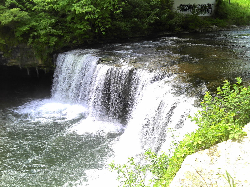
Ludlow Creek is interesting in how it has a mixed set of rules.The river is listed as an official part of the Stillwater River Scenic River Trail.It has put-in and take-outs marked on the map with the falls marked as a probable portage.However, the local law enforcement at Ludlow Falls will jump on you in a heartbeat if they see you unload your boats at the falls.This is a crying shame since the falls are a beautiful vertical drop into nice green water.Now if you use the access points noted on the Miami Conservancy District maps you can probably blitz down stream and plunge over the falls and then disappear into the gorge never to be seen.Just don’t hang out and wait to see what happens.The falls are very nice and there are a few other rapids downstream.
Waterfalls (1)
Hazards & Portages (1)
Caution: The following locations may require scouting or portaging. Always check current conditions.
Difficulty
Class II+(IV)
Length
3.8 mi
Gradient
5 ft/mi
max 50
Rapids
0
1 Portage
Access Points
Difficulty Classes
I Easy
II Novice
III Intermediate
IV Advanced
V Expert/Extreme
VI Unrunnable
Permit Required
Depends on who you ask.
Current Conditions
5-Day Forecast
Whitewater data from
American Whitewater
American Whitewater