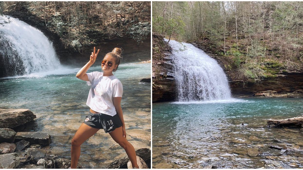
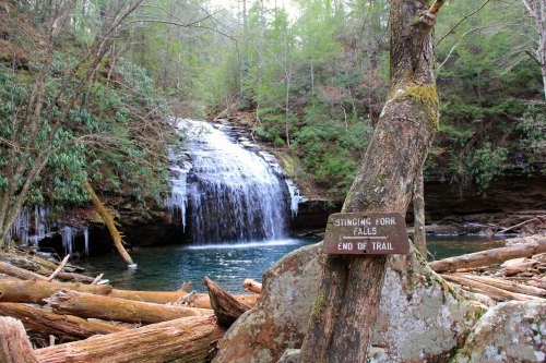
Stinging Fork Falls to Piney River
Linked via: Proximity 92% confidence Synced 6mo ago
Gauge Conditions
Runnable: ? – ? CFS
Approximate reading: This gauge is 11.4 miles away on Stinging Fork. Use as a general reference only.
Data from American Whitewater & USGS
Run Map
Run Time Estimate
Select put-in and take-out to estimate time.
Unlock Advanced Trip Planning
See wind-adjusted speed maps, forecast planning, and detailed time estimates.
Sign in to generate an AI timing estimate for this run.
Whitewater timing varies with scouting, portages, and group pace. Use as a planning baseline.
Description
Very beautiful, looks like fun, but with a well-deserved nasty reputation. Many good boaters apparently figure it's simply not worth it
Gomer wrote, in Boater Talk:
'Over a mile carry-in to the Falls. Counting the lead-in drop, I'd say it's a double drop of perhaps 60'. Probably best to run it with a lot of water so you'll land in a foam pile instead of on a static surface. There's a small rocklip in the lower part of the main drop that can launch one into an automatic boof, and, as GaCreeker says above, that's not desirable. The last time I was there (many moons ago) a good friend severely injured his back and never returned to the sport at the level he was at prior to that incident.
You can run all the way down to the takeout for the Piney River. It is a total of about seven miles with the first 2.5 being on Stinging Fork and the last 4.5 being on Soak Creek. Stinging Fork has a gradient of close to 280 ft/mile. Other than the falls, Stinging Fork has a twenty foot slide shortly after. There are some nasty undercuts, but some good ledges and rapids as well. There is wood. Soak Creek averages 100 ft/mile, so expect some good class 3 boogie with possible strainers and shoaly regions.
Ga\_Creeker's contribution was, simply:
'Don't boof it. I know of several people that have hurt their back on this one.'
Waterfalls (2)
Hazards & Portages (1)
Caution: The following locations may require scouting or portaging. Always check current conditions.
Difficulty
Class IV(V)
Length
5.4 mi
Gradient
120 ft/mi
max 250
Rapids
0
1 Hazard
Access Points
Difficulty Classes
I Easy
II Novice
III Intermediate
IV Advanced
V Expert/Extreme
VI Unrunnable
Current Conditions
5-Day Forecast
Whitewater data from
American Whitewater
American Whitewater