Upper Falls to Lower Falls (4.1 miles)
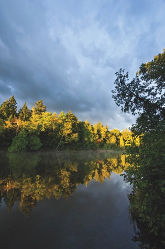
Tahquamenon
Linked via: Unknown Synced 3mo ago
Gauge Conditions
Runnable: 500.0 – 2,000.0 CFS
Adequate for main falls and left side of lower falls.
Data from American Whitewater & USGS
Run Map
Description
Billed as ' *the second largest falls east of the Mississippi*' (behind Niagara, of course), and ' *third most voluminous vertical waterfall east of the Mississippi River, after Niagara Falls and Cohoes Falls, both in New York State*', Tahquamenon Falls State Park hosts two areas of falls in what is otherwise a flatwater river. This seldom gets run because it lies 'in the middle of nowhere' (a long way from most of the great U.P. whitewater).
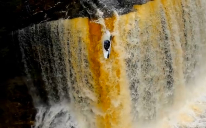
Upper Falls is a wide, sheer-vertical drop (in the neighborhood of 50 feet tall and 200 feet wide) which has been run by a few 'big cajones' boaters. (Most mere-mortal boaters will be content to enjoy the view of this impressive falls, and will boat only the lower falls.) Click for a video (queued to 0:25 to skip some of the float in) of Marcelo Galizio running the falls on 2018.12.30: *Marcelo Galizio runs the falls*
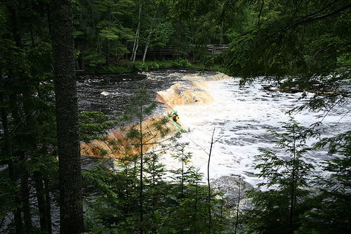
Lower Falls occurs 3.6 flatwater miles downstream. You can put-in below the Upper Falls and paddle down to the Lower or just park-and-play at the Lower. An island splits the river at the Lower, so routes are possible on both sides. From the Lower parking lot picnic area, carry your boat the short distance to the steps down to the water and paddle over to the island. As of May, 2022, there is a handicapped accessible pedestrian bridge to the island, but this would be a long hike to carry your boat. After paddling to the island, hike your boat up to hit either channel.
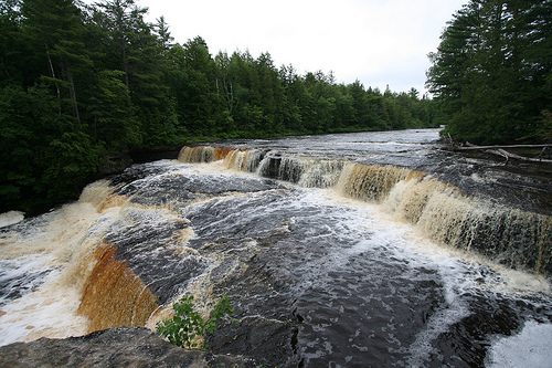
Just upstream of the island there is a river wide, shallow ledge that does have a few small play waves on river left. This is also the deepest water to run the ledge. You could paddle to shore and portage 50' to get above the ledge, then paddle down.
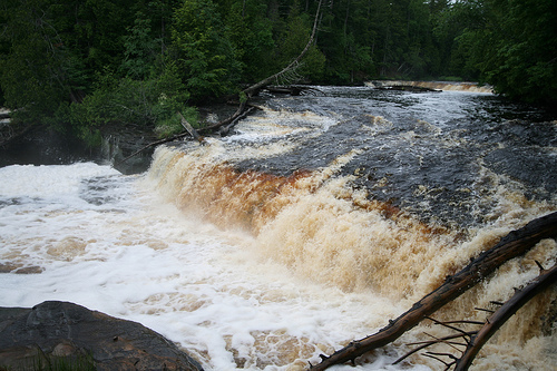
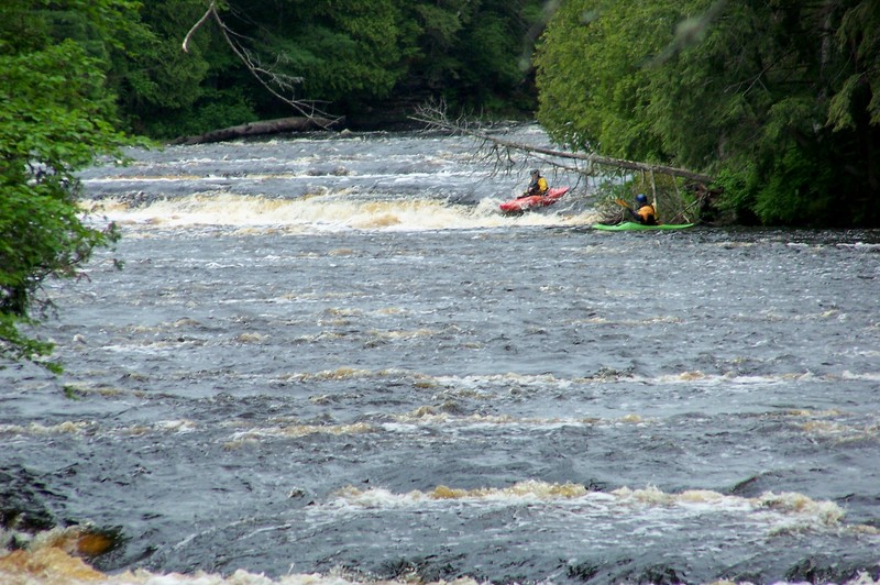
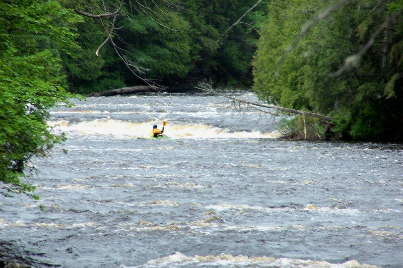
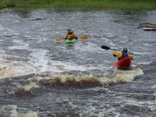
River-right around the island are two ledge drops of about 6 to 8 feet which land hard on bedrock, one right after the other. Flows will need to be somewhere in excess of 1000 cfs to provide enough cushion to launch and land a good 'boof'.
River-left around the island also has two ledge drops of about 6 to 8, but they are seperated by about 200 feet. The first is a 6' river wide ledge that can be run in more than one place. The best run is probably on the right side where the ledge comes to a slight point. If you go off the point, you end up far enough out from the hole that you don't get sucked back in. This is a nice boof drop, though at lower levels the water above the drop can be shallow and you might be stopped at the lip.
The second ledge is more fun. Run to the left of the second small island by the falls viewing platform. (You can run to the right of the small island, but it is shallow.) To the left of the small island, the river narrows and there is kind-of-a-tongue on the right. No boof is needed here as the water just washes you through. Below this ledge there are some shallows that you have to pick and bump through, but then paddle over to the landing on the island and do it all again. You can also avoid the shallows by paddling directly to the island before going thru them, though this depends on water level.
This reach is usually runnable from May 1 thru about mid-July. Be warned though, that the bugs are vicious from about mid-May to mid-June. The park is pretty empty at this time of year because of the mosquitos and black flies. Wear full gear with gloves. You'll be sorry if you wear shorts! The water is up other times of the year, though of course the river is frozen in winter, e.g. December to March or sometime in April.
Rapids in this Run (1)
Waterfalls (4)
Difficulty
Class IV-V
Length
4.0 mi
Gradient
20 ft/mi
max 50
Rapids
1
Access Points
Shuttle Info
You'll need a Michigan DNR Park vehicle permit for the parking lots.
Upper Falls: There is a parking lot about 1/4 mile from the river and 3/8 mile from the falls. There is a paved walkway and steps to the falls. There is also a paved pathway, steps and a boardwalk that take you near the bottom of the falls.
Flatwater: To paddle the flatwater section below the Upper Falls, park in the back of the Upper Falls parking lot (away from the buildings, in the third parking area). There is an unpaved trail that goes to the steps to the boardwalk to the river. This is also the location of a trail that goes from the Upper to the Lower falls; an 8 mile round trip hike. You should be able to put-in here. There is also a large, year round rest room with indoor plumbing next to the parking lot for changing.
Lower Falls: There is a picnic area next to the Lower Falls parking lot. At the back of the picnic area there are steps down to the river. Put-in here. This is also the take-out if you come down from the Upper Falls. Note that there is a campground loop just off this parking lot. The campground loop has a shower/restroom building with indoor plumbing; a good place to change. To run just the Lower Falls, paddle over to the island and take-out at the row boat ramp. Hike your boat to the other end of the island to run either left or right of the island. Also, up stream of the island there is a river wide ledge that can be run, but is shallow. There is also a small play spot on river left below the ledge. To run the river wide ledge and the play spot, paddle upstream from the island to river left where the Upper to Lower Falls trail is at the river bank just below the river wide ledge. Take out here, hike 100' upstream and put-in.
Difficulty Classes
I Easy
II Novice
III Intermediate
IV Advanced
V Expert/Extreme
VI Unrunnable
Current Conditions
5-Day Forecast
Whitewater data from
American Whitewater
American Whitewater